
2007 | 2008 | 2009 | 2010 | 2011 | 2012 | 2013 | 2014 | 2015 | 2016 | 2017 | 2018 |2019 |2020 |2021 |2022 |2023 |2024 | 2025
2025
-
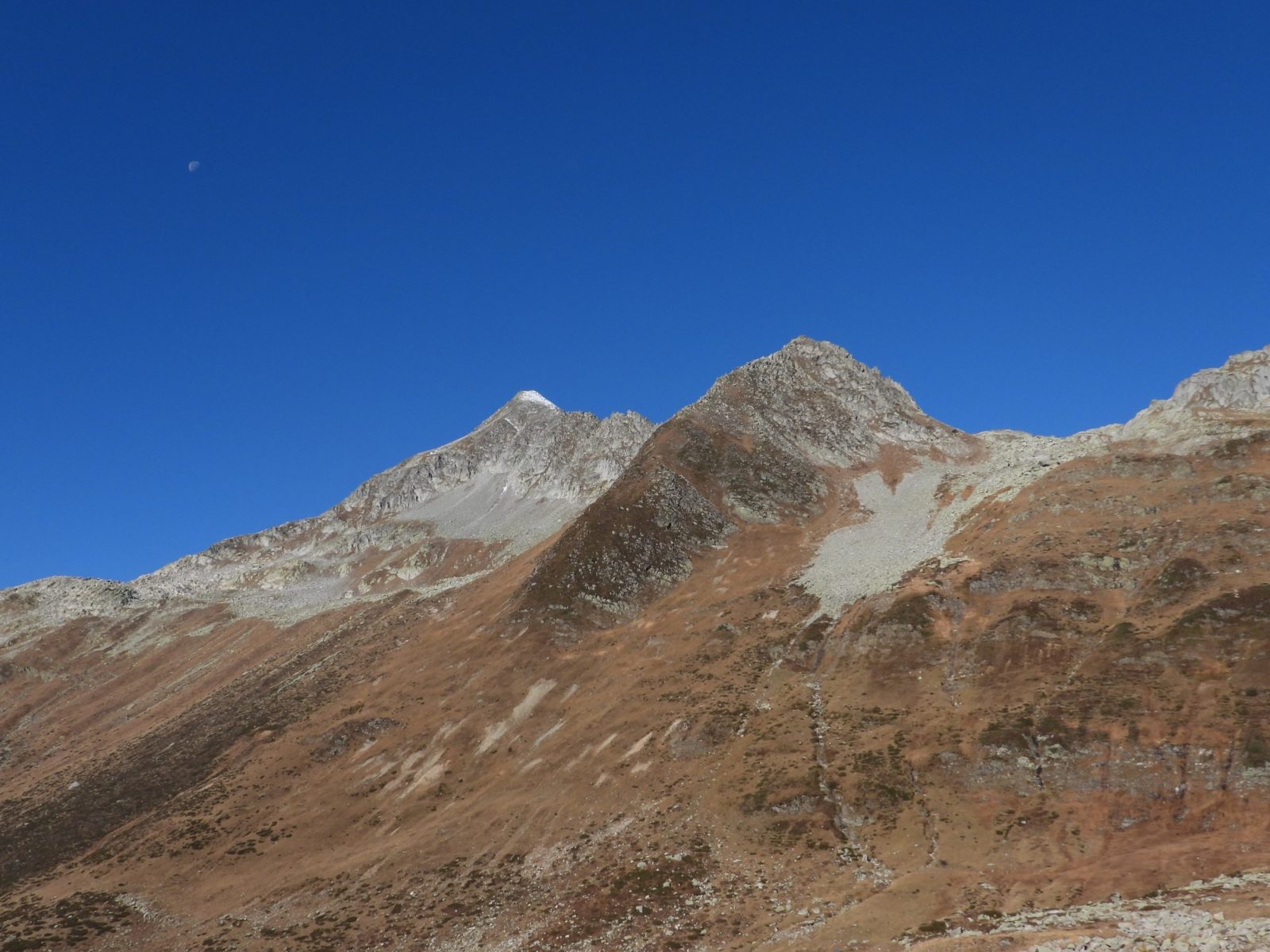
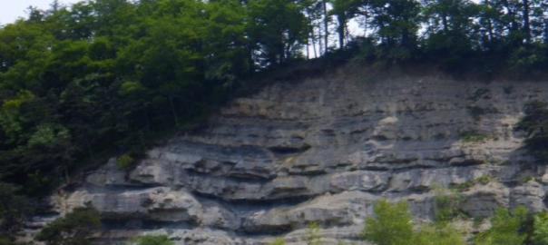
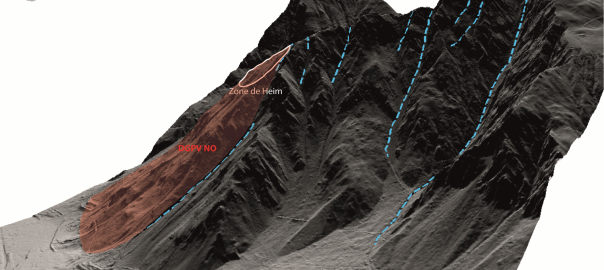
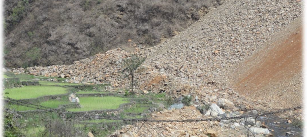
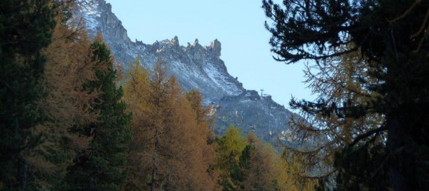
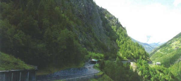
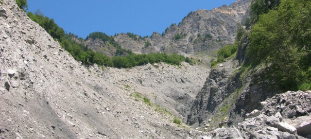
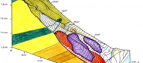
Aurélien Gay-des-Combes: Analyse des processus gravitaires du flanc des Revenettes (Commune de Trient, Valais)
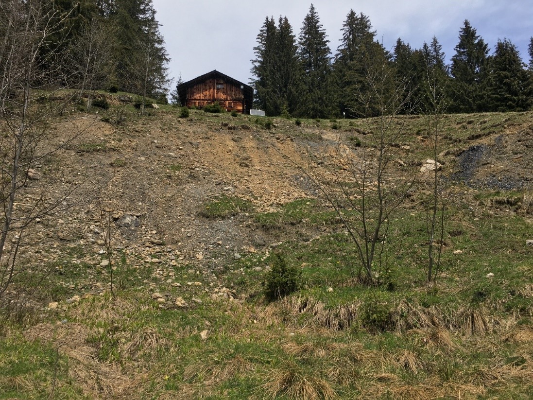
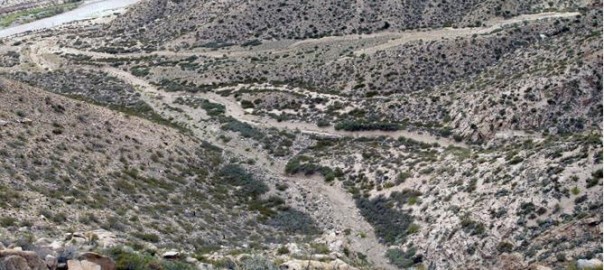
This study focuses on gravitational processes affecting the slope of the Revenettes, located inthe municipality of Trient, in the canton of Valais, within the Swiss Alps. This area is mainlycomposed of scree and has been known for over a century to show signs of slope instability.The most active and concerning sector is the Donna Gremé…
-
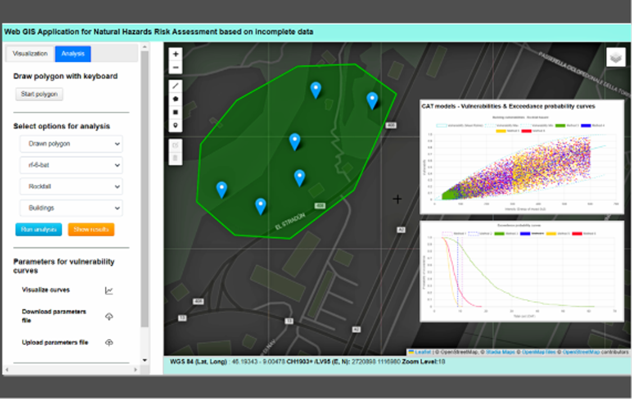
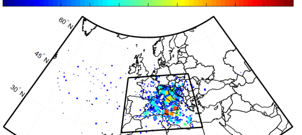
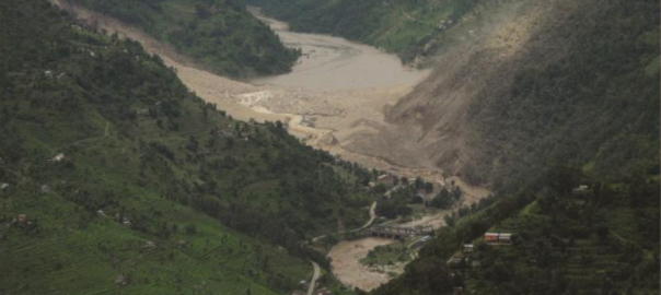
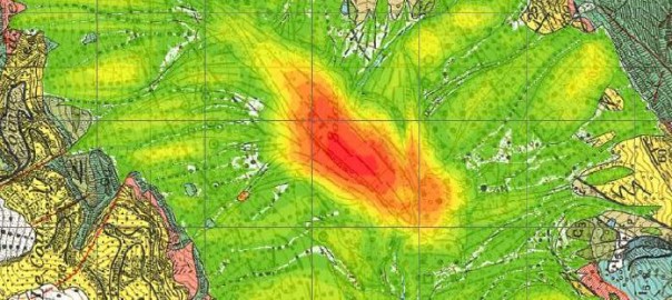
Hélder Peixoto : Web GIS Application for Natural Hazards Risk Assessment Based on Incomplete Data
Natural hazards have a significant impact on global populations causing fatalities and damage to agriculture, buildings, and infrastructure. With climate change, such hazards are expected to become more frequent and severe, especially in Alpine regions. The 10 deaths that occurred in Switzerland in the summer of 2024 illustrate these problems, in regions where the hazard…
2024
-
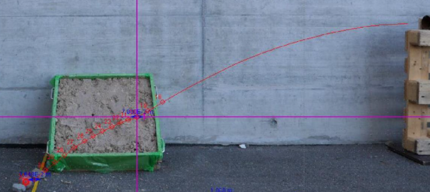
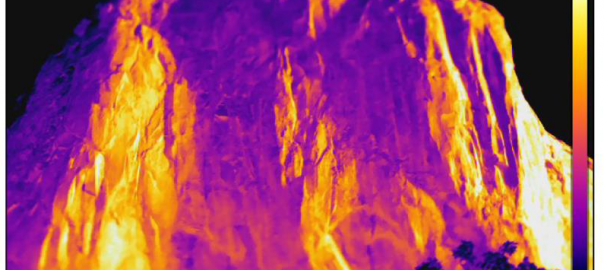
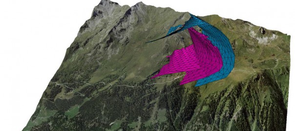
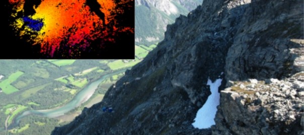
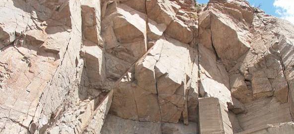
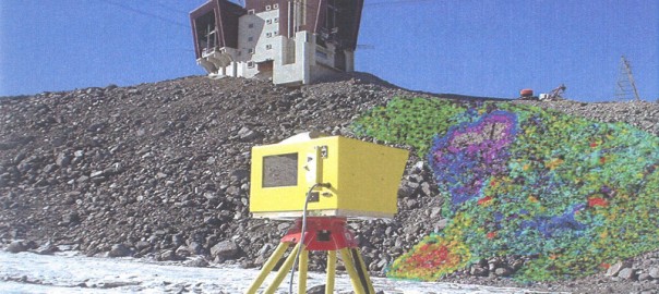
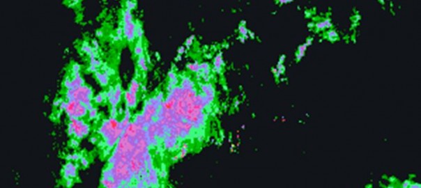
Linus Lewandowski: Exploring the possibilities of high-resolution spectral imaging to investigate rockfall source areas
Weathering reduces rock strength, consequently the stability of a cliff depends crucially on its weather-ing degree. Simultaneously, other parameters are altered as well, among which is surface color. By in-vestigating surface color, conclusions can be drawn about weathering degree. Inherently, the direct in-vestigation of outcrops imposes danger to the investigator and should ideally be avoided.…
-
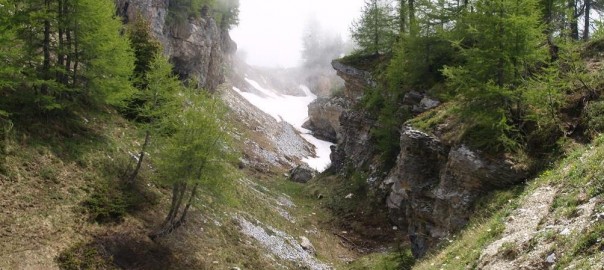
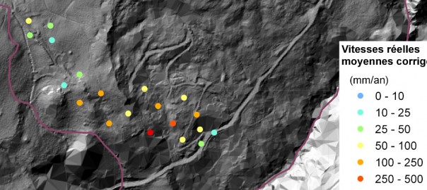
Natacha Dupertuis: The Study of a Landslide in the Valley of Santa Maria in Ticino
This master’s thesis focuses on the analysis of an active rock landslide in the Santa Maria Valley, located in northern Ticino. The main objective is to estimate the total volume of the unstable mass, assess its activity level, and understand the mechanisms responsible for its evolution. The study is based on geomorphological analysis, laboratory geotechnical…
2023
-
Sylvain Köhli: Étude du potentiel des modèles analogiques dans l’analyse des tsunamis issus de glissement de terrain – Étude de cas pour le lac Léman
The aim of this project is to evaluate the potential of analog models in a study of the formation of…
-
Thomas Egli: L’impact du mélange pluie-neige sur les glissements de terrain en Suisse
L’objectif de cette étude était d’explorer comment la neige fond en contact avec l’eau, afin de mieux comprendre le processus…
-
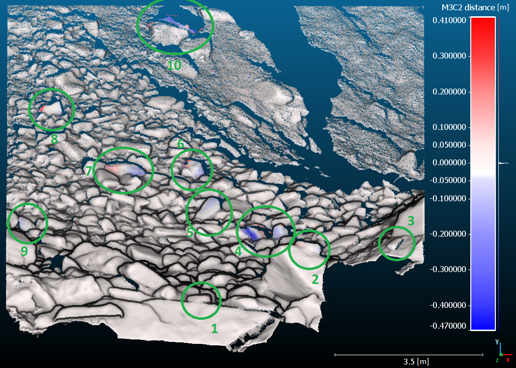
Daniel Uhlmann : Topographic changes in the high-altitude walls of the Mont Blanc massif: quantification at different spatial and temporal scales
Long-term topographic changes at high altitude in the Alps, at different spatial and temporal scales, are challenging to quantify, often…
2022
-
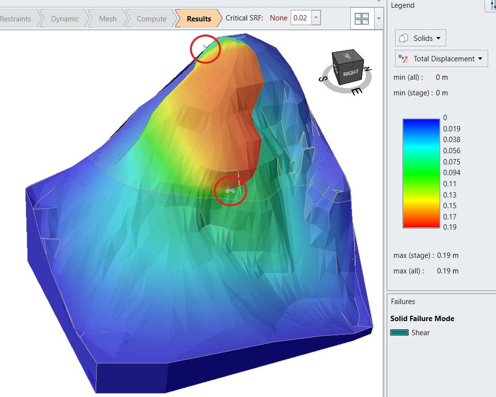
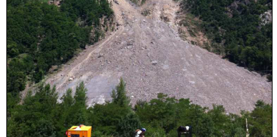
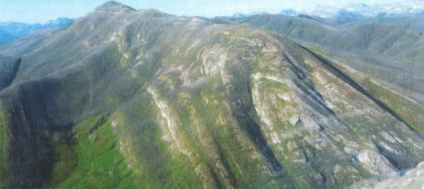
Tetiana Sheremet: The 1991 Randa rockslide slope stability modeling in 2D&3D
The Swiss Alps, despite their breathtaking beauty, can hide many dangers such as structural instability. These can be caused by…
-
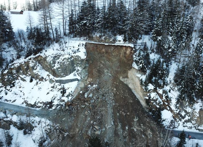
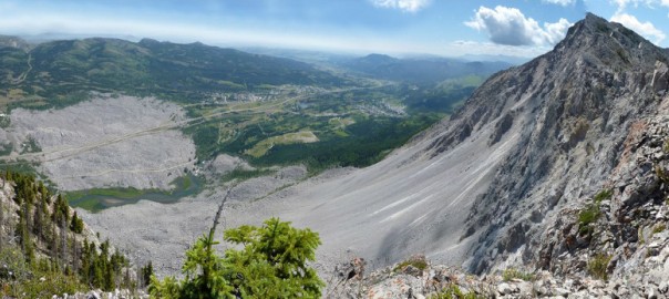
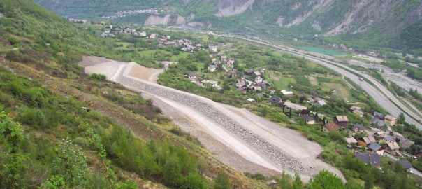
Justine Chaubert: Les divers processus de l’éboulement du Ban du For
In Switzerland, the canton of Valais is one of the cantons most affected by natural hazards such as debris flows,…
-
Joëlle Jeltsch: Processus et aléas des laves torrentielles du bassin versant de Chamoson (Valais, Suisse)
The canton of Valais in Switzerland is heavily affected by debris flows. In 2018 and 2019, the village of Chamoson…
-
Maxime Mignot : Etude de l’influence des systèmes structuraux dans l’effondrement des falaises de Haute-Normandie : analyse structurale et modèles analogiques.
Le recul des falaises normandes est un processus multifactoriel et constitue un aléa important pour ces régions côtières. Ce travail…
-
Amalia Gutiérrez : Geological, geometrical, and statistical analysis of landslides and rockfalls listed in Ticino during the last 20 years
In the south of Switzerland, the canton Ticino corresponds to the transition from a pre-Alpine to a fully Alpine setting.…
-
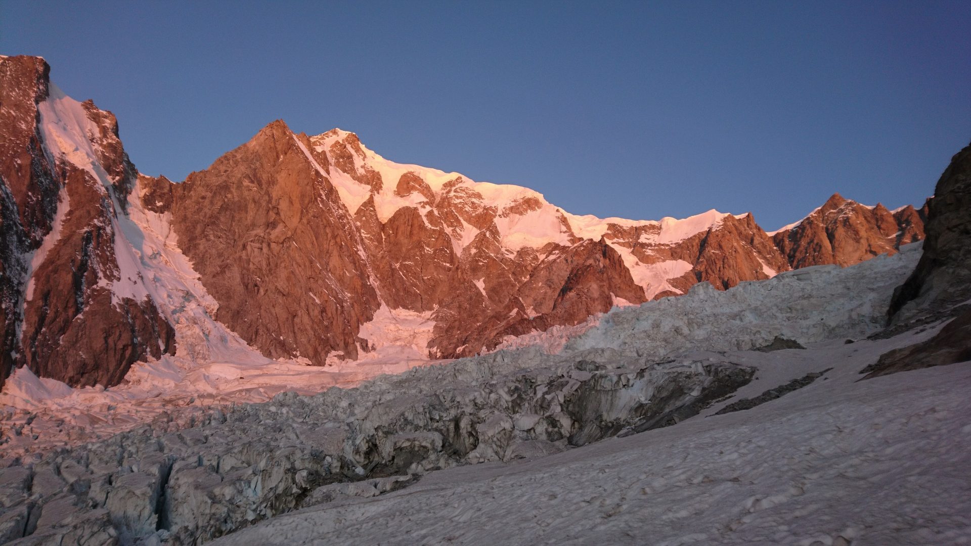
Joëlle Hélène Vicari : Rock instability hazard in high mountain area: the example of the Brenva spur (Mont Blanc massif)
Rockfalls and mass movements in the Mont Blanc Massif (MBM) are increasing due to climate change and can affect humans,…
2021
-
Delphine Bossuat Pahud: Evaluation de la fiabilité de l’interférométrie radar satellitaire pour la gestion du risque de glissement de terrain (Vallée d’Aoste, Italie)
As part of the management of risks arising from slope instabilities, the acquisition of interferometric radar (InSAR) datas offer an…
-
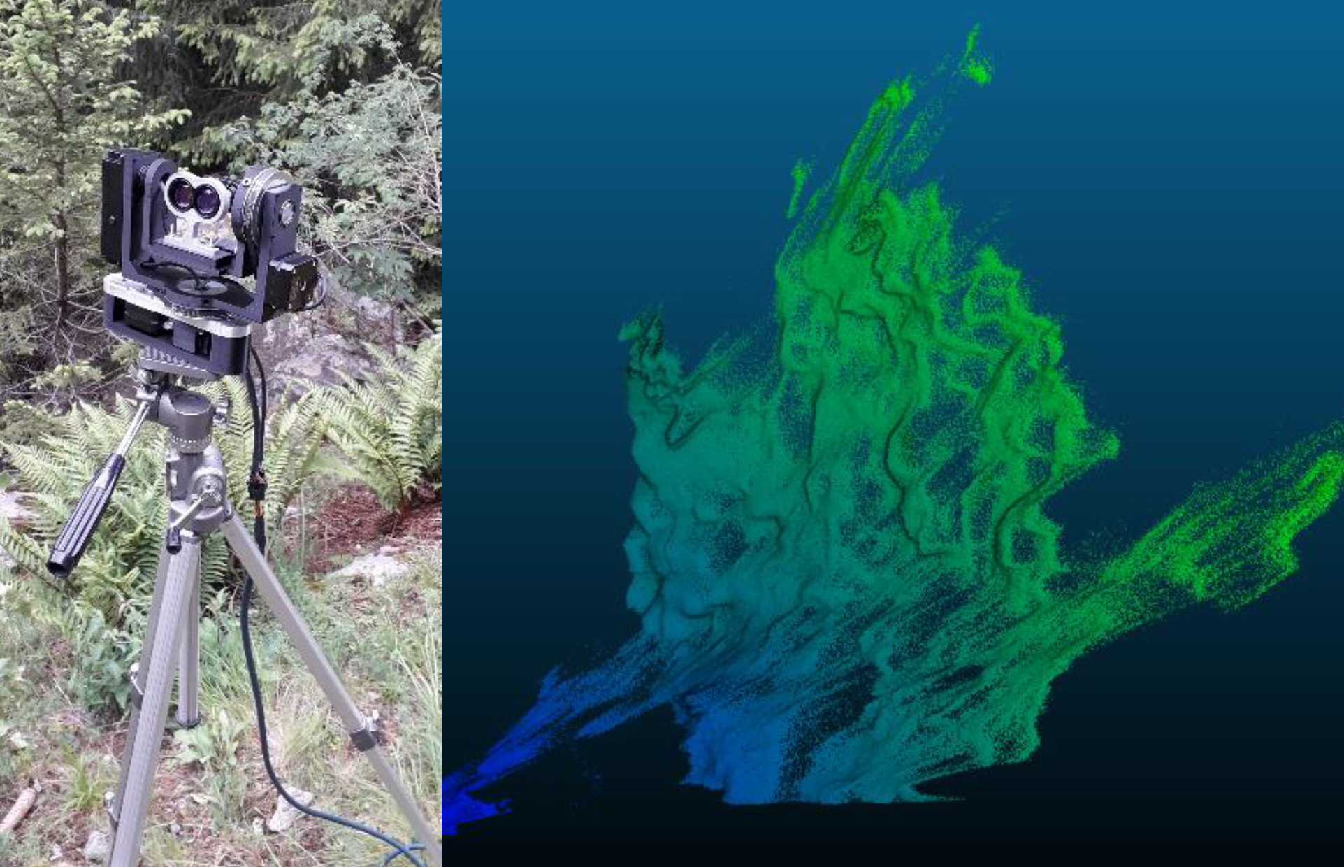
Cristiano Gygax: Scanner LiDAR terrestre à faible coût basé sur Arduino
La recherche de solutions d’équipement à faible coût en géomatique et dans d’autres domaines est un thème abordé par un…
-
Céline Cardot: La Mono-photogrammétrie comme méthode de suivi des mouvements gravitaires: évaluation du potentiel et des limites
Ce travail de recherche s’intéresse à l’utilisation de la Mono-photogrammétrie (Mono-P) en tant que méthode de suivi de mouvements gravitaires…
-
Marc Auer: Monitoring multi-technique du glissement de terrain du Pont-Bourquin (Les Diablerets)
Le but de ce travail est d’étudier l’évolution en surface du glissement du Pont Bourquin. Actif depuis 2004, il affecte…
-
John Awad: Real-Time Automated SfM Monitoring for Landslides
A real-time, automated SfM monitoring technique was adapted and tested on the Pont Bourquin landslide in Ormont-Dessus, Switzerland, and on…
-
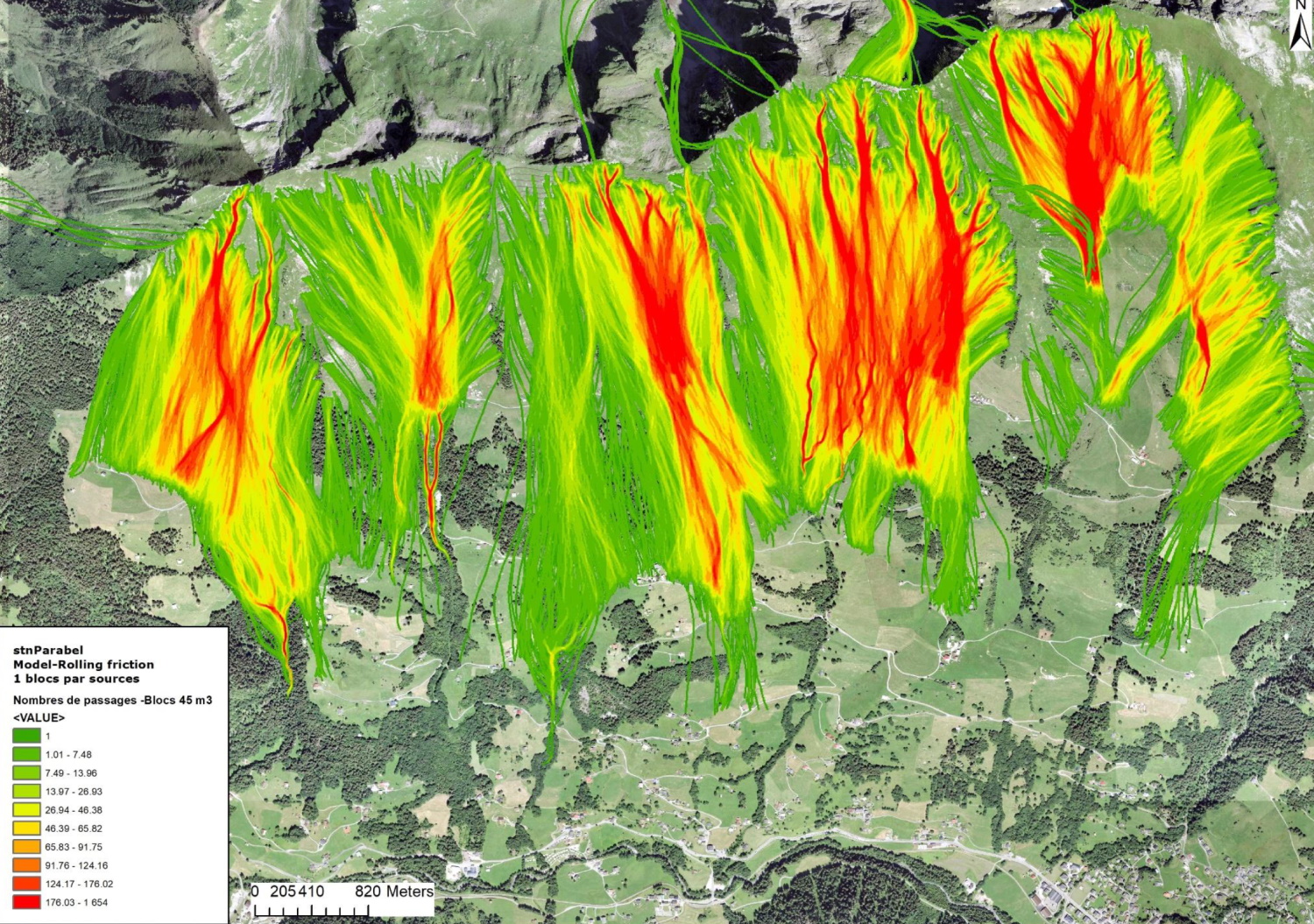
Adrien Jeannerat: Evaluation et analyse des dangers de chute de blocs entre le Pic Chaussy et La Pare (VD)
L’objectif général de ce travail est d’évaluer et d’estimer le danger lié aux chutes de blocs le long de la…
2020
-
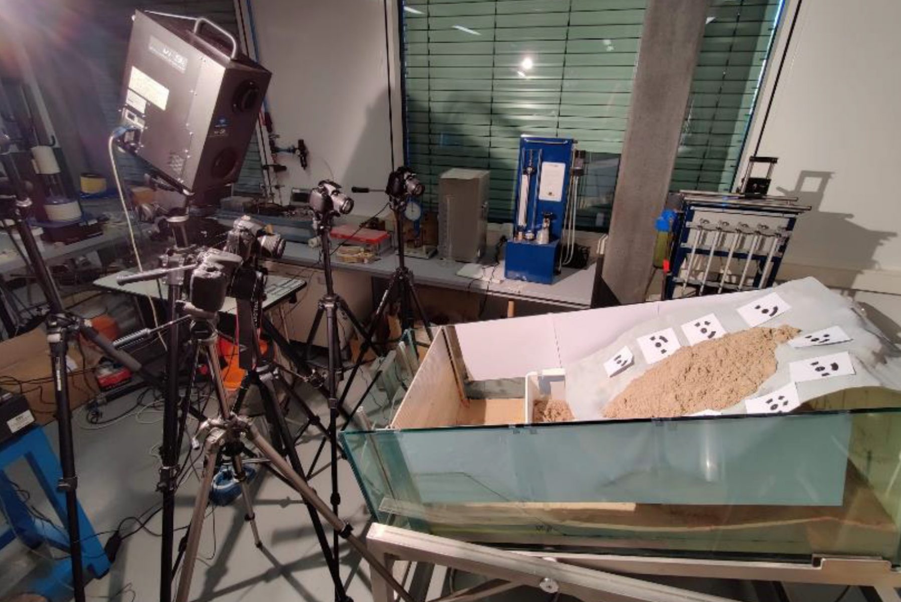
Baptiste Englert: Reconstruction de trajectoires 3D et calcul de paramètres d’impact latéraux dans le contexte des chutes de pierres par une méthode de tracking et une expérience à petite échelle
The modeling of block falls in order to establish forecasts of their scope and magnitude has been evolving for several…
-
Vincent Regard: Synthesis and Exploration of Rock’s Alterations due to Thermal Stress Under the
Superficial alteration of rocks caused by thermal stresses is often overlooked to the benefit of other mechanism such as frost…
-
Léna Maillard: Les comportements d’une paroi rocheuse face aux changements thermiques journaliers
The aim of this thesis is to understand the behaviour of rock with regard to heat transfers between the…
2019
Nothing found
2018
-
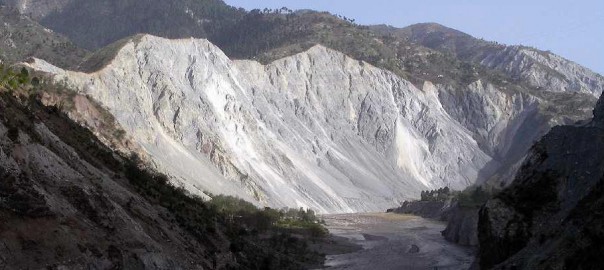
José Pullarello: First characterization of the “Rumi-Pana” rock avalanche deposits (Famatina Range, La Rioja, Argentina)
Active mountain fronts are subject to large scale slope collapses which have the capacity to run long distances on piedmont…
-
Aron Somazzi: Rockfall hazard and risk analysis in the Pichoux Gorges (Jura, Switzerland)
First, the potential sources of rockfalls are detected. These locations are determined using the slope histogram method. Then, one passes…
2017
-
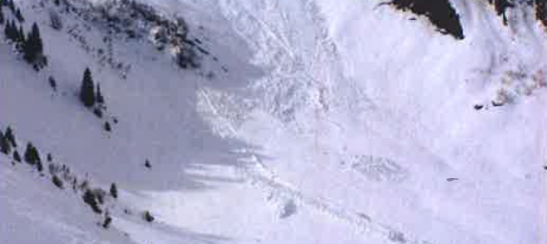
David Médico: Caractérisation des avalanches de neige mouillée
David Médico Director: Prof. Michel Jaboyedoff Assistant: MSc. Antoine Guérin The winter 2011-2012, relatively rich in snow, was very marked in the…
-
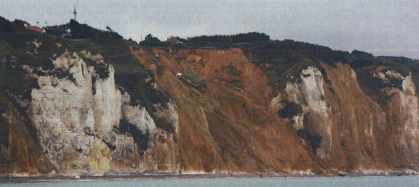
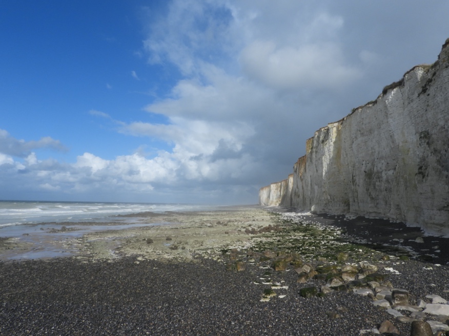
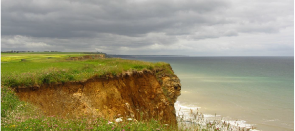
Patrick Huber: Exploitation du LIDAR embarqué dans l’étude des falaises littorales de Seine-Maritime; Normandie, France
Patrick Huber Director: Dr. Marc-Henri Derron Expert: Dr. Clément Michoud The coastal chalk cliffs in Normandy located in the North-West…
-
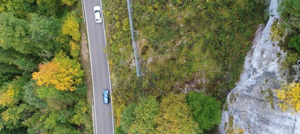
Amin Mudaqiq: Rockfall risk analysis along road cantonal between Aigle and Le Sépey
Amin Mudaqiq Director: Prof. Michel Jaboyedoff This study aims to identify the risk of rockfall alongside a road on a…
-
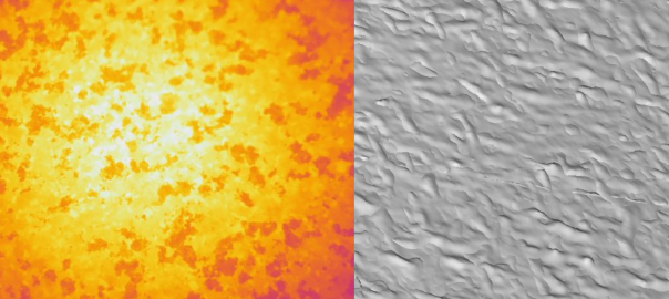
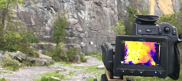
Olivier Dubas: La thermographie infrarouge dans le domaine du rocheux: éléments d’influence et corrections de la température apparente en température réelle
Olivier Dubas Director: Dr. Marc-Henri Derron Experts: Prof. Michel Jaboyedoff, MSc. Antoine Guerin In the field of risk analysis related…
-
Cécile d’Almeida: Model and cartography of the Saint-Eynard cliff erosion by rockfalls
Cécile d’Almeida Supervisors: Prof. Michel Jaboyedoff, MSc. Antoine Guerin Rockfall hazard is a major concern in mountainous area and its characterization…
-
Maxime Collombin: De l’affleurement à la caractérisation réservoir : étude de fracturation sur la base d’une acquisition LiDAR
Maxime Collombin Supervisor: Dr. Marc-Henri Derron The study of fractured reservoirs is of primary importance for hydrocarbons, water and geothermal exploration.…
2016
-
Zeynabou Sy: Analyse de risques hydrologiques et modélisation de la nappe de Thiaroye (Dakar, Sénégal)
Zeynabou Sy Directors: Prof. Michel Jaboyedoff, Serigne Faye The Dakar region experiencing recurrent floods in the years 1989 to 2012. These…
-
Caroline Lefeuvre: Influence des effets thermiques dans l’e valuation de l’ale a chute de blocs
Caroline Lefeuvre Co-supervisors: Prof. Michel Jaboyedoff, Dr. Marc-Henri Derron Les aléas liés aux mouvements gravitaires sont des phénomènes très présents…
-
Cindy Vulliez: Apports des méthodes d’imagerie 3D pour la caractérisation et le monitoring du glissement rocheux de Séchilienne (Vallée de la Romanche, Isère, France)
Cindy Vulliez Director: Prof. Michel Jaboyedoff Co-directors: Dr. Antonio Abellán, MSc. Antoine Guerin External Expert: Marie-Aurélie Chanut The Sechilienne landslide,…
2015
-
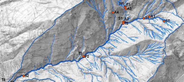
Jean?Marie Vuignier: Caractérisation de la source sédimentaire et estimation du budget sédimentaire dans le bassin versant de Jatún Mayu (Cochabamba, Bolivie)
Jean?Marie Vuignier Director: Prof. Michel Jaboyedoff Co?director: Dr. Ivanna Penna Experts: Prof. Stuart Lane, Dr. Karen Sudmeier?Rieux Natural and human-induced…
-
Nicolas Emery: Evaluation de l’influence de la hauteur d’eau et de l’inclinaison de la pente sur le comportement des glissements de terrain en laboratoire
Nicolas Emery Director: Prof. Michel Jaboyedoff Expert: Dr. Marc-Henri Derron Supervisors: MSc. Dario Carrea, Dr. Antonio Abellan Landslides are complex…
-
Liliane Nguyen: Identication de précurseurs synoptiques aux évènements de précipitations extrêmes pour des situations de Sud dans les Alpes par l’analyse des trajectoires inverses
Liliane Nguyen Supervisors: Dr. Pascal Horton, Prof. Michel Jaboyedoff One of the most expensive natural disasters in Switzerland consists of…
-
Remo Gygax: GPU accelerated numerical simulations and laboratory experiments on viscous avalanches
Remo Gygax Director: Prof. Y. Podladchikov Jury: Prof. M. Jaboyedoff, Prof. F. Herman, L. Räss, C. Longchamp Numerical simulations are…
-
Alizée Vioget: Analyse de l’évolution morphostructurale des falaises littorales du Bessin, Basse-Normandie, France
Alizée Vioget Director: Prof. Michel Jaboyedoff Co-directors: Prof. Olivier Maquaire Expert: MSc. Clément Michoud The coasts’ recession is a major…
-
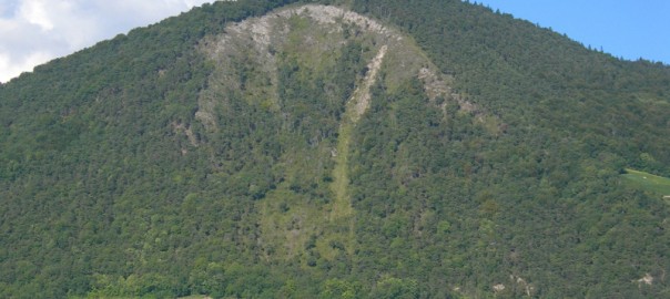
Susanna Büsing: Analyse spécifique de l’activité récente des éboulements au Piz Lischana (Basse-Engadine)
Susanna Büsing Supervisor: Prof. Michel Jayboyedoff Internal Experts: MSc. Antoine Guerin, Dr. Marc-Henri Derron External Expert: Dr. Marcia Phillips On 31…
2014
-
Emmanuel Wyser: Investigations phénoménologiques et numériques de l’impact de gouttes d’eau sur un milieu granulaire et du processus de diffusion
Emmanuel Wyser Director: Prof. Michel Jaboyedoff Supervisor: MSc. Benjamin Rudaz Water erosion phenomenons are increasingly studied and understood but raindrop…
-
Jaccaud Léonard: Étude de l’instabilité rocheuse du Kilchenstock, Glaris (Suisse)
Jaccaud Léonard Directors: Prof. Michel Jaboyedoff and Prof. Stefan Schmalholz The Kilchenstock peak is located in the Swiss Alps about…
-
Geoffroy Leibundgut: Analyse de mouvements de versants rocheux et quantification des risques induits le long de la vallée de la Grande-Eau, Suisse: Le phénomène de débâcle
Geoffroy Leibundgut Supervisor: Prof. Michel Jaboyedoff Co-supervisor: Jérôme Tixier La nuit du 23 février 2014, un bloc rocheux de 100…
2013
-
Philippe Limousin: De la caractérisation du sol, à l’étude de propagation et des risques induits : Les cas du glissement de Pont Bourquin
Philippe Limousin Supervisor: Prof. Michel Jaboyedoff Co-supervisor: Bernard Vayssade Les risques liés aux dangers naturels sont de plus en plus présents…
-
Christopher Puglia: Multidisciplinary study of two anthropogenic landslides in Sindhupalchok and Ramecchap districts, Central Nepal
Christopher Puglia Direction: Prof. Michel Jaboyedoff, Dr. Karen Sudmeier-Rieux, Dr. Marc-Henri Derron, MSc. Pierrick Nicolet The purpose of this thesis…
-
Lauren Gavillet: Dynamique d’érosion et étude de stabilité d’un petit bassin versant alpin: le cas du Courset (VD, Switzerland)
Lauren Gavillet Supervisor: Prof. Michel Jayboyedoff Internal Experts: MSc. Pierrick Nicolet, MSc. Benjamin Rudaz External Expert: Marcel Burri The landslide triggered on…
-
Tiziana Egli: Cartes de danger de chutes de blocs sur le village des Morgnes (Bagnes)
Tiziana Egli Co-supervisors : Dr. Vincent Labiouse, Prof. Michel Jaboyedoff Experts : Dr. François Joseph Baillifard, MSc. Clément Michoud The…
-
Maria Ponzio: Etude des instabilités du Val Canaria (Tessin, Suisse) et analyse de la stabilité de l’éboulement de Sotto Corte
Maria Ponzio Supervisor : Prof. Michel Jaboyedoff Rapporteur : Prof. Stefan Schmalholz La zone d’étude se trouve dans le Val Canaria, au Nord…
-
Camille Perraudin: Characterization of Montset rock slope instability in Hérémence valley.
Camille Perraudin Supervisor: Prof. Michel Jayboyedoff Experts: Dr. Marc-Henri Derron, MSc. Dario Carrea The study focuses on the characterization of Montset rock slope…
-
Line Rouyet: Monitoring and characterization of rock slope instabilities in Norway using GB-InSAR.
Line Rouyet Co-supervisors: Prof. Michel Jayboyedoff, Dr. Marc-Henri Derron Experts: Dr. Lene Kristensen, MSc. Clément Michoud The master thesis named “Monitoring and characterization of…
2012
-
Murielle Voutaz: Etude d’une déformation gravitaire profonde de versant (DGPV) dans la région du Simplon par une approche structurale et cinématique.
Murielle Voutaz Direction: Prof. Michel Jaboyedoff Rapporteur: Prof. Jean-Luc Epard Suivi: Andrea Pedrazzini, Battista Matasci Deep-seated gravitational slope deformations (DSGSD) are poorly understood.…
-
Léonard Jaton: Development and application of a hydrological and slope stability model using Matlab
Léonard Jaton Supervisor : Prof. Michel Jaboyedoff Expert : Pascal Horton This master thesis is focused on the development and application…
-
Jérémie Voumard: Simulation dynamique du trafic routier pour l’estimation du risque sur les routes de montagne
Jérémie Voumard Supervisor : Prof. Michel Jaboyedoff Experts : Dr. Marc-Henri Derron, Dr. Luuk Dorren, Olivier Caspar The main theme of this Master…
-
Virgile Nanchen: Application de la technologie LIDAR à la méthodologie Matterock
Virgile Nanchen Co-supervisors : Prof. Michel Jaboyedoff Experts : Alex Loye, Andrea Pedrazzini The rockslide of 1991 in Randa motivated…
-
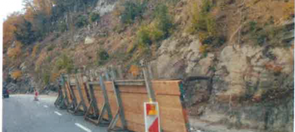
Romain Chenillot: Analyse des aléas rocheux des falaises du Grand Bois du Ban, Lavey Village
Romain Chenillot Co-supervisors: Prof. Michel Jaboyedoff, Prof. Vincent Labiouse, Dr. Mario Sartori This analysis of rock falls hazards relates to…
-
Tristan Burnand: Étude des processus érosifs et bilan sédimentaire au Vallon de Nant
Tristan Burnand Supervisor: Prof. Michel Jaboyedoff Expert: Alexandre Loye This master thesis studies the Vallon de Nant, a glacial valley located…
2011
-
Thomas Zufferey: Analyse et monitoring des mouvements gravitaires du versant sud-est du massif de l’Arpille
Thomas Zufferey Supervisor: Prof. Michel Jayboyedoff Expert: Andrea Pedrazzini The present study concerns the deep-seated gravitational slope deformation (DSGSD) of the…
-
Damien Roth: Analyse microclimatique du Vallon de Nant
Damien Roth Co-supervisors: Prof. Michel Jayboyedoff, Pascal Horton, Jean-Michel Fallot This paper aims to treat and analyze a data set coming from…
-
Martin Franz: La falaise des Bornes du Diable : de l’Instabilité au Tsunami.
Martin Franz Co-supervisors: Prof. Michel Jaboyedoff, Prof. Yury Podladchikov, MSc. Clément Michoud Expert: Dr. Marc-Henri Derron The case study, “les Bornes du Diables”…
-
Vincent Dauphin: Evaluation de la vulnérabilité des bâtiments d’habitation individuelle à Delémont ; vers une nouvelle approche de la gestion du risque d’inondation.
Vincent Dauphin Co-supervisors: Prof. Michel Jayboyedoff, Marc Choffet The vulnerability, when it’s not defined quantitatively, tally with a rate of damage. However,…
-
Nicolas Sarrasin: Etudes d’instabilités rocheuses dans le Saastal et le Mattertal (Valais, Suisse)
Nicolas Sarrasin Supervisor: Prof. Michel Jayboyedoff Assistant: Andrea Pedrazzini A lot of alpine areas are characterized by ground movements. These may…
-
Maria Elena Fonticoba: Etude structurale et GPR de la région de Varneralp (Valais)
Maria Elena Fonticoba Co-supervisors: Prof. Michel Jayboyedoff, Prof. Dr. François Marillier Assistants: Andrea Pedrazzini, Jehanne Correia-Demand This work aims the understanding and characterization…
-
Jacques Bechet et Julien Duc: Etude et quantification des processus et dynamique d’érosion à Draix
Jacques Bechet et Julien Duc Co-supervisors: Prof. Michel Jayboyedoff, Alexandre Loye Expert: Dr. Marc-Henri Derron The Roubine catchment located in the…
-
Stephanie Jaquet: Forest cover trends and landslides occurrence in selected areas, Dolakha District, Central Nepal
Stephanie Jaquet Supervisor: Prof. Michel Jayboyedoff Experts: Dr. Marc-Henri Derron, Dr. Jane Carter The purpose of this thesis is to study forest cover…
-
Marie Charrière: Granulometrical, geological and morphological description of the Frank Slide deposit (Alberta, Canada)
Marie Charrière Supervisor: Prof. Michel Jaboyedoff Expert: Ing. Geol. Corey Froese The Frank Slide (Alberta, Canada) is one of the rock avalanches…
-
Florian Humair: Turtle Mountain anticline (Alberta, Canada): Rock slope stability related fracturing
Florian Humair Co-supervisors: Prof. Michel Jaboyedoff, Dr. Jean-Luc Epard Expert: Ing. Geol. Corey Froese Assistant: Andrea Pedrazzini The aim of…
2010
-

Benjamin Rudaz: Evolution Géomorphodynamique d’un bassin versant torrentiel
Benjamin Rudaz Supervisor: Prof. Michel Jaboyedoff Expert: Alexandre Loye This master thesis is focused on the Saint-Barthélémy stream, in the…
-
Anthony Monnier: Etude du danger de chute de blocs le long de la ligne ferroviaire Aigle – Les Diablerets
Anthony Monnier Supervisor: Prof. Michel Jaboyedoff Expert: Andrea Pedrazzini This Master memory focuses on the risk of rockfall along the Aigle…
-
Fabian Eggertswyler: Analyse de l’évolution d’une commune soumise à des dangers naturels au moyen de techniques numériques. Etude de site: La commune D’ormont-Dessus.
Fabian Eggertswyler Supervisor: Prof. Michel Jaboyedoff Experts : Prof. Jean Ruegg, Alexandre Loye, Marj Tonini Alpine valleys represent a significant…
-
Benoit Fragnol: Le LiDAR et ses applications pour l’étude des chutes de blocs
Benoit Fragnol Supervisor: Prof. Michel Jaboyedoff In mountainous areas, rockfall hazards cause many damages to the infrastructures and have a…
-
Florence Delasoie: Études des instabilités de versant de la Barmasse (Valais, Suisse) par une approche pluridisciplinaire.
Florence Delasoie Co-supervisors: Prof. Michel Jaboyedoff, Dr. François Baillifard Rapporteur: Prof. Jean-Luc Epard The DSGSD (Deep Seated Gravitational slope Deformations) phenomena occur…
-
Raja Mastouri: Modelisation 3D des bassins sedimentaires du Sahel Tunisien: Implication Géodynamique et Intérêt Pétrolier
Raja Mastouri Co-supervisors: Prof. Samir Bouaziz, Prof. Michel Jaboyedoff Experts: Merj Tonini, Chedly Abbes, Mohamed Moncef Sarbeji The Tunisian Sahel domain…
-
Nicolas Gendre: Caractérisation de deux événements d’éboulements rocheux dans la région des Préalpes fribourgeoises. Le cas de la Dent de Lyss et celui de Varvalanna (Fribourg, Suisse).
Nicolas Gendre Supervisor: Prof. Michel Jaboyedoff Expert: Andrea Pedrazzini Les éboulements de la Dent de Lyss et de Varvalanna se situent…
2009
-
Emmanuel Wick: Etude détaillée d’un bassin versant à laves torrentielles le long de la Route Internationale n° 7, Courbe de Guido, Province de Mendoza, Argentine
Emmanuel Wick Supervisors: Prof. Dr. Michel Jaboyedoff, Valérie Baumann The International Road 7 crosses Argentina from East to West, linking…
-
Clément Michoud: Application de l’interférométrie différentielle Radar dans la surveillance du glissement de La Frasse, Suisse
Clément Michoud Supervisors: Prof. Dr. Michel Jaboyedoff, Andrea Pedrazzini Spaceborne Differential Interferometric Synthetic Aperture Radar (DInSAR) is a remote sensing…
-
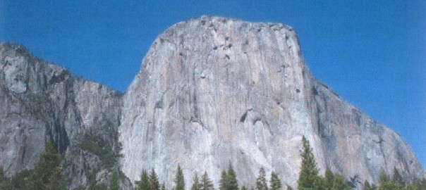
Aurélie Pannatier: Méthodologie de détection et d’analyse d’instabilités rocheuses aux échelles régionale et locale. Applications à la vallée de Yosemite (Californie/Etats-Unis) et à l’éperon du Sex Frei (Valais/Suisse).
Aurélie Pannatier Co-supervisors: Prof. Michel Jaboyedoff, Thierry Oppikofer Expert: Frank Philippossian Rapporteur: Prof. François Marillier Rock instabilities have been studied…
-
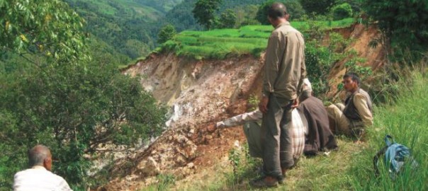
Alain Breguet et Jérôme Dubois: Landslide risk mapping in Pakistan and Nepal based on field survey and modeling techniques.
Alain Breguet et Jérôme Dubois Co-supervisors: Prof. Michel Jaboyedoff, Karen Sudmeier-Rieux Expert : Andrea Pedrazzini Rapporteur : Prof. François Marillier Himalayan…
-
Guillaume Favre-Bulle: Instabilités rocheuses le long de la route nationale 7 Secteur Guido – Uspallata (km 1118 à 1133) Provincia de Mendoza – Argentina.
Guillaume Favre-Bulle Co-supervisors: Prof. Michel Jaboyedoff, Valérie Baumann, Andrea Pedrazzini The National Road 7, important link between Argentina and Chile, is subject…
-
Sébastien Lévy: Analyse de l’évolution morphologique d’une partie du bassin versant de la rivière Chacoura, Québec, Canada.
Sébastien Lévy Co-supervisors: Prof. Michel Jaboyedoff, Professeur Jacques Locat Expert: Alexandre Loye The large plains of Eastern Canada sensitive clays are cut…
-
Micaela Isabel Vargas Garnica: Modèle pour l’analyse spatiale des risques environnementaux et approche sociale de la zone de Tablas Montes et El Sillar, province de Colomi-Cochabamba-Bolivie.
Micaela Isabel Vargas Garnica Co-supervisors: Prof. Michel Jaboyedoff, Rafael Tapia Expert : Karen Sudmeier-Rieux Whilst managing a territory, several considerations should…
-
Marc Choffet: Evaluation de la vulnérabilité du bâti existant face aux inondations dans un contexte d’assurance immobiliére. Etude de cas du village de Le Pâquier, Fribourg.
Marc Choffet Supervisor: Prof. Michel Jaboyedoff Experts: Dr. Olivier Lateltin, Pr. Jean Ruegg The vulnerability has a direct influence on…
-
Valentin Métraux: Quantification de l’érosion et de la dynamique sédimentaire dans un bassin versant torrentiel à l’aide de la télédétection. Application au bassin versant du Merdenson (Valais/Suisse).
Valentin Métraux Supervisor: Prof. Michel Jaboyedoff Expert: Alexandre Loye The watershed of Merdenson dominates the villages of Vollèges and Cries. Many…
-
Benoît Mazotti: Création d’une carte de danger lave torrentielle. Le cas du bassin versant Nord du Mont-Rogneux (Val de Bagnes, Valais).
Benoît Mazotti Co-supervisors: Prof. Michel Jaboyedoff, Alexandre Loye Expert: François-Joseph Baillifard The aim of this work is to diagnose the main hazard…
-
Caroline Christinaz: Etude des instabilités et analyse du danger rocheux. Le cas de la Crevasse, dans le district d’Entremont.
Caroline Christinaz Co-supervisors: Prof. Michel Jaboyedoff, Andrea Pedrazzini Expert : Dr. François-Joseph Baillifard The limestone wall of the Crevasse, located in the…
2008
-
Sarah Derendinger: Etude hydrochimique et modélisation géologique de l’aquifère et du tassement de terrain de la Chaux dans le vallon de Nant (VD).
Sarah Derendinger Co-supervisors: Prof. Michel Jaboyedoff, Prof. Hans-Rudolf Pfeifer Expert : Prof. Torsten Vennemann Ce travail porte sur l’analyse hydrochimique et la modélisation géologique…
-
Nielsen Saga: Analyse de la zone de glissement de l’Abefet et analyse de risque.
Nielsen Saga Co-supervisors: Prof. Michel Jaboyedoff, Dr. Pierre Gex The Abefet zone is situated in the Solalex-Anzeinde valley, on top of…
-
Sacha Gaillet: Modélisation du remplissage quaternaire d’une vallée glaciaire à une échelle locale, basée sur une approche géophysique et numérique. Le cas du pâturage de Solalex Commune de Bex, Vaud, Suisse.
Sacha Gaillet Co-supervisors: Prof. Michel Jaboyedoff, François Marillier L’objectif de ce travail était de déterminer la géométrie, l’épaisseur d’un remplissage quaternaire…
-
Cédric Coquelin: Projet d’installation d’un réseau de stations météorologiques, Vallon de Nant
Cédric Coquelin Co-supervisors : Prof. Michel Jaboyedoff, Dr. Jean-Michel Fallot Experts : Dr. Richard Metzger Le projet Pont de Nant…
-
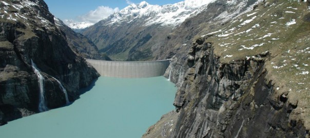
Julie Bory: Evaluation des dangers potentiels au sein du bassin versant d’un ouvrage hydro-electique. Le cas du barrage de Mauvoisin (Val de Bagnes, Valais, Suisse).
Julie Bory Supervisor: Prof. Michel Jaboyedoff Expert: François-Joseph Baillifard Avec une hauteur de 250 m, le barrage de Mauvoisin (Val de…
-
François Riff: Contribution du laser scanner 3D dans l’étude du fluage du pergélisol (Développement méthodologique et comparaison avec le D-GPS).
François Riff Co-supervisors: Christophe Lambiel, Prof. Michel Jaboyedoff Les objectifs principaux de ce mémoire sont doubles. D’une part, cette étude…
-
Romain Herren: Caractérisation et tracking en continu des précipitations : analyse des pluies de 2006 sur l’Ouest de la Suisse.
Romain Herren Supervisor: Prof. Michel Jaboyedoff Experts: Dr. Richard Metzger, Pascal Horton The purpose of this work is to develop a continuous…
-
Sarah Bitz: Etude des processus hydrologiques du bassin versant de la Tinière (VD). Application du traçage environnemental et modélisation.
Sarah Bitz Co-supervisors: Prof. Michel Jaboyedoff, Prof. Torsten Vennemann, Hans-Rudolf Pfeifer Cette étude a pour but de nous faire acquérir…
2007
-
Yannis Borle: Phénomènes érosifs dans le bassin versant de Lourtier (Valais, Suisse). Etude d’une instabilité rocheuse et établissement d’un bilan sédimentaire à l’aide d’une cartographie de terrain détaillée: méthodologie et application.
Abstract will be available soon.
-
Cédric Borlat: Utilisation d’un MNT laser-1m pour le levé géologique et l’interprétation structurale dans la chaîne du Mont Tendre.
Abstract will be available soon.
-
Julien Travelletti: Glissements et coulées issus de l’altération du gypse (Approche géophysique, numérique et géotechnique). Application à la région du Bois de la Glaive (Ollon, Vaud, Suisse).
Julien Travelletti Co-supervisors: Prof. Michel Jaboyedoff, Prof. François Marillier In Switzerland, landslides cover about 7% of the national territory. Affected areas…
-
Andrea Pedrazzini: Étude des instabilités rocheuses entre Muraz et Vionnaz à l’aide de techniques numériques et analyses de terrain.
Andrea Pedrazzini Co-supervisors: Prof. Michel Jaboyedoff, Dr. François Baillifard La falaise des Pics surplombe la route cantonale reliant les communes…