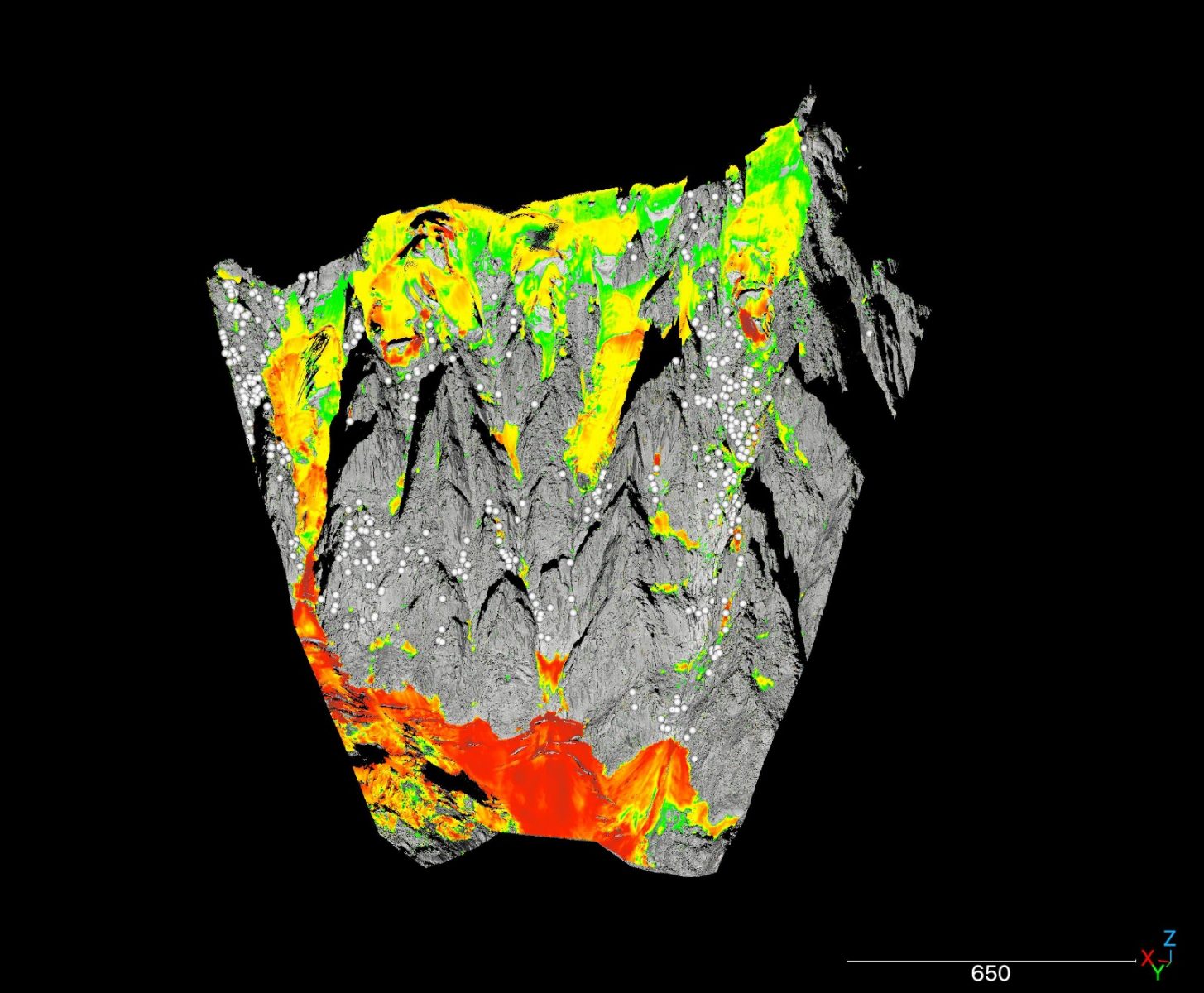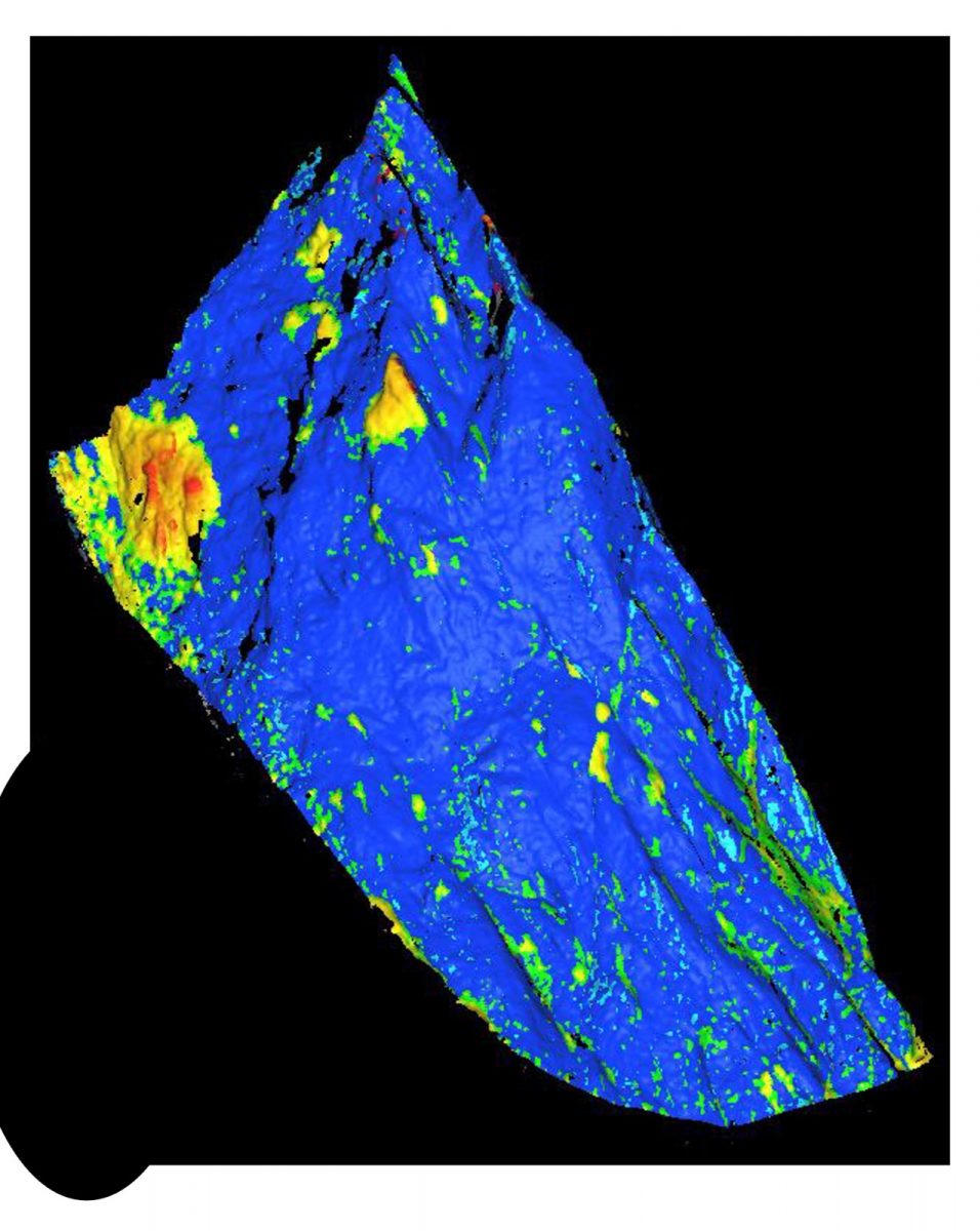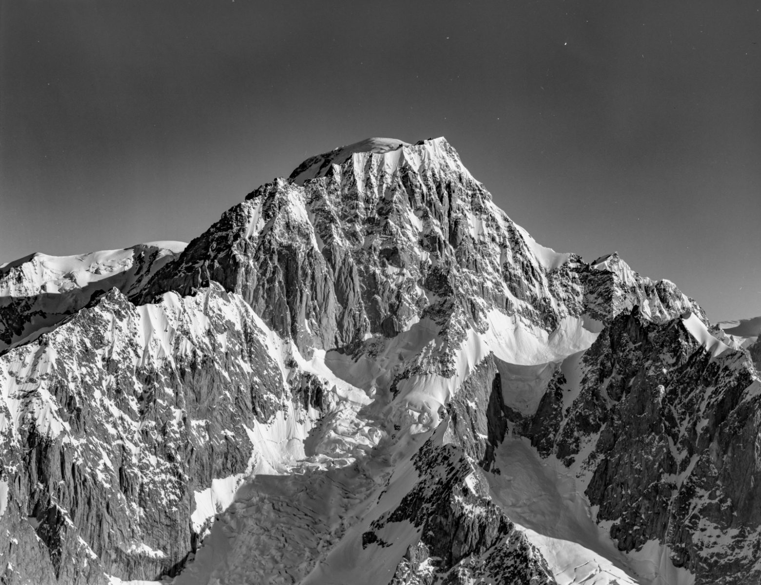
Long-term topographic changes at high altitude in the Alps, at different spatial and temporal scales, are challenging to quantify, often due to lack of direct evidence. Historic rockfalls are not always visually evident and their debris is frequently consumed by surrounding glaciers, and hanging glaciers leave no moraines to mark their evolution. Remote sensing techniques such as Light Detection and Ranging (LiDAR) have become powerful tools for precisely quantifying geomorphometric changes in the 21 st century. However, rates of change based on the short time intervals of data produced since the advent of these modern techniques might not reflect longer-term trends. To extend the record of topographic changes of rock and glacier surfaces, Structure-from-Motion (SfM) photogrammetry techniques exploiting archival imagery can be used to create 3D models of past Alpine zone topography with which modern LiDAR can be combined to quantify longer-term rates of change. Combining archival SfM and recent LiDAR 3D models allows the estimation of historical erosion rates and glacier surface height change in the Mont-Blanc massif from the southeast face of Grand Pilier d’Angle (GPA; 4,243 m a.s.l.) from 1929-2021, the Brouillard Pillars (BP; 4150 m a.s.l.) from 1950-2021, the Aiguille du Midi (AdM; 3,842 m a.s.l.) from 1909-2022, and the Aiguille Verte (4,122 m a.s.l.) from 1932-2021. 1-year-interval LiDAR surveys of the GPA and AdM from 2020-2021 and 2021-2022, respectively, provide high-resolution erosion rates for a reference against the rates calculated with the SfM method. The GPA had erosion rates of 5.9±2.3mm year -1 and 8.5±0.1 mm year -1 for the 1929-2021 and 2020-2021 time-intervals, respectively. The BP had a rate of 1.0±0.39 mm year -1 for the period 1950-2022, and the AgM had a 16.4± 0.9 mm year -1 rate from 2021-2022. The 6 hanging glaciers of the AdM north face had an average surface height change of -9.39 m from 1909-2022. SfM models from archival photographs show an increase in the annual erosion rate of the GPA but more LiDAR scans are necessary to calculate the current rate of the Brouillard Pillar.