
Deepak KC, PhD Student and Prof Michel Jaboyedoff, University of Lausanne
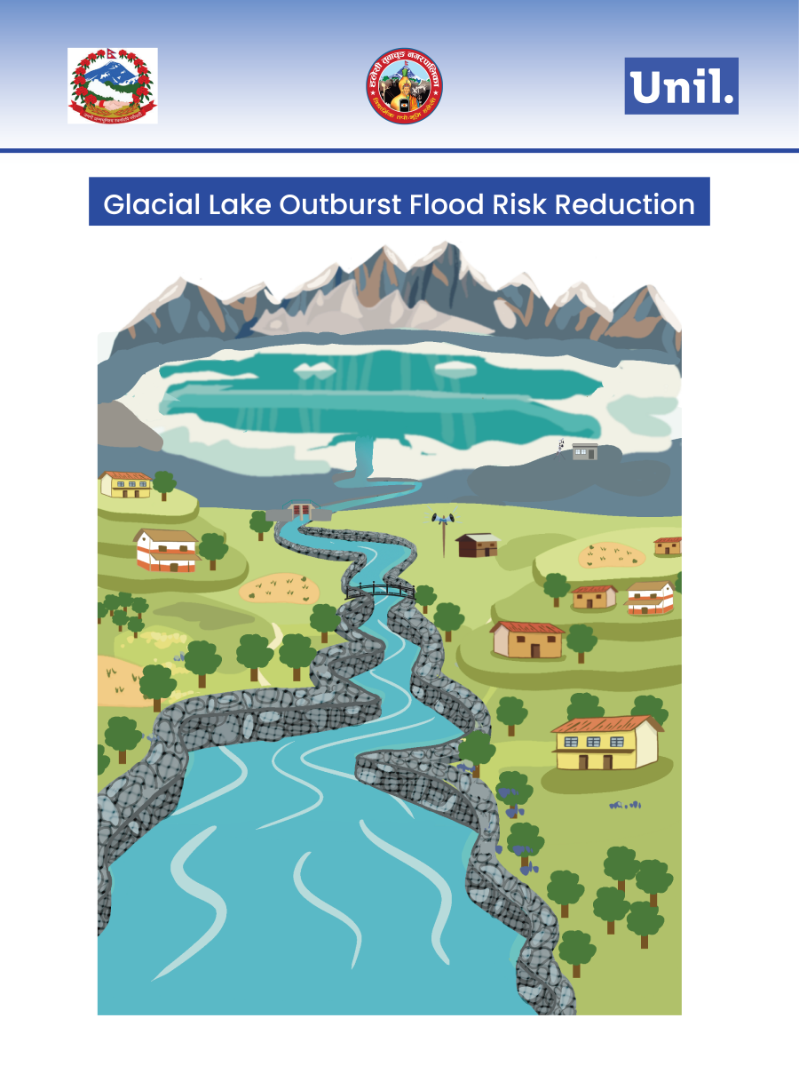
The NEPALPINE initiative—kNowledge Exchange to Promote Awareness of natural hazards and related Preparedness In Nepal—is a collaborative outreach partnership between the University of Lausanne (UNIL) and Tribhuvan University (TU). The project addresses key themes including Seismology, Geology, Climate & Landslides, GLOF & Floods, and Human Perception. Within this framework, the GLOF COACHING component was implemented to strengthen scientific understanding, institutional preparedness, and school-level awareness of Glacial Lake Outburst Flood (GLOF) risks in the Dudhkoshi watershed of eastern Nepal.
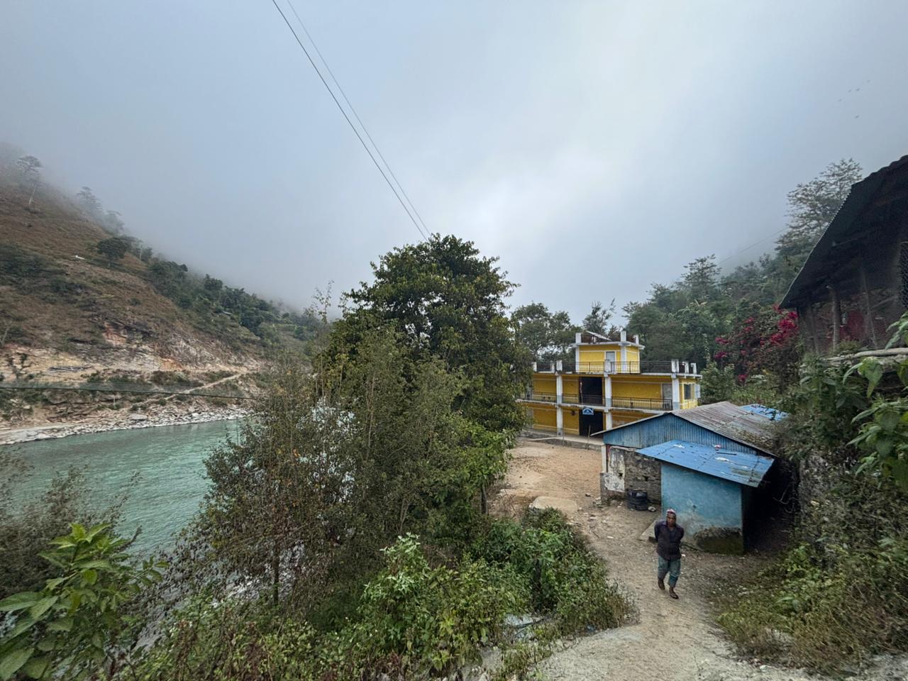
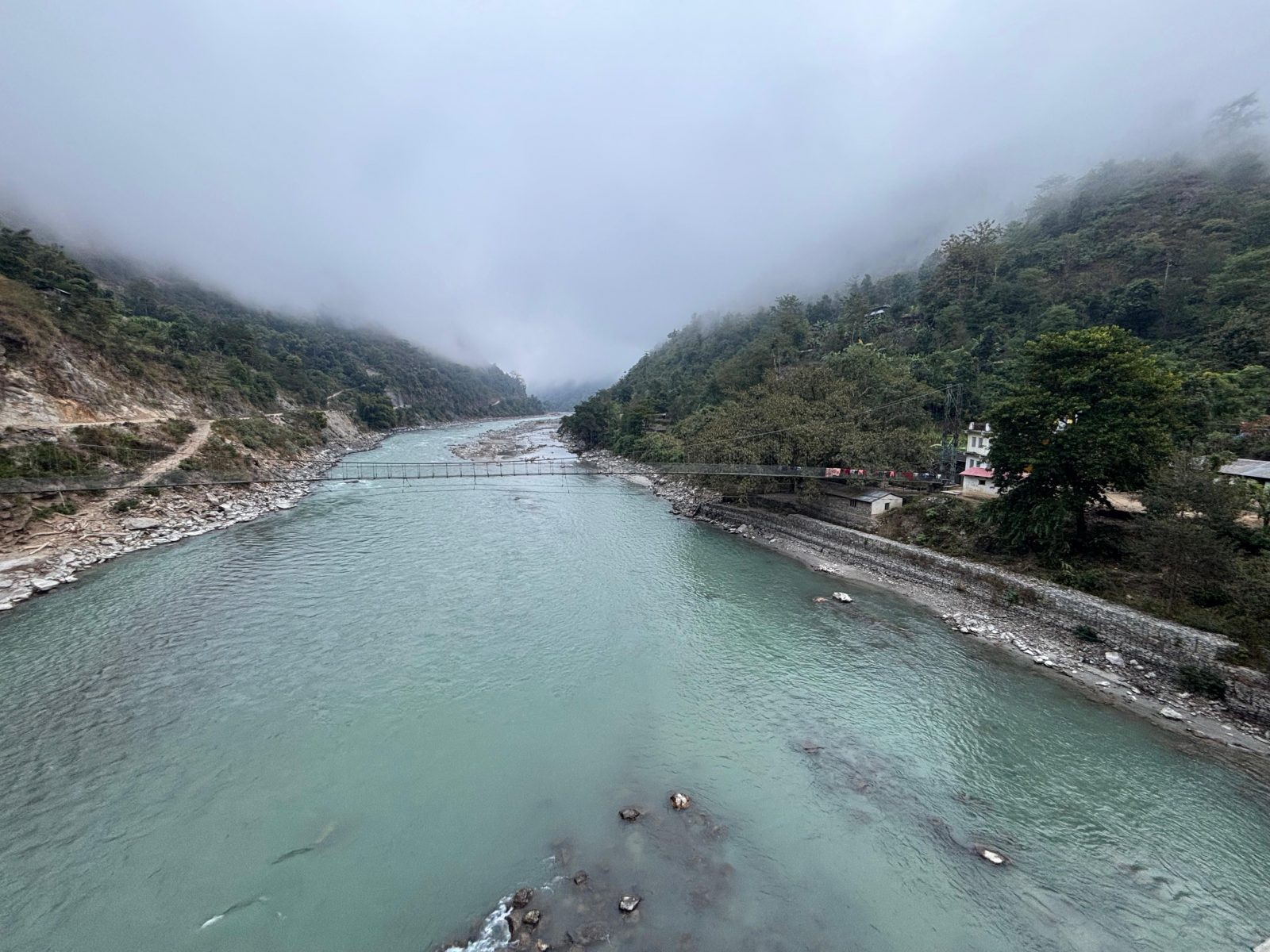
Accelerated glacier retreat across the Himalaya has contributed to the formation and expansion of glacial lakes, increasing GLOF hazards to settlements and critical infrastructure in the downstream. Shree Dudhkoshi Basic School (Lower Secondary), located in Haleshi Tuwachung Municipality, along the Dudhkoshi river corridor, was identified as physically exposed to potential GLOF and riverine flood risks. The intervention therefore aimed to establish an evidence-based, replicable model of school-centered awareness and preparedness.
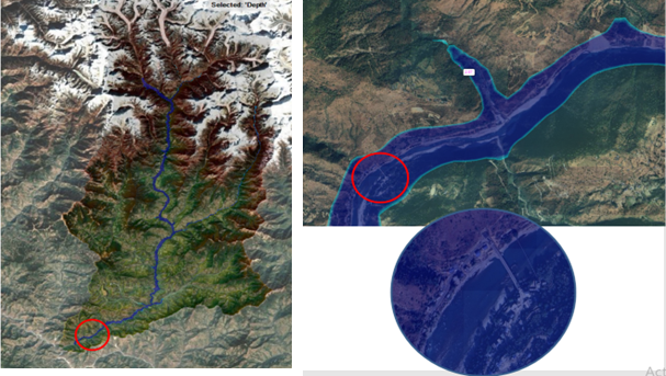
Hydro-geomorphological modelling was carried out to delineate potential GLOF source areas and downstream flood propagation corridors in the Dudhkoshi basin, consistent with established Himalayan hazard assessment approaches (Carrivick and Tweed, 2016; Worni et al., 2012). The basin contains several expanding moraine-dammed lakes, notably Lumding Tsho and Hongu-II, which are considered potentially dangerous under ongoing glacier retreat trends documented across the eastern Himalaya (Bolch et al., 2019).
Given the historical evidence of destructive GLOFs in Nepal (Bajracharya et al., 2007), the Dudhkoshi system represents a high-exposure river corridor where compound cryosphere–monsoon interactions may amplify downstream impacts (Emmer and Vilímek, 2013; Kikstra et al., 2022).
To quantify potential impacts, a hydraulic flood simulation using HEC-RAS was conducted, following methodologies widely applied in Himalayan basins for GLOF routing and inundation mapping (Khanal et al., 2015; Somos-Valenzuela et al., 2014). Glacier-dominated mountain regions face distinct adaptation challenges under ongoing climate change, particularly due to the increasing threat of glacial lake outburst floods (GLOFs), which can rapidly inundate downstream areas and cause significant social, environmental, and economic impacts. Peak outflows were estimated using the Froehlich dam-breach method (Froehlich, 1995; 2008), assuming partial breach depths of up to 7 m, a parameter range commonly adopted for moraine-dam scenarios (Worni et al., 2012). The worst-case scenario combined synchronous breach hydrographs from Lumding Khola and Hongu Khola with a 100-year return period monsoon flood, representing a plausible compound hazard configuration. Model results indicate that confluence amplification within the confined Dudhkoshi valley could generate peak discharges of several thousand cubic metres per second, magnitudes consistent with documented Himalayan GLOF events (Froehlich, 2025).
Spatial inundation outputs reveal that Dudhkoshi Basic School lies within a potential exposure corridor under this multi-glacial Lakes breach scenario. As river terrace schools and associated community infrastructure are recognized as highly vulnerable elements in mountain floodplains (ICIMOD, 2011; UNDRR, 2019), the findings underscore significant risks for downstream infrastructures including schools, students, access routes, and surrounding livelihoods as a whole. Height Above Nearest Drainage (HAND) analysis can strengthen exposure interpretation by identifying low-lying river terraces and flood-prone corridors. In the Dudhkoshi basin, elements at risk—including households, access routes, livelihood areas, and other infrastructure including Shree Dudhkoshi Basic School—located at low HAND values are more susceptible to rapid inundation during compound GLOF–monsoon events.
The modelling therefore provides a strong scientific basis for GLOF hazards mapping/zonation, need of prioritizing GLOF risk reduction measures, early warning systems, structured evacuation planning with school and community-based mock drills, and risk-sensitive land-use management in the Dudhkoshi watershed, aligning with national and sub national level policies and action plans.
To guide intervention design, three diagnostic assessments were conducted:
Shree Dudhkoshi Basic School scored 50/60 (83%), placing it in the Very High risk category on Physical Exposure and Vulnerability Perception Assessment, indicating school’s Very High physical exposure”. All 10 core physical indicators scored 3/3, confirming <100 m river proximity, valley confinement, annual/seasonal flooding, debris evidence, and past flood reach floodplain location, annual flooding, active erosion, and recent flood reach while preparedness and warning capacity averaged 2/3, reflecting partial readiness. The Student Knowledge and Awareness Assessment reveals limited conceptual understanding of glacier dynamics and GLOF risks. The school scored 25/90 on the Existing Curriculum, Capacity and Practice Assessment indicating Weak status indicating very limited coverage of climate change topics but minimal integration of cryosphere related hazards including GLOF, Avalanche and no history of mock drills.
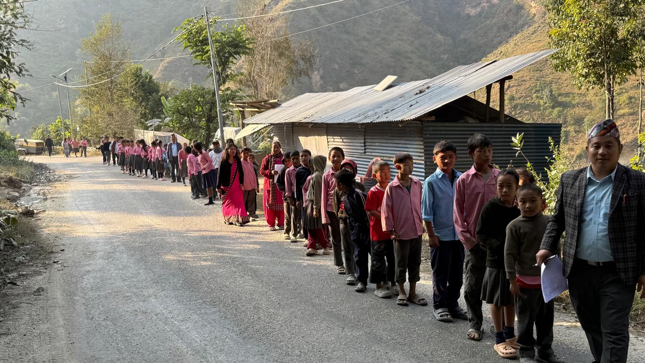
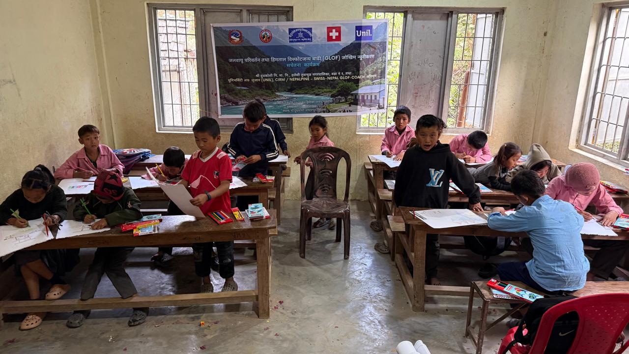
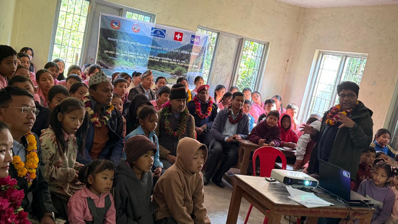
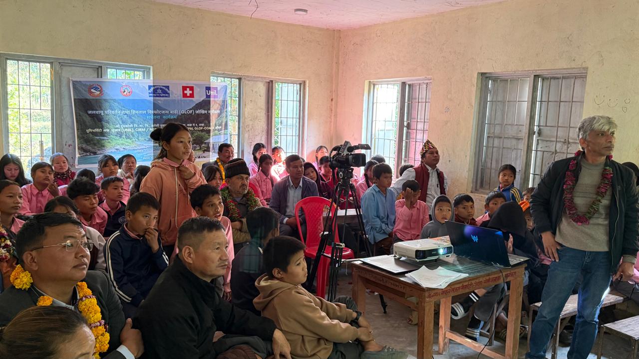
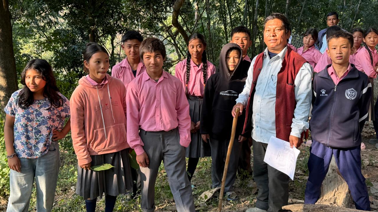
Based on these findings, a comprehensive School-Level GLOF Awareness Event was organized with participation from over 120 stakeholders, including the Mayor of Haleshi Tuwachung Municipality, ward officials, media representatives, security forces, Red Cross, teachers, and approximately 90 students (Kindergarten to Grade 8).
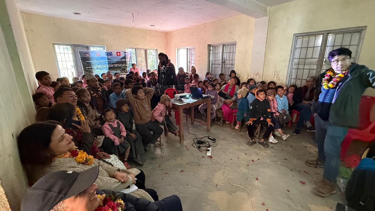
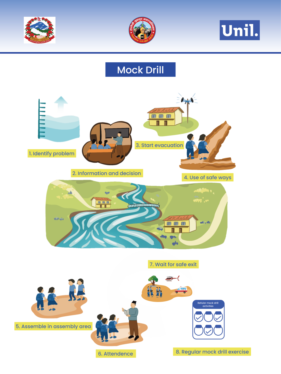
The program included a symbolic climate-adaptation inauguration through tree plantation, interactive visual lectures in simple Nepali language, quizzes and educational videos, the first-ever structured GLOF mock drill in the school’s history, and a student art competition on climate change and disaster risk reduction.
To ensure sustainability, a 9-member ECO–DRR Student Club has been formally established, and educational materials—including environmental storybooks, art supplies, and printed mock drill SOPs—were handed over to the school.
Replication Across Nepal’s Ecological Regions
Nepal’s Mountain, Hill, and Terai regions are hydrologically interconnected. While GLOFs originate in high mountain basins, their impacts cascade downstream through hills and plains. The NEPALPINE intervention significantly enhanced awareness, strengthened practical preparedness, and fostered local ownership for sustainability of such activities. The Haleshi Tuwachung Municipality authorities expressed strong commitment to replicate and upscale such interventions across other schools within the municipality. This intervention demonstrated that combining scientific hazard modeling, structured technical and participatory assessments, and strong local and school stakeholder engagement can create a coherent and scalable framework for resilience-building and replication. This model should be replicated across high-exposure schools in Dudhkoshi and adjoining watersheds and progressively adapted across Nepal’s ecological gradients.
Bridging Science, Policy, and Practice
The NEPALPINE GLOF COACHING experience underscores a central lesson: resilience emerges where rigorous hazard science converges with education, governance, and community ownership. Monitoring glaciers without community engagement is insufficient. Conducting awareness programs without scientific grounding is equally limited. Integrated, multi-scale actions across various domains such as Ecological / Natural Environment, Socio-economic Systems, Governance & Institutions, Physical Infrastructure and Education, Knowledge & Innovation is the only viable pathway forward for effective results on building resilience in the communities. From glacier monitoring in the high Himalaya to mock drills in local classrooms, building resilience requires sustained collaboration, institutional commitment, and scalable implementation. The Dudhkoshi experience offers a concrete foundation for transforming cryospheric risk knowledge into long-term societal resilience across Nepal’s mountain river corridors.
Strategic Recommendations for Scaling Impact
1. Regular Monitoring of Glaciers and Glacial Lakes
Continuous satellite-based observation combined with periodic field validation is essential to track glacier retreat, lake formation and expansion, moraine stability, and breach susceptibility. Monitoring systems must be institutionalized through national agencies and linked with academic partners to ensure dynamic risk forecasting. Local government needs to be engaged to make necessary actions plan for safety of the communities downstream.
2. Regular Updating of GLOF Hazard Zonation and Mapping
GLOF and Avalanche hazard maps must be treated as living documents and very important milestones to loss and damage of economic and non-economic assets. The example hazard mapping and early warning system of Swiss Alps is exemplary. Such maps must guide risk sensitive land use planning for establishing any infrastructures such as schools, residents, markets , agricultural practices and efficient disaster risk reductions and management to avoid such loss and damages.
3. Updated Glacial Lake Inventory and Identification of Critical Lakes
Nepal requires systematic updating of its glacial lake inventory, including lakes of all sizes—not only large, well-known systems. Smaller lakes can evolve rapidly under climate stress. Risk prioritization should integrate lake volume, expansion rate due to rising temperature at the glacier environment, dam material characteristics, slope instability, elements at risk in the downstream with exposure density.
4. Watershed-Scale GLOF Risk Reduction Measures
Watershed-scale integration ensures upstream mitigation reduces downstream exposure.
Risk reduction must combine structural and non-structural measures such as controlled lake lowering and drainage systems, riverbank stabilization and protective embankments and slope stabilization in erosion-prone corridors. Similarly, the Non-structural measures include end-to-end Early Warning Systems (EWS), community evacuation planning, institutionalized mock drills and risk communication protocols.
5. Integration into National and Local School Curriculum
Climate change, glacier dynamics, Climate Change induced hazards such as Avalanche, GLOF risk reduction, and cascading climate-induced hazards must be formally integrated into national and local curricula. Local curriculum development should reflect watershed-specific hazard contexts. In addition to the curriculums, practical implementation is essential such as bi-annual mock drills, school evacuation route mapping, hazard visualization exercises and student-led awareness campaigns. Education must move from theoretical understanding to practiced response behavior.
6. Institutionalization Through School Governance
Environment Conservation and Disaster Risk Reduction (ECO–DRR) Clubs, School Management Committees, and municipal education authorities must prioritize practical teaching and learning approach and should embed such climate actions in the regular school calendar as a routine school governance. Institutionalization brings indigenous knowledge and prevents intergenerational knowledge loss and ensures sustainability.
7. Resource Mobilization Across Governance Levels
Building resilience costs resources and hence must be budgeted, not assumed. Sustainable implementation requires coordinated and sustained financing mechanisms. Local governments, provincial authorities, federal agencies, and development partners must allocate dedicated resources for such actions which build climate resilient communities. The resources should be allocated for glacier and Glacial Lakes monitoring, GLOF Risk Reductions, Early Warning Systems, teachers’ training, curriculum development, School safety, regular drills and awareness campaigns.
Acknowledgement: Seed Funding Project – NEPALPINE – kNowledge Exchange to Promote Awareness of naturaL hazards and related Preparedness In NEpal, Faculty of Geosciences and Environment, Interdisciplinary Centre for Mountain Research, University of Lausanne .