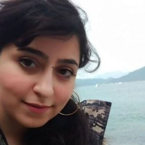
Biography

I am a geoscience researcher at GAIA laboratory, University of Lausanne, since 2020. When I was a little girl, I was curious about how to make people live longer and froze my small fish to make an experiment on it. My interest in mathematics and engineering made me forget about this curiosity. I have done a B.S. in Surveying Engineering. I was lucky that I chose remote sensing in my graduate years, making me a free girl who can follow her curiosity. Although I am not able to make people live longer, I can still analyze remotely sensed data to understand how our environment and the planet change in order to have a better life.
Research Statement
As remotely sensed data is affected by acquisition limitations, such as clouds, shadows, revisiting time, and so on, my research focuses on producing a continuous and consistent Earth surface data by analyzing available climate data and remotely sensed images. Currently, I am working on estimating high-resolution images of snow cover and snow water equivalent.
Grants
- Received the UNIL mobility fellowship 2021.
- Received a Virtual Student Travel Grant to participate in American Geophysical Union (AGU) Fall Meeting, 2020.
- Received research visiting financial support from the National Elites Foundation (society of prominent students of the country), 2017-2018.
- Received POSTECH Summer Program admission, 2019.
Awards
- Awarded student member of the National Elites Foundation (society of prominent students of the country).
- Ranked 2nd among M.S. students of Remote Sensing major, K. N. Toosi University of Technology.
- Ranked 3rd among bachelor students in surveying engineering, at the surveying college, Tehran.
International Experiments
- Exchange researcher at UC Berkeley, Nov. 2022- Apr. 2023.
- Visiting researcher at the Institute of Space and Earth Information Science, the Chinese University of Hong Kong, Hong Kong, Feb. 2018- Oct. 2018.
Key Publications
Articles
- Zakeri F., Mariethoz G., “Synthesizing long-term satellite imagery consistent with climate data: Application to daily snow cover”, 2024, Remote Sensing of Environment_URL.
- Zakeri F., Mariethoz G., “A review of geostatistical simulation models applied to remote sensing: methods and applications”, 2020, Remote Sensing of Environment_URL.
- Zakeri F., Saradjian M., “Change Detection in Multispectral Images Based on Fusion of Change Vector Analysis in Posterior Probability Space and Posterior Probability Space Angle Mapper”, 2020, Geocarto International_URL.
- Zakeri F., Huang B., Saradjian M., “Fusion of Change Vector Analysis in Posterior Probability Space and Post Classification Comparison for Change Detection from Multi-Spectral Remote Sensing Data”, 2019, Remote Sensing_ URL
- Zakeri F., Valadanzouj M.J., “Adaptive Method of Speckle Reduction Based on Curvelet Transform and Thresholding Neural Network in Synthetic Aperture Radar Images”, 2015, Journal of Applied Remote Sensing, 9(1)_URL
Conferences
- Zakeri F., Mariethoz G., Girotto M., “Advancing Snow Water Equivalent Estimation: A Novel Technique for High-Resolution Daily Data Reconstruction from 1950 to 2100”, AGU23_URL.
- Zakeri F., Mariethoz G., “Synthesizing Daily Snow Cover Maps Using Satellite Images and Climate Information”, EGU22_URL.
Employment History
- Research Assistant, GAIA laboratory, University of Lausanne, Switzerland, Apr. 2020-continuing (full-time).
- Research Assistant, Sharif University of Technology, Sep. 2017- Jan.2018 (part-time).
- Surveying Engineer (Tehran Building Engineering Council, Dec. 2014- Mar. 2020) (part-time).
Language Ability
• English (fluent): IELTS BandScore 7,
• Persian (native),
• Azeri (native),
• Turkish (familiar),
• Arabic (familiar),
• French (basic, continuing learning)
Contact
Institute of Earth Surface Dynamics (IDYST),
UNIL-Mouline, Geopolis,
University of Lausanne,
1015 Lausanne, Switzerland
fatemeh.zakeri@unil.ch
