One of our main research areas is related to Multiple-Point Statistics, and here is a list of references related to MPS.
Please check out the book that will tell you everything you always wanted to know about MPS, which is published with Wiley.
Below is a (incomplete and not up-to-date) list of some recent and less recent research topics. For a more complete list, please refer to the publications page where links to journal articles are available, except the very recent ones for which there may be an embargo period. You can also send me an email if you need a specific paper (please no researchgate or linkedin messages).
Ongoing projects
- Downscaling of digital elevation models
- Stochastic models for super-small-scale rainfall generation
- Colorization of multispectral remote sensing images
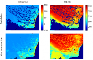
- Analogue-based fusion of different satellite products
- Fundamental development of geostatistical algorithms (working on both training image-based and covariance-based models)
- Environmental data acquisition with innovative low-cost sensors – we want to know where the data we model are coming from!
- Application of the above to real-world questions, mostly in the context of environmental change in alpine regions
A selection of some past projects
Building large distributed and spatially-calibrated hydrological models for large semiarid catchments. Determining the value of different datasets (climate reanalysis datasets and evaporation datasets) for improved hydrological forecast, under different climate scenarios.
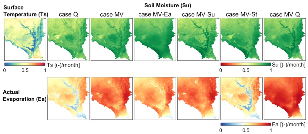
Algorithms for training image-based Super-Resolution and downscaling of Climate models, rainfall fields, digital elevation models, and satellite imagery.

Multiple-point geostatistics for noise-filtering time series, for generating rainfall time series data, and for gap-filling streamflow time series, at single sites or at multiple sites along a large river network, and for multisite rainfall.
Multiple-point geostatisics with the QuickSampling algorithm – more on the methods and open-access code here.
![]()
Strategies to accelerate multiple-point geostatistical simulation: by using a two-stage strategy that distinguishes complex and simple patterns, or through parallelization.
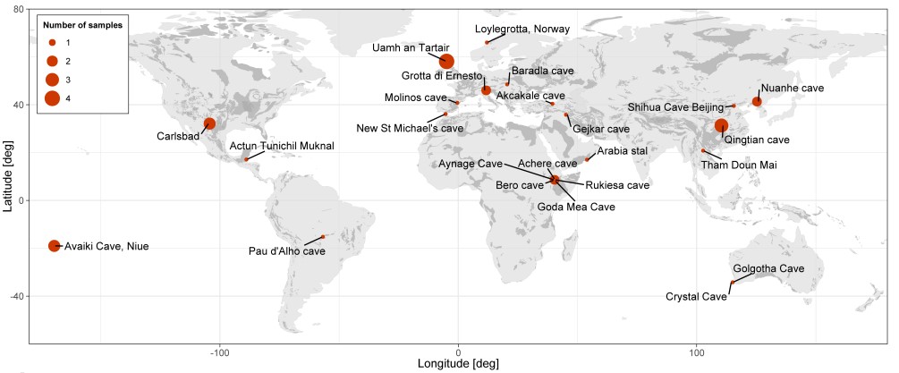
Quantative characterization of speleothems for paleoclimate reconstruction, with new metrics used in Ethiopia (here and here), as a global review, and with a digital technique to automate laminae counting.
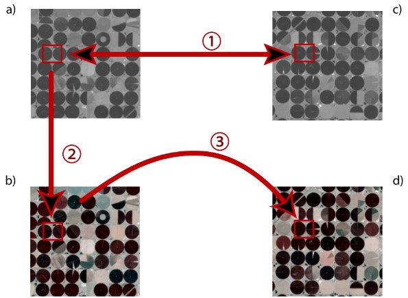
Colorization of ancient remote sensing images.
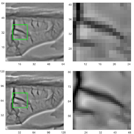
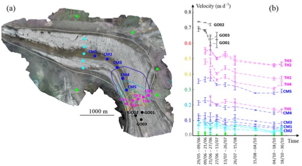
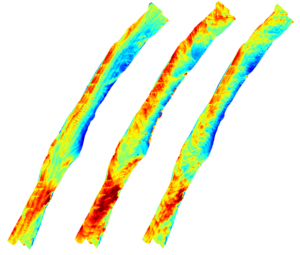
Glacier observation and velocity quantification with repeated drone surveys.
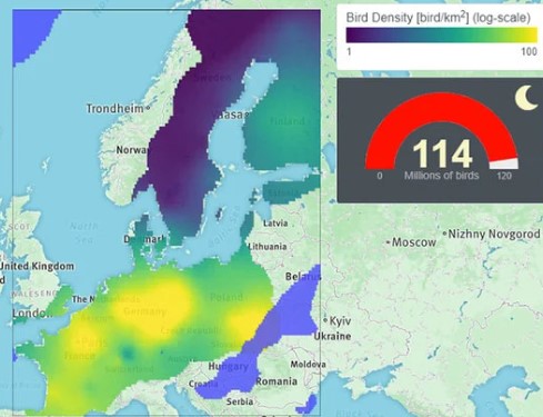
Geostatistical characterization of bird migration patterns using radars and models
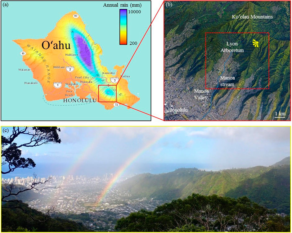
Characterization of rainfall patterns in tropical island catchments.
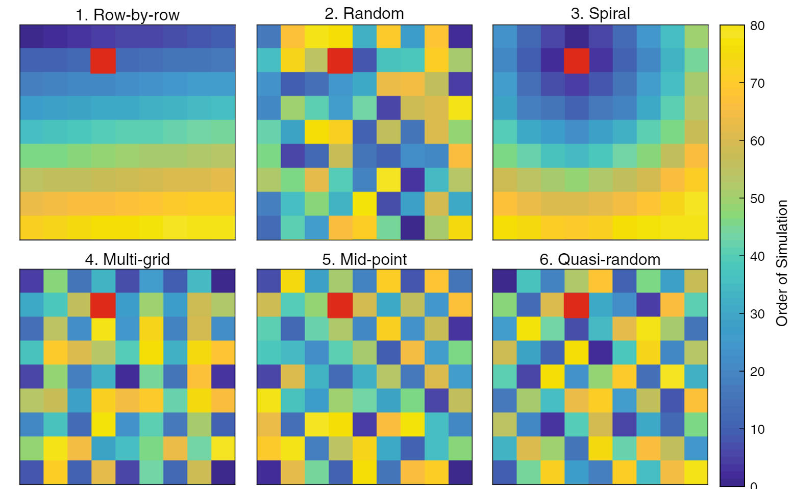
Investigation of the best possible path in sequential simulation algorithms for speed and for best simulation.
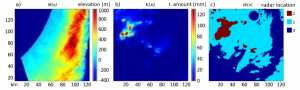
Rainfall simulation with multiple-point geostatistics including radar data, elevation and weather types.
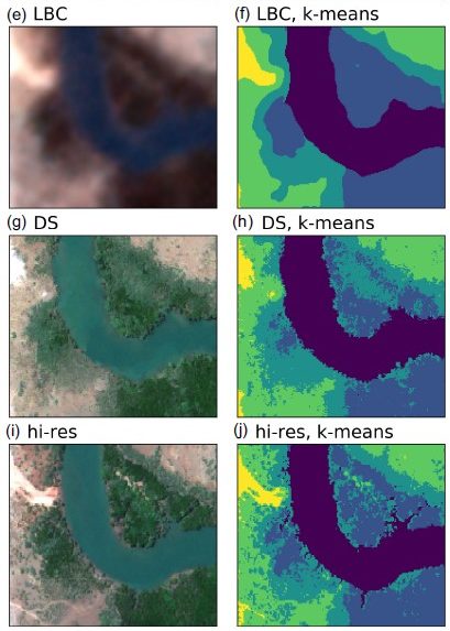
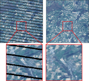
Gap-filling of satellite images using analogues – and other techniques (with particular focus on Landsat-7, but not only)
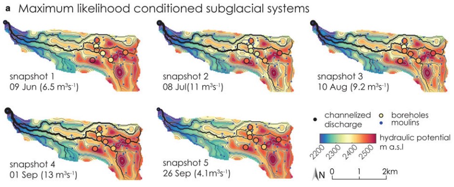
Inverse modeling of subglacial networks, with fundamental developments on a method for simulating a channels network conditioned to pressure data, and its application to the seasonal evolution of the a real alpine glacier.
Agent-based models for water resources management, their use to incorporate social dynamics, and to investigate the timing of such dynamics.
Multiple-point simulation using graph cuts
Fusion of radar and rain gauge data (and combining data more in general)
Space-time rainfall simulation: a review, a new model for very high resolution rainfall, also for different rain types and for assimilating radar data.
Optimal sampling design aided by training images
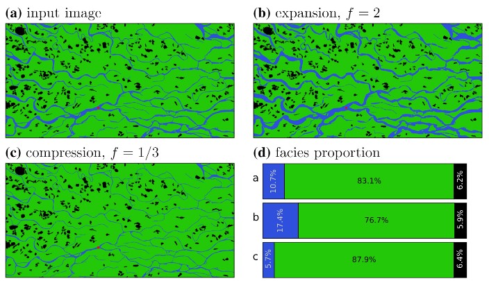
Making multiple-point simulations more usable: block constraints, imposing proportions and trends, and the interactive edition of training images.
Graph cuts for efficient geostatistical inversion
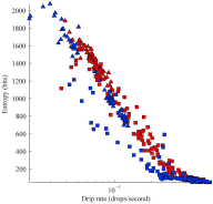
The use of Lidar for the identification of cave morphological features, the quantification of relationships between cave morphology and water percolation, the identification of different drip types in caves, and a low-cost Lidar system so that everyone can have fun in caves.
![]()
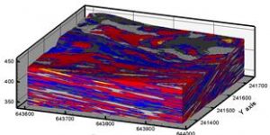
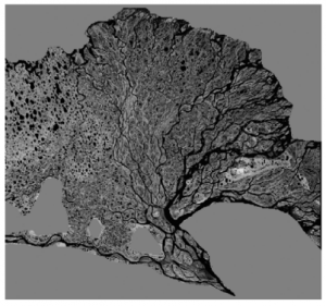
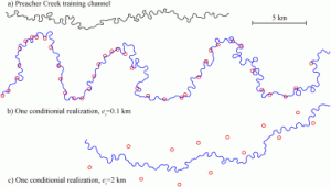
Stochastic simulation of meandering structures with satellite-based analogs
And some cool animations here and here
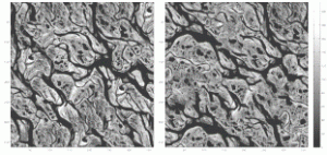
Texture synthesis algorithms – including Image Quilting – see more on image quilting here.
Automatic selection of training images for MPS: Validation of training images by patterns comparison for training image selection (Download the Fortran code), and an improved approach using image analysis.
Automatic parameterization of MPS algorithms:
Probabilistic mapping of buried soil features
Reconstruction of buried paleovalleys
Remote sensing spatio-temporal gaps reconstruction
Percolation processes in karst environments and chaotic behavior
Transform-invariant distances – with applications to subsurface models
![]()
Spatial inverse problems: Iterative Spatial Resampling
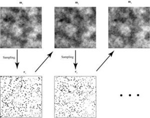
Direct Sampling multiple-point simulation
Cosimulation by Probability aggregation
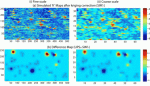
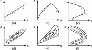
We propose a new cosimulation algorithm for simulating a primary attribute using one or several secondary attributes known exhaustively on the domain. This problem is frequently encountered in surface and groundwater hydrology when a variable of interest is measured only at a discrete number of locations and when the secondary variable is mapped by indirect techniques such as geophysics or remote sensing. In the proposed approach, the correlation between the two variables is modeled by a joint probability distribution function. A technique to construct such relation using underlying variables and physical laws is proposed when field data are insufficient. The simulation algorithm proceeds sequentially. At each location of the domain, two conditional probability distribution functions (cpdf) are inferred. The cpdf of the main attribute is inferred in a classical way from the neighboring data and a model of spatial variability. The second cpdf is inferred directly from the joint probability distribution function of the two attributes and the value of the secondary attribute at the location to be simulated. The two distribution functions are combined by probability aggregation to obtain the local cpdf from which a value for the primary attribute is randomly drawn. Various examples using synthetic and remote sensing data demonstrates that the method is more accurate than the classical collocated cosimulation technique when a complex relation relates the two attributes.
Ressources
Powerpoint presentation: Mariethoz_cosimul_proba_aggregation.ppt
References
Mariethoz Grégoire, Renard Philippe, Roland Froidevaux, 2009. Integrating auxiliary parameters in geostatistical simulations using probability aggregation. Water resources Research 45(W08421), doi:10.1029/2008WR007408. mariethoz2009b.pdf