The main research interests of the research group reside in the d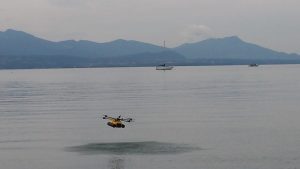 evelopment of methods to understand the variability inherent to natural systems. We use advanced spatio-temporal modeling to study problems related to water resources and climate change.
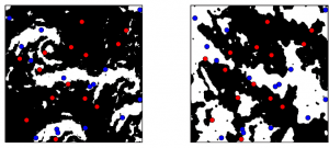
The statistical and machine learning approaches we develop are leveraging large amounts of data such as those coming from satellite observations or climare models. As such, we work at the frontier between Environmental Science and Computer Science, with a strong emphasis on stochastic models, training images and analog-based modeling. Our contributions include algorithms to perform missing data reconstruction and stochastic simulations, broadly known as Multiple-Point Statistics (MPS). Please check out the book on this topic.
The main research themes are: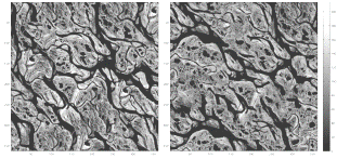
- Remote Sensing (Image processing, gap-filling, data fusion, statistical downscaling, pattern analysis).
- Geostatistics (Multiple-point geostatistics as well as variogram-based geostatistics, training images, model inference, spatial variability, texture synthesis, parallel computing).
- Climate (rainfall measurement and uncertainty quantification, climate change indicators, predictions from multiple climate models).
- Hydrology (Spatio-temporal rainfall analysis, rainfall-runoff modeling, rainfall measurement, time series analysis, water resources management using Agent-Based Models).
- Hydrogeology (Aquifer heterogeneity, flow and transport modeling, inverse problems, pore-scale models, karst infiltration processes, groundwater usage optimization).