
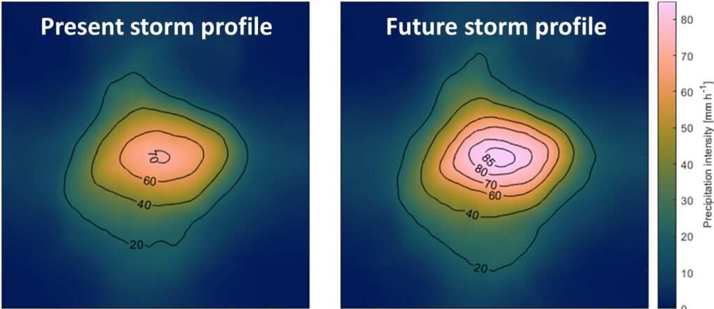
The Spatial Quantile Mapping (SQM) is a simple method for spatially adjusting the structure of design storms. This method enables the morphing of recorded precipitation fields (intensities, storm area and spatial structure) following, e.g., changes in climate
References
Peleg, N., Ban, N., Gibson, M.J., Chen, A.S., Paschalis, A., Burlando, P. and Leitão, J.P., 2022. Mapping storm spatial profiles for flood impact assessments. Advances in Water Resources, 166, p.104258.
Code
Nadav Peleg. (2022). Spatial quantile mapping code example. Zenodo. https://doi.org/10.5281/zenodo.6563635