
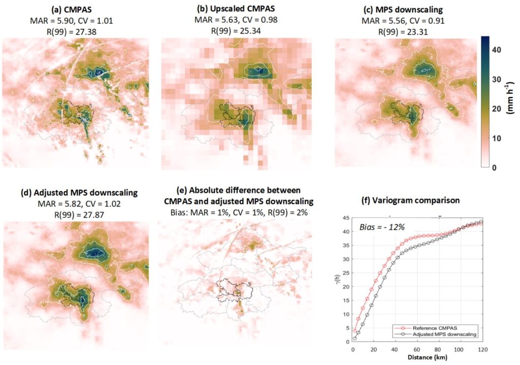
A 2-dimensional precipitation downscaling method is suggested by using the multiple-point geostatistics (MPS) model (Gravey and Mariethoz, 2020) with a precipitation coefficient of variation adjustment. An example of an application in Beijing (China) is provided in the code. The MPS-based downscaling approach can be easily modified and applied to other rainfall products and regions.
References
Zou, W., Hu, G., Wiersma, P., Yin, S., Xiao, Y., Mariethoz, G., Peleg, N., Multiple-point geostatistics-based spatial downscaling of heavy rainfall fields. Journal of Hydrology, 632, 130899.
Code
Zou, W., & Peleg, N. (2024). Mutiple-point geostatistics (MPS) based spatial downscaling of heavy rainfall fields —– An example of Beijing city. Zenodo. https://doi.org/10.5281/zenodo.10497207