The Institute of Earth Sciences is monitoring erosion dynamics in a study site in Draix (SE France), in cooperation with several other research groups, as part of Benjamin Rudaz’ PhD project, and in continuation of previous studies (A. Loye, P. Béchet, J. Duc).
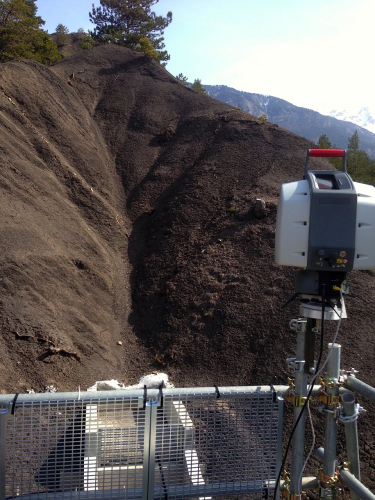
This region is characterized by black marls outcrops, wheathered and eroded by the alpine mediterranean climate, resulting in a pluricentimetric annual erosion rate, which can be quantified and observed through high-resolution LiDAR-acquired DTMs. LiDAR campaigns began in 2007 for the Roubine catchment (~1400 m2), and thanks to a research grant from the Herbette Foundation, it will continue and develop on the Roubinette, a first-order gully of 140 m2 situated right by the Roubine.
The goals of this new research is to increase the precision when comparing LiDAR scans, by removing the vegetation, scanning from a higher position and combining LiDAR and photogrammetric methods.
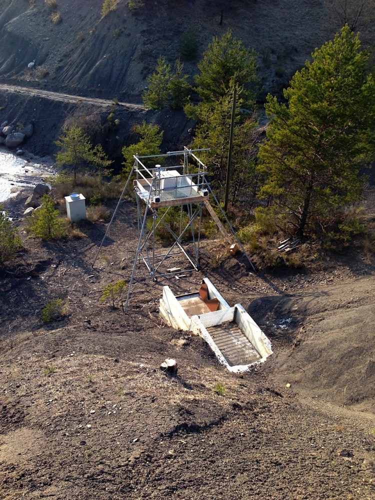
Higher scanning position has been achieved with a 4 meters steel-beam tower, on top of which sits the LiDAR pad. This allows the scanner to view nearly 100% of the incised terrain. Also perched on the tower are 2 Harbotronics time-lapse packages, taking high-quality digital photograph every hour during the day. Their separation, as with human eyes, will allow 3D reconstruction of the terrain, on an hourly basis. This will complement LiDAR scans, which can be only done every few months. Finally, the setup is accompanied by a meteorological station, soil humidity sensors, and a concrete sediment catch which captures the outgoing water and sediments.
The installation was finalized during a field trip in march 2014, and is thus now fully operational. Stay tuned for future exciting results!