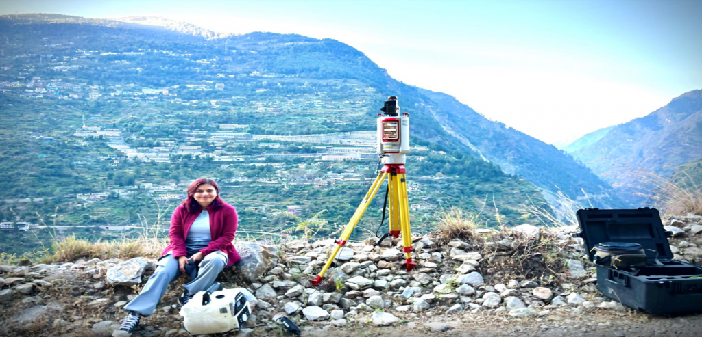
Joshimath, a hill town in India’s Garhwal Himalayas, is densely populated despite its fragile terrain and proximity to the active Himalayan thrust faults. The town rests on old extensive landslide debris, deeply incised by the Dhauliganga and Alaknanda rivers and has long experienced intermittent creeping and secondary landslides along the hill toe. These slopes have further faced additional instability due to heavy toe erosion from the recent February 7, 2021 debris flow. Construction in Joshimath has been largely unplanned, further straining its unstable slopes. Since October 2021, accelerated surface movements have caused significant damage, with 868 buildings damaged and nearly 1,000 residents displaced as of January 2023.
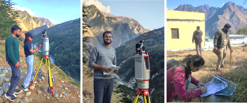
To analyse and monitor the recent acceleration of surface movements in Joshimath town, fieldwork was conducted in two phases (November–December 2023 and November–December 2024) by Shobhana Lakhera, a PhD student, at the Institute of Earth Sciences (ISTE), University of Lausanne (UNIL). This This was part of Shobhana’s PhD research supervised by Prof. Michel Jaboyedoff and co-supervised by Sr. Lecturer and researcher Marc Henry Derron. The research benefited from data generously provided by the Uttarakhand State Disaster Management Authority (USDMA) and was supported by Prof. Ajanta Goswami, from the Indian Institute of Technology Roorkee (IITR), in India. Lucky Shukla, Tapas Kumar Nahak and Shahi Gaurav, PhD students from IITR’s Centre of Excellence in Disaster Mitigation and Management in Prof. Goswami’s group, along with Mohd. Attaullah Raza Khan from UNDP, contributed to the field data collection through their collaborative efforts, which greatly enriched the study.
Objectives and Activities
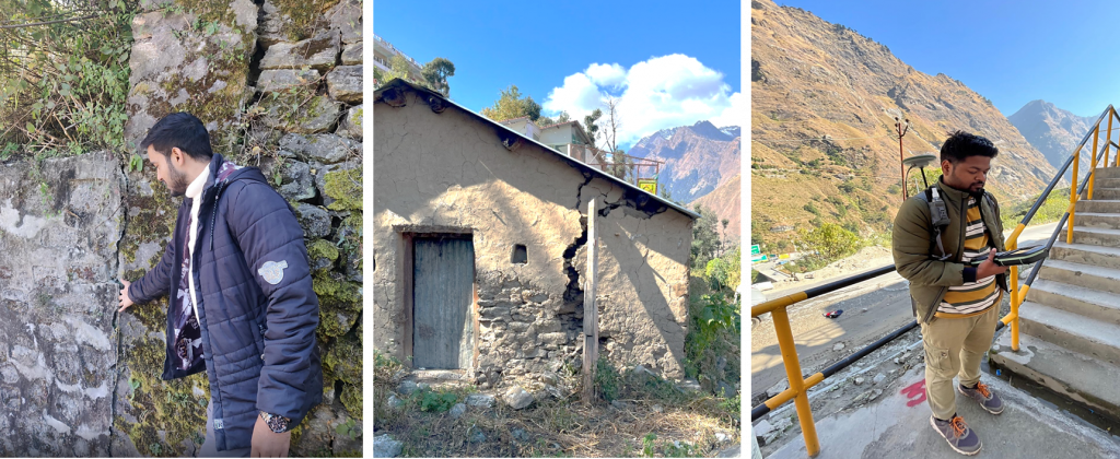
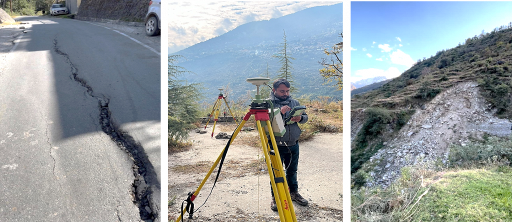
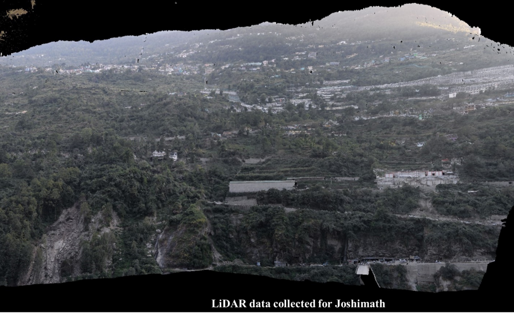
The field surveys aimed to assess and monitor ground conditions and validate existing data to better understand Joshimath’s accelerated surface movements. Key activities included:
- Topographical Analysis: Using terrestrial LiDAR to monitor topographical changes.
- Surface Movement Monitoring: Collecting DGPS data for comparison with InSAR datasets.
- Damage Documentation: Recording locations and photographing damaged buildings and ground cracks.
- Toe Erosion Analysis: Documenting active landslides and erosion caused by the DhauliGanga River and internal drainage networks.
- Water Drainage Observations: Noting drainage systems, water seepage issues, contributing to ground instability.
- Community Engagement: Meeting local representatives and impacted residents to gather insights and perspectives.
The situation in Joshimath is alarming, with unplanned construction, poor water management, and unstable deep-seated landslides compounding the risks. Accelerated surface movements since October 2021 highlight the urgent need for robust monitoring and mitigation. This project focuses on understanding how heavy toe erosion impacts landslide stability, while ongoing studies aim to track triggers and seasonal variations affecting surface movements, especially given the significant population at risk.

