The Risk Group participated to the European Geosciences Union (EGU) General Assembly in Vienna, Austria, on 17 April to 22 May 2017. This huge meeting brought together 14’496 scientists from 107 countries with 4’849 orals, 11’312 posters and 1’238 PICO presentations.
It is always an excellent opportunity for our group to meet new people and other scientists we work with during the five days of the meeting. The Risk Group people presented 30 contributions as first authors whose titles are below.
4 orals:
- Rockfall travel distances theoretical distributions
- Rockfall monitoring of a poorly consolidated marly sandstone cliff by TLS and IR thermography
- Characterization of the deformation and thermal behavior of granitic exfoliation sheets with LiDAR and infrared thermography (Yosemite Valley, USA)
-
Optimizing the use of airborne LiDAR data for a better analysis and communication of 3D results? François Noël et al.
4 PICO:
- Debris flows susceptibility mapping under tropical rain conditions in Rwanda.
- Five years database of landslides and floods affecting Swiss transportation networks
- Three consecutive years of road closures due to natural hazards in the Weisstannen valley, Canton of St-Gallen, Switzerland
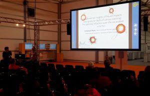
- Experimental insights of liquid impacts onto granular beds of various packings : The packing influence over the excavated volumes
9 posters:
- Integrated risk management and communication: case study of Canton Vaud (Switzerland)
- Radiometric enhancements of thermal infrared images for rock slope investigation by coupling with groundbased LiDAR
- Landslide-Generated Tsunami model
- Introducing a moving time window in the analogue method for precipitation prediction to find better analogue situations at a sub-daily time step
- Using genetic algorithms to achieve an automatic and global optimization of analogue methods for statistical downscaling of precipitation
- Development of a 3D rockfall simulation model for point cloud topography
- Understanding three decades of land use changes and a cloudburst in Phewa Lake Watershed, Western Nepal
- Automatic 3D relief acquisition and georeferencing of road sides by low-cost on-motion SfM
- Preliminary 2D numerical modeling of common granular problems


