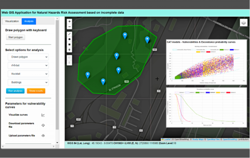
Natural hazards have a significant impact on global populations causing fatalities and damage to agriculture, buildings, and infrastructure. With climate change, such hazards are expected to become more frequent and severe, especially in Alpine regions. The 10 deaths that occurred in Switzerland in the summer of 2024 illustrate these problems, in regions where the hazard estimated in the past is probably no longer relevant. This project aims to develop a WebGIS application for natural hazard risk assessment using open-source technologies and free data from Swiss platforms, introducing uncertainty in the parameters used to estimate the risk. This approach is similar to Cat-models.
The application was built with HTML, CSS, JavaScript, and plugins like Bootstrap, Leaflet, AGGrid, and Chart.js. Data was sourced from Swiss official platforms, and six methodologies were used to estimate potential damage by assessing building vulnerability, which can be adjusted based on expert opinions for specific areas. Moreover, statistical techniques were implemented to address missing building data.
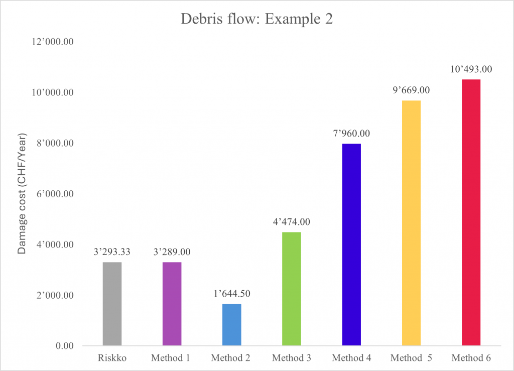
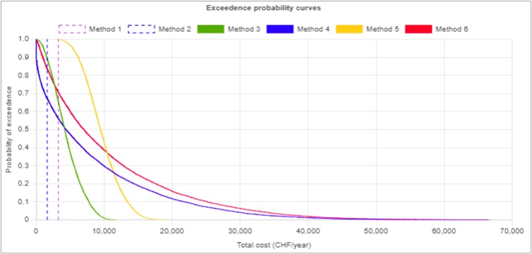
Results include total damage values per year, exportable in CSV format, and exceedance probability curves shown in histograms and graphs. Different approaches are used to calculate risk, introducing different types of uncertainty depending on the type of input data and approach, e.g. the standard Swiss risk method, which provides only one risk value, is also used to generate exceedance curves. These results were consistent with those from the Swiss assessment tools. The insurance and reinsurance industries, as well as the planners and decision-makers use similar probabilistic approaches.
This study leverages open-source technologies, demonstrating that different models can be applied to various geographical areas depending on data availability. Future enhancements, such as a mobile app for assessing building attributes like height, construction type, and materials, would further increase the accuracy of damage estimates.


