A new understanding of the uplift and incision of the Colorado Plateau from classical and electron spin resonance thermochronology
Horizon Europe, MSCA Postdoctoral Fellowships – (2023-2026)
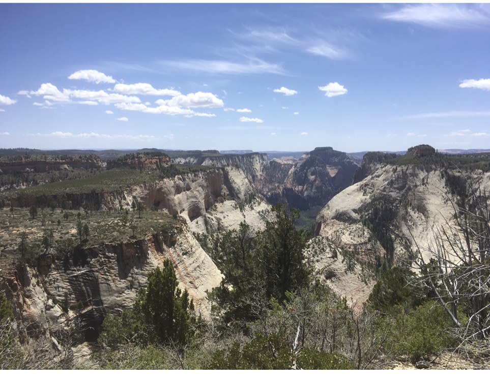
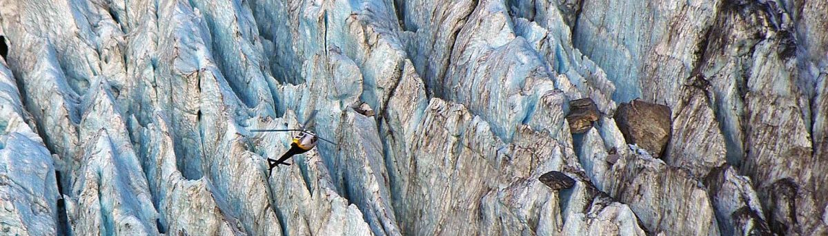
High-standing orogenic plateaus are key features of most mountainous regions, and typically have profound regional, and in many cases global, impacts on atmospheric circulation and precipitation patterns. The Colorado Plateau is characterized by a low-relief surface at high elevation and deep canyon incision at the plateau margins. Although these canyons are key features of ecosystems and water resources, the chronology of the uplift and subsequent canyon incision remains debated. In addition, the relative importance of deep-seated processes, changes in paleogeography and climate, on the late geomorphologic evolution of the plateau remains controversial. Two endmember models of Grand Canyon incision have been proposed: a 80-60 Ma incision or a 6-5 Ma incision, the discrepancy between these models is partly related to limitations in conventional thermochronology techniques.
This project will provide new constraints on the incision history of the canyons carved across the Colorado Plateau using an innovative set of thermochronometers. Apatite (U-Th-Sm)/He and fission-track data will be combined with electron spin resonance (ESR) thermochronometry to document the thermal history of rocks in selected canyons. ESR is a new thermochronometer sensitive to temperature ranging from 50 to 30˚C and thus it can document the late stage of rock exhumation. Low-temperature thermochronology data, including ESR, will be integrated in a numerical model of the landscape evolution to test different processes (change in base level versus mantellic process) and associated scenarios for the Colorado Plateau uplift and incision.
Team members involved: Audrey Margirier (PI), Georgina King
Constraining drought records in the central Great Plains (USA) within the last 1,500 years using innovative luminescence-dating methods
SNF/DFG Funding – (2023-2025)
Droughts are amongst the most significant natural threats in the central and southern Great Plains (USA). Accurate and precise chronologies of droughts and related dune activity phases in the Great Plains are paramount for understanding the frequency and magnitude of these natural disasters. Beyond historical records on the timing and magnitude, droughts can be revealed only from sediment archives. Due to the limited abundance of lakes or other sedimentary sinks in the central and southwestern Great Plains (Colorado, Nebraska, Kansas), aeolian (sand) dunes and their drought-induced re-activation are expected to provide the most valuable information on severe phases of aridity during the past centuries. This project aims at a new, accurate and precise temporal placement of pre-historic droughts in the southwestern Great Plains over the last 1,500 years. Within the project, we aim at (1) developing a routine luminescencedating technique using zircons to constrain geomorphological processes on short times scales (up to 1,500 years) with ideally annual precision, (2) generating a high-resolution landscape model of pre-historic dune activity in the southern Great Plains using a high-resolution chronological model and new statistical approaches. Against the background of global warming, these results are expected to contribute to predicting and effectively mitigating future drought hazards in the study area. The project is a collaboration of Université de Lausanne (Switzerland), Heidelberg University (Germany) and the University of Nebraska-Lincoln (USA).
Team members involved: Christoph Schmidt (PI)
Towards reconstructing latitudinal and altitudinal temperature gradients from the Last Glacial Maximum to the Present –
Development of a globally applicable palaeothermometry method based on luminescence
SNF Project Funding – (2022-2026)
This project aims to create a globally applicable palaeothermometry method utilizing feldspar and quartz luminescence, allowing for the reconstruction of absolute temperature-time series from the Last Glacial Maximum (LGM) to present. Current data on terrestrial surface air temperatures during the LGM, especially in tropical regions, is limited. Accurate temperature histories are crucial for climate modeling, which relies on precise observational data. The research will span various latitudes and altitudes, from the equator (Ruwenzori Mountains, Uganda) to high latitudes (Norway, 62 °N), to understand how surface air temperatures evolved. Additionally, altitudinal transects in the tropics (Ruwenzori Mountains) and mid-latitudes (Mt Blanc) will capture changes in the adiabatic lapse rate. Through extensive sample collection and lab experiments, the project aims to enhance the precision and accuracy of luminescence measurements. The resulting dataset will cover a wide range of latitudes and altitudes, serving as vital input for future climate models. Ultimately, this new palaeothermometry method will transcend the spatial limitations of existing terrestrial proxies.
Team members involved: Christoph Schmidt (PI), Georgina King (PI), Frédéric Herman, Salome Oehler, Pontien Niyonzima
The Impact of ClimatE on mountain Denudation (ICED)
ERC Starting Grant – (2019-2026)
Mountain ranges evolve in response to tectonic uplift, erosion and climatic change, but decoupling the feedbacks between these processes remains one of the most active debates in Earth Science. Resolving this debate is fundamental for successful projection of Earth’s surface response under a changing climate. The Impact of ClimatE on mountain Denudation (ICED) remains highly contested because no technique is available to resolve changes in erosion rates over the timescale of glacial-interglacial cycles i.e. 103-6 years, a key time range for quantifying the role that silicate weathering and denudation plays in modulating global climatic change. ICED will resolve this debate through establishing time-series of rock erosion over 103-6 years, allowing erosion rate changes to be related to specific climatic changes, and specific processes. These data will show whether tectonics or climatic feedbacks on surface processes are dominant in determining rates of surface denudation, providing insights into the influence of the lithosphere on global climatic change throughout the Quaternary period (ice age).
The objective of ICED will be achieved through the development and application of recently established thermochronometers based on the luminescence and electron spin resonance of quartz and feldspar minerals. Thermochronometers measure the rate of rock cooling, from which rates of rock exhumation and thus erosion rates can be calculated. Unlike existing methods, the new techniques developed within ICED are capable of resolving changes in erosion over timescales of between 103-6 years. Combining these new methods with cosmogenic nuclide data, using numerical models developed within ICED, will allow the generation of high-resolution time-series of erosion. These new techniques will be applied to the western European Alps.
Team members involved: Georgina King (PI), Melanie Bartz, Xiaoxia Wen, Kathy Zimmerman, Maxime Bernard (joining Jan 2024). Former team members involved: Lily Bossin, Leif Anderson
SNSF SPARK Project – (2019-2020)
The recently introduced SNSF SPARK program is designed to fund proof-of-concept studies that develop novel ideas. The luminescence properties of quartz and feldspar minerals is determined by their chemical and structural composition, it thus follows that modifications to mineral chemistry should also affect the luminescence properties. In collaboration with Jasquelin Pēna and Stephanie Grand, this project will explore whether changes in the luminescence of quartz and feldspar can be provoked following sequential, laboratory chemical weathering. The ultimate objective is to create a novel proxy for total chemical weathering amount.
Team members involved: Georgina King (PI), Melanie Bartz