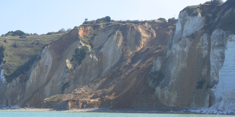
The Risk group has been working for a couple of years with the universities of Caen (S. Costa, P. Letortu and O. Maquaire) and Bretagne Occidentale (C. Delacourt) on coastal erosion and evolution. Clément Michoud and Dario Carrea (PhD students) have contributed to this project by making possible laser scanning from boat coupling a terrestrial lidar with an inertial navigation system. Around 20 km of coast could be scanned in 2012 and 2013 in the area of Dieppe. During this workshop first results from embarked lasers scanning were presented: spatial resolutions, rock fall detection, and in particular the landslide of Dieppe (100’000 m3).
https://www.sites.univ-rennes2.fr/costel/LIDAR/Seminaire_LIDAR/Accueil.html