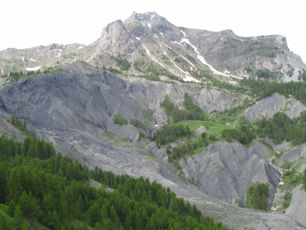
Alpine municipalities are exposed to numerous natural hazards, such as snow avalanches, rockfalls, landslides and debris flows. The Bagnes and Vollèges municipalities in Valais (Switzerland) lie between 600 m and 4200 m m.s.l. with an area of 300 km2. The anthropization is rapid because of the fast growing ski resort of Verbier. In such situation the municipalities needs to have global overview of the natural hazards for landplaning purpose and decision making. The susceptibility mapping at regional scale allows the detection of the areas that are exposed to natural hazards, without considering the intensity and the frequency of the phenomena.
The aim of this study is to provide susceptibility maps at 1:25’000 for the following natural hazards: landslides, shallow landslides, rockfalls, debris flows, snow avalanches, flooding and river overflowing.
The present method was first developed for the Canton of Vaud (2’800 km2). Because it is applied to a smaller area, more numerical models on High Resolution DEM and field investigations were performed. In addition historical event were included in the study.
- The landslide mapping identifies deep-seated slope gravitational deformations, landslides and shallow landslides. It is based on the observations of geomorphological criteria on HR-EM, orthophotos and field work. Finally, the activity of each landslide is described by the knowledge of local guides.
- The shallow landslide susceptibility mapping is realized thanks to the software SInMap, calculating Security Factor (FS) and Stability Index (SI) according to the land use, the topography and the climatic conditions. The model is calibrated on the basis of the 67 shallow landslides already identified for the first map.
- The rockfall susceptibility mapping is a two steps process. First, the potential source areas of blocks are detected using a statistical analysis of the slope angle distribution, including external knowledge on the geology and land cover. Then the run-out is assessed with numerical methods based on the shallow angle method (software Conefall) and on an energy-based run-out calculation (software Flow-R).
- The debris flow susceptibility mapping is based on Flow-R to map debris flow sources and spreading. Slope, flow accumulation, contributive surfaces, plan curvature, geological and land use dataset are used to detect the source areas. The spreading is simulated by a multiple flow algorithm (rule the path that the debris flow will follow) coupled to a run-out distance calculation (energy-based).
- The snow avalanches susceptibility mapping is again based on Flow-R, to map sources areas and spreading. Slope, altitude, land use and one minimum surface are needed to detect the sources areas. The spreading is simulated with the “Perla” methodology using Flow-R. A second simulation of the spreading with RAS is performed by means of the alpha-beta methodology.
- Regarding to the river overflowing along the Dranse de Bagnes, the hotspots which could create blockages (bridges, pipes, etc.) are identified on the field. The propagations of the overflowing are simulated with Flow-R from the spots recognized earlier.
Finally, results show good concordances with past events and the knowledge of the local geologist and guides. The susceptibility maps will help the decision-makers of the Bagnes valley to prioritize area of interest for the creation of more expensive hazard maps.
Featured image: rockfall susceptibility mapping (hillshade: copyright swisstopo)