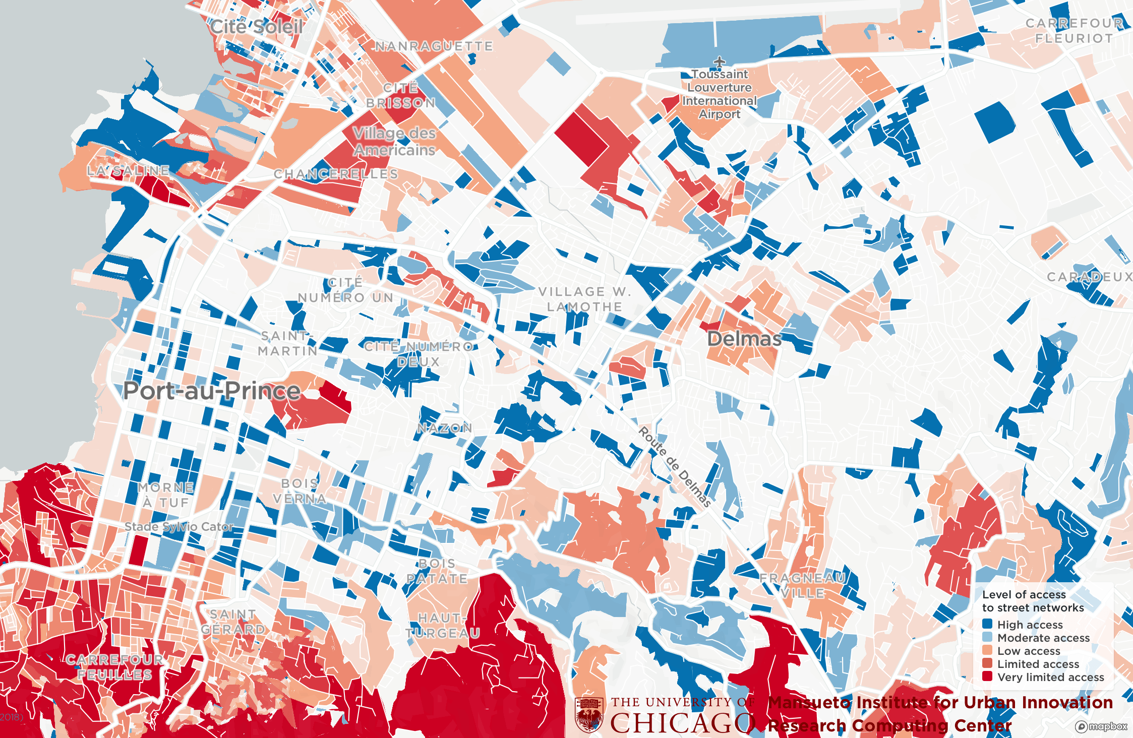
The Million Neighborhoods Map is a groundbreaking visual tool that provides the first comprehensive look at informal settlements across Africa, helping to identify communities most in need of roads, power, water, sanitation and other infrastructure. Updates for Central and South America, India and parts of Europe and Asia will come online in early 2020.
The Million Neighborhoods Map is the first such map of its kind and digitally renders building infrastructure and street networks – or the lack thereof. The goal is to provide municipal leaders and community residents with a tool to help inform and prioritize infrastructure projects in underserviced neighborhoods, including informal urban settlements that are sometimes known as “slums.”
View the map at https://millionneighborhoods.org.
The Million Neighborhoods initiative is a collaborative network of diverse organizations working locally in Chicago and in neighborhoods throughout the world towards more sustainable and equitable human development. The network builds a common framework, tools, and data for mapping, planning, and coordinating solutions towards fulfilling the UN’s Agenda 2030 for Global Sustainable Development.
For the science behind the map, check out:
Brelsford, C., Martin, T., Hand, J., Bettencourt, Luís M. A., Toward cities without slums: Topology and the spatial evolution of neighborhoods (August 29, 2018). Science Advances. Vol. 4, no. 8, eaar4644. https://doi.org/10.1126/sciadv.aar4644
Brelsford, C., Martin, T. Bettencourt, Luís M. A., Optimal reblocking as a practical tool for neighborhood development (June 12, 2017) Sage Journals. https://doi.org/10.1177/2399808317712715