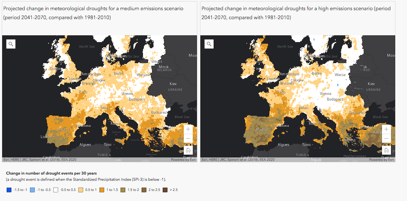
The European Environmental Agency has recently published a cartographic platform to map the impact of global warming on droughts, floods, agriculture, forest fires and sea level rise in Europe. These maps are based on different greenhouse gas emissions scenarios (medium or high) and refer to the expected changes in the period 2041-2070 as compared with the period 1981-2010. Data and climate models and have been published already in various EEA reports and indicators. Based on these maps, what are the challenges that your region faces and how to adapt to them?
