Category: 
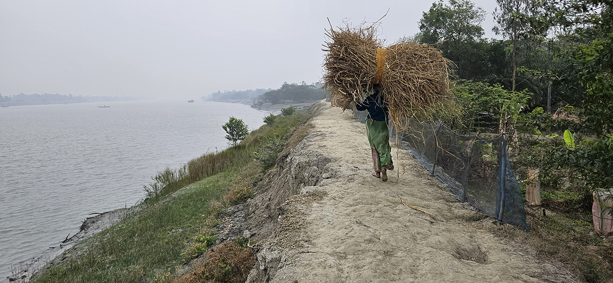
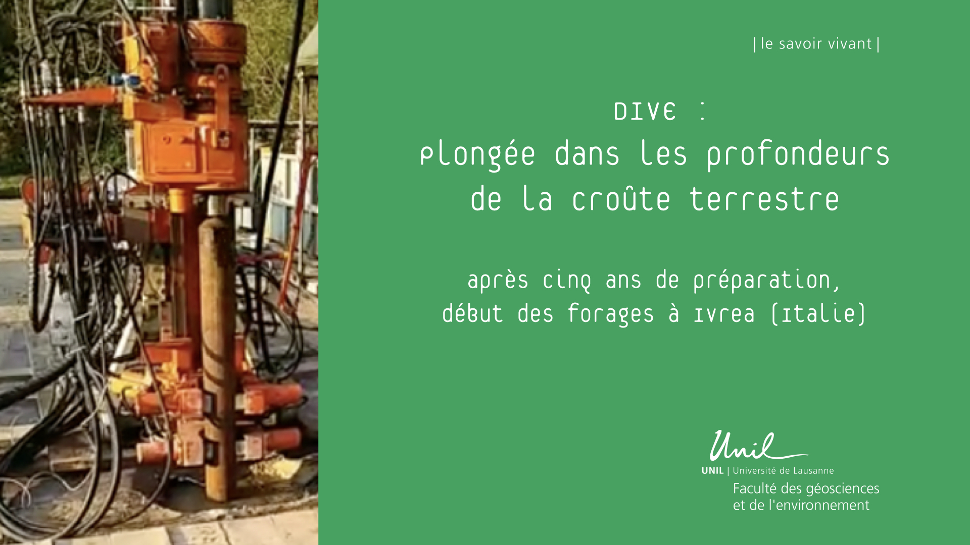
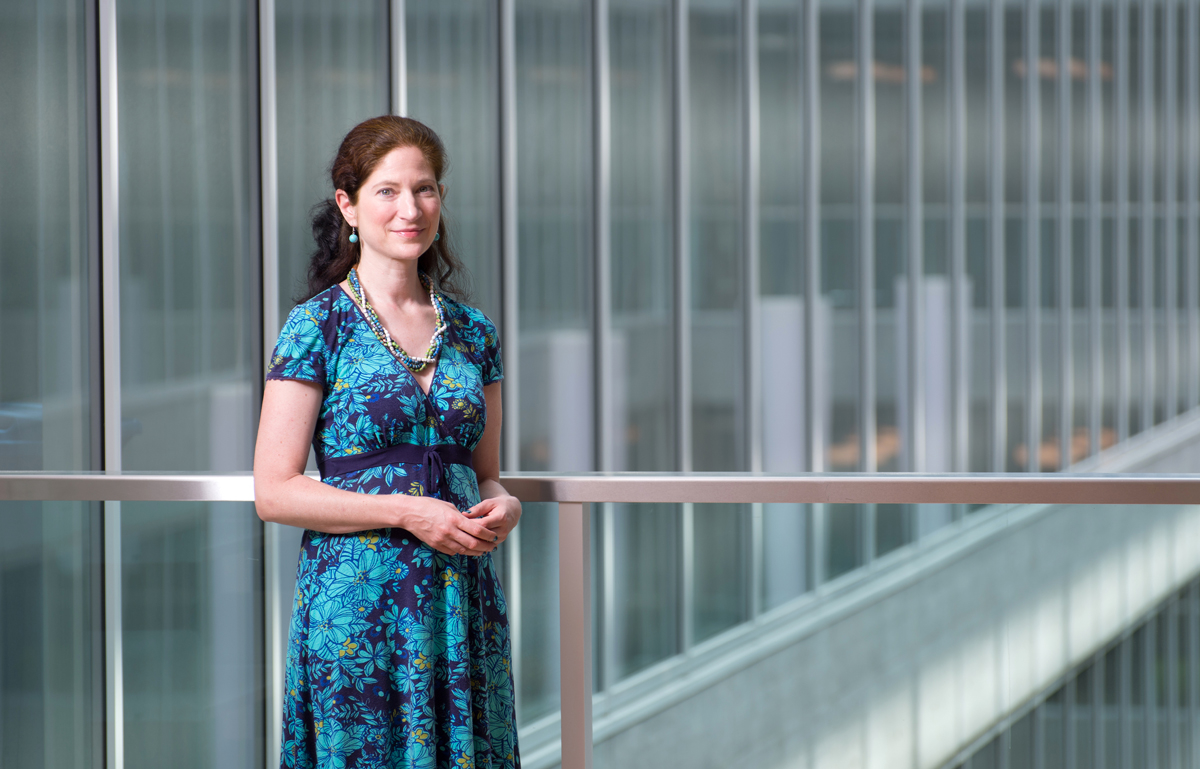
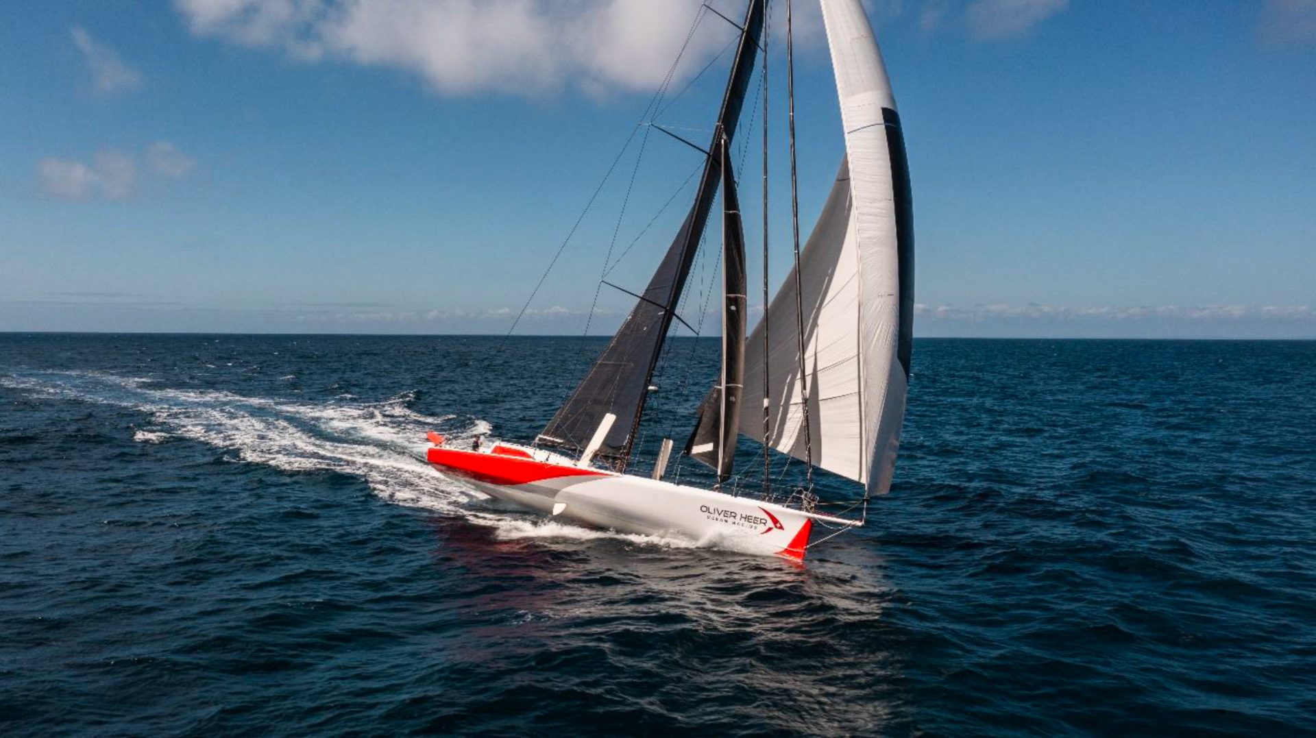
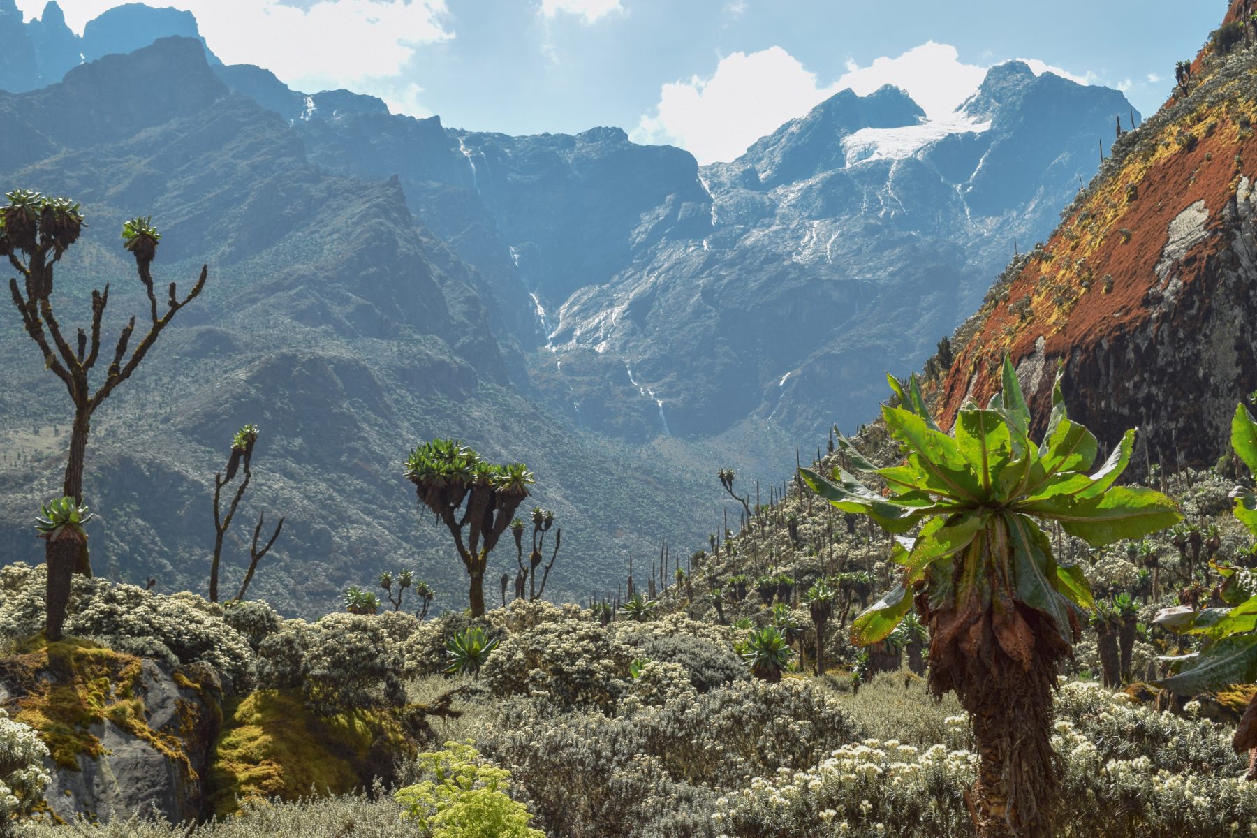
Portraits of projects

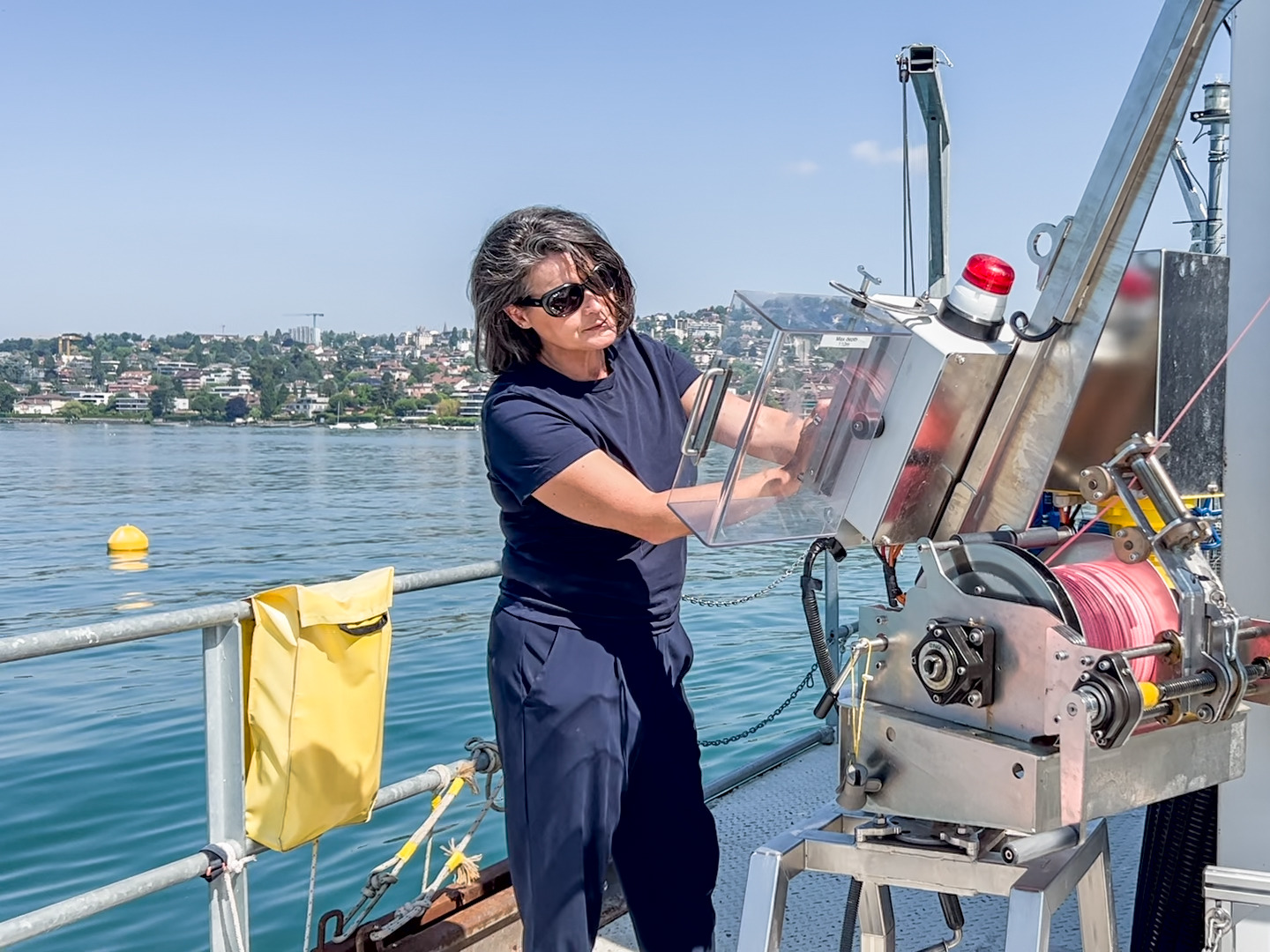
Portraits of a project or a researcher, when obtaining new funding or for new activities at the FGSE:, discover the aspirations and motivations of our researchers in this section.

Find all project laureates on GeOréka.

  • Why does Lake Geneva emit large quantities of CO2? UNIL scientists provide the answer and solve a scientific enigma

    Why does Lake Geneva emit large quantities of CO2? UNIL scientists provide the answer and solve a scientific enigma

    Marie-Elodie Perga, Institut des dynamiques de la surface terrestre

    Unlike oceans, lakes are significant emitters of CO₂. But why is this the case, and what mechanisms are at play?

    For the first time, UNIL scientists have successfully explained the complete carbon cycle in Lake Geneva, creating a model that can be applied to several of the world’s largest lakes.

    Like most lakes in the world, Lake Geneva is an emitter of greenhouse gases, particularly carbon dioxide (CO2). Annually, it produces as much CO2 as the automobile transport of the city of Lausanne (≃ 150,000 inhabitants). This phenomenon – the production of COby lakes – has been known for years. There is, however, widespread debate as to the mechanisms at work.

    Traditional scientific theories suggest that lake CO2 emissions are primarily due to the influx of organic matter from surrounding soils. This material, originating from the decomposition of plant and animal residues, is carried into the lake by rainfall, where it is broken down by microorganisms, leading to the release of CO2. This process is known as respiration. While this theory accounts for the behavior of some lakes, it doesn’t apply to Lake Geneva, which receives very little organic matter from its shores. In theory, its annual carbon balance should be neutral, with winter CO2 production (from organic matter decomposition and water mixing) balanced by summer CO2 absorption (due to algae photosynthesis). So why does Lake Geneva still emit large amounts of CO2?

    A mechanism finally identified

    A team of UNIL scientists has just deciphered the mechanisms involved. Most of the emissions actually come from the natural erosion of rocks in the lake’s upstream basin. When rainwater hits the rocks, it releases bicarbonate and calcium ions, which then find their way into the lake. In summer, under the effect of heat and the growth of algae – which change the PH of the water and act as a catalyst – the ions form microparticles of limestone. This is known as calcite precipitation. This chemical reaction releases CO2, giving the lake its milky blue-green appearance in the warm season. Algae continue to absorb CO2, but this is not enough to compensate for the massive production resulting from rock erosion. The additional emissions are therefore the result of a geological process, not just a biological one, as previously thought.

    This discovery was published in Science Advances. “Our results not only explain the carbon cycle in Lake Geneva, they also reveal a universal process that applies to several of the world’s great lakes,” explains Marie-Elodie Perga, professor of limnology at UNIL’s Faculty of Geosciences and Environment and co-author of the study. “This issue had been nagging at me since my thesis,” she explains. “Using a scientific infrastructure that is unique in the world – the LéXPLORE platform – we were able to observe, model and equate these processes on a very fine scale, providing the missing piece to traditional carbon cycle modeling.” Laid out on Lake Geneva, the floating laboratory made it possible to monitor various parameters linked to the carbon cycle, continuously and at high frequency.

    The right way to combat global warming

    In addition to the purely scientific interest of this discovery, this new data is central to the fight against global warming. “Assessments are carried out every year to identify the emitters (sources) and storages (sinks) of carbon on our planet,” explains Marie-Elodie Perga. “It’s very important to have in-depth knowledge of how CO2 is naturally transported, stored and transformed between continents, water and the atmosphere. Only a global vision will enable us to take effective action to combat global warming.”

    Source
    • G. Many, N. Escoffier, P. Perolo, F. Bärenbold, D. Bouffard, M-E. Perga, Calcite precipitation: the forgotten piece of lakes’ carbon cycle, Science Advances, 2024

    The LéXPLORE platform

    LéXPLORE is a 10 m x 10 m scientific research platform located on Lake Geneva in Switzerland, almost 600 m from the shore. It is equipped with high-tech instrumentation (109 sensors) and provides continuous measurements, day and night, in all weather conditions. LéXPLORE brings together five institutions (EPFL, EAWAG, INRAE, UNIL, UNIGE) conducting cutting-edge, multidisciplinary research on the lake and its atmosphere. It is also used as a training and teaching facility, and as a popularization tool for the general public.

  • “The acceptance of the Electricity Law has given us the starting signal we were waiting for”

    “The acceptance of the Electricity Law has given us the starting signal we were waiting for”

    Selin Yilmaz, Institute of Geography and Sustainability

    UNIL researcher Selin Yilmaz is collaborating on the implementation of a pilot project for local electricity communities (LECs).

    In various test in municipalities in Switzerland, citizens will join forces to produce, sell, and consume local renewable energy, using the public distribution network.The acceptance of the Electricity Law in Switzerland on June 9th has allowed the project to take off.

    In order to move away from fossil fuels and drastically reduce its dependence on foreign energy supplies, Switzerland will massively increase its production of renewable electricity. This was approved by the public on June 9th, during the vote on the Electricity Law. In addition to the development of solar, wind, and hydroelectric installations, the law specifically includes the creation of local electricity communities (LECs).

    LECs offer each citizen within a municipality the opportunity to produce, sell, and consume renewable electricity at an attractive price to their neighbours, in a local and autonomous manner. For the first time, they will be able to use the public distribution network for this purpose.

    This system will soon be tested in several municipalities in French-speaking Switzerland. This action is a sub-project of the Sweet-Lantern program, funded by the Federal Office of Energy (SFOE), which aims to establish a network of living labs throughout Switzerland.

    Efficiency and Sobriety

    Specialising in the governance of energy transformations at UNIL, Selin Yilmaz is involved in these operations. She will take care of the sociological aspect of the experiment. This will involve conducting co-creation and support workshops, analyzing and measuring the societal impacts of the approach, and promoting participants’ engagement in the project. “There is currently a gap between the available technologies and the low rate of acceptance and use of these devices. Integrating citizens into the energy market, informing them of the benefits, social and technological developments, is very important for building a sustainable future,” explains the scientist.

    Thanks to smart meters and interfaces that allow the real-time tracking of energy flows and billing, members of the LEC will be able to optimize their resource use and profits by favouring consumption periods as well as overall sufficiency. “Solar energy, for example, is inherently intermittent, causing peaks and troughs in production. Creating dynamic online pricing encourages consumption at the most opportune times and helps to limit these fluctuations,” explains the researcher.

    At the end of these pilot studies, a guide should be developed to transpose these structures to other localities. “Just as we favor local foods and products, we could imagine a future where we prioritize local production and consumption, with attractive rates and control over the entire production chain,” says Selin Yilmaz. “Recent events in Ukraine and Russia have shown us that Switzerland is currently too easily destabilized. Local production and the development of energy strategies are essential for the country’s independence.”

    Sweet-Lantern

    Sweet (SWiss Energy research for the Energy Transition) – Lantern (Living Labs Interfaces for Energy Transition)

    The Sweet-Lantern project is a funding program by the Federal Office of Energy (SFOE). Its goal is to accelerate innovations that are essential for the implementation of Switzerland’s Energy Strategy 2050 and the achievement of the country’s climate objectives. Coordinated by HES-SO Valais-Wallis, it brings together a broad consortium of universities, universities of applied sciences, municipalities, and companies.

    With a budget of 10 million francs, the program will run for 8 years (2022-2030). At UNIL, Selin Yilmaz is tasked with establishing, through pilot projects, implementation processes for energy cooperation networks that can be applied to various localities. She will also study human-technology interactions, user resilience, for example, and their impact on data collection and network optimization.

  • A dive into the dawn of Earth’s history

    A dive into the dawn of Earth’s history

    Jack Gillespie, Institute of Earth Sciences

    How did the Earth’s continental crust form and transform over geological time?

    This question about the beginnings of our planet’s fundamental dynamics remains hotly debated. Jack Gillespie, who has just taken up his post as Ambizione fellow1 at the Faculty of Geosciences and Environment (FGSE), is keen to unravel this mystery.

    How do you infer a history of over 4.5 billion years?

    Jack Gillespie: I am an isotope geochemist. Using the isotopic composition of rocks, I try to understand what they have experienced – the geological processes they have gone through over the course of their long history. Thanks to these “tracers”, I’m working to resolve a question that keeps nagging at me: was the early Earth similar to the one we live on? Or was the early tectonic environment profoundly different from today’s Earth?

    “We know so little about the origin of the planet we live on.”

    Jack Gillespie

    Why are you interested in early Earth history?

    J. G.: The scale of our ignorance is immense. We know so little about such a vast period! That’s what I find so compelling. And the further we go back in time, the greater the challenge, as our archives are increasingly small and fragmented. The most ancient rocks we have are 4 billion years old. For the first 500 million years, we simply don’t have any intact rock.

    Now, how can you meet the challenge of jumping into the distant past?

    J. G.: Today, we can “do more with less”. We’ve improved both our conceptual understanding and our technical abilities. So we can examine a very small volume of material and extract more information out of it. Just a few decades ago, geologists had to reduce and dissolve down large chunks of rock to derive geochemical insights. 

    My project synthesizes and brings together a bunch of powerful advances to develop new tools that can meet this challenge.

    “The conditions that prevailed during the formation of a rock leave different signatures in the minerals. We’re deciphering them to try and reconstruct these conditions.”

    Jack Gillespie
    The mineral zircon is one of the major tools used by geochemists: it’s robust, hard to break, and found as tiny grains in many rocks. In this electron micrograph, we can also see inclusions of another mineral inside: Apatite. More easily destroyed, it nevertheless contains a wealth of complementary information to zircon about our past. Jack Gillespie aims to access and make sense of this information in a way we couldn’t before. In particular, he is trying to understand when and how these minerals formed, in order to deduce far-reaching earth processes. (© Jack Gillespie)

    What did early Earth look like?

    Was it a hellish period, as the name “Hadean” suggests, in reference to the god of the underworld, Hades? This is a somewhat outdated idea, and we’ve known for some time that this wasn’t precisely the case. But the nature of the primary landscapes and the forces that governed them during the Hadean and the Archean remain uncertain. Some emphasise a violent and eventful history for the early Earth, such as is illustrated on the left, with burning skies and meteorites crashing everywhere.

    Others would argue the more peaceful vision on the right, with its placid volcanoes and bodies of water is more faithful to reality. This scenario is compelling, with the hot pools at the edge of the land identified as a good place for the first hatching of life.

    Why did you choose the FGSE for your Ambizione?

    J. G.: Several groups at the Institute of Earth Sciences (ISTE) are raising questions about early Earth, and our approaches will enrich each other. Johanna Marin Carbonne is working on the link between the atmosphere, the oceans and primitive continents, and the processes that led to life and oxygenation of the atmosphere. Othmar Müntener is interested in the creation of the earth’s crust.

    The SwissSIMS ion probe is ideal for what I want to do: measuring tiny features and extracting information from it.


    1. Ambizione est une bourse carrière du Fonds National Suisse, à destination des jeunes chercheuses et chercheurs (dans les quatre ans suivant l’obtention du doctorat) qui ambitionnent réaliser et diriger un projet de manière autonome. Les subsides sont octroyés pour une période de quatre ans. ↩︎
  • A Journey to the center of the Earth with scientists from the University of Lausanne

    A Journey to the center of the Earth with scientists from the University of Lausanne

    Othmar Müntener and György Hetényi. (Fabrice Ducrest © UNIL)

    Experts from UNIL are co-directing a scientific drilling project almost a kilometer deep, aimed at reaching and documenting, for the first time, the base of the continental crust and the transition to the Earth’s mantle. This international project is taking place in Piedmont, Italy, in an area where usually deep-seated rocks are accessible thanks to a natural shortcut.

    What constitutes the interior of our planet? How was the Earth’s crust formed, and how deep can Life be found? For years, these fundamental questions have remained partly unanswered due to technical and financial obstacles. Despite several attempts, humans have never succeeded in continuously exploring the rocks beyond the Earth’s crust to reach the next layer: the mantle, usually some thirty kilometers below the surface.

    Scientists from the University of Lausanne’s Faculty of Geosciences and Environment are coordinating an international project that could change the game. Project DIVE (for Drilling the Ivrea-Verbano zonE) carries out scientific drilling in the geological area in the Alps known as Ivrea-Verbano (Piedmont, Italy), the uniqueness of which should make it possible, as a world first, to cross the crust and reach the Earth’s upper mantle.

    A region with virtually unique features in the world

    “Since around 35 million years ago, the African (Adria) and European continental plates have been moving towards each other. When they collided, in this segment Adria stayed above Europe, contributing to the formation of the Alps,” explains György Hetényi, professor at UNIL and co-leader of the project. “This phenomenon, accompanied by surface erosion, brought up rocks that were usually at depths of tens of kilometers. In this way, over some fifty kilometers on the surface, the Alps form a “shortcut” to the Earth’s mantle  which is then practically within reach.   Another particular feature of this region is that the continental crust is exceptionally well preserved and intact, with little fragmentation.

    In the village of Megolo di Mezzo, a borehole (the second in the DIVE project) was therefore initiated in November 2023 and will be completed in April 2024. From a current depth of 870 metres, the hole is expected to reach almost one kilometer, and will document the beginning of the transition between the continental crust and the mantle. In the field, specialists are already analyzing the cores extracted by the drillers, using two scientific containers, one dedicated to geological studies, the other to biology and gas analysis (such as hydrogen and other rare gases). A team of microbiologists is investigating whether there are organisms capable of surviving in extreme pressure conditions at depth.

    The precious cores will then be transferred to the various universities, depending on their area of expertise. “At the University of Lausanne, we are studying in particular the chemistry and isotopic composition of rocks, as well as their thermal and seismic properties,” explains Othmar Müntener, professor at the UNIL, initiator and co-leader of the project. “These analyses will give us unprecedented information about the formation and composition of the Earth’s crust.”

    The bulk of the work remains to be done, but the first results, notably from the first borehole – which reached a depth of 578 m – are starting to come out, and they are already bringing some surprises.  “There is more sulphur, carbon, fractures and above all a surprising spatial variability compared to what we expected in the lower crust”, observes György Hetényi. “We are also discovering the presence of minerals in unexpected amounts, such as graphite.”

    The next step is to complete this second borehole and continue the scientific analyses. A third borehole is planned, dedicated to analyzing and fully crossing the entire crust–mantle transition.

    DIVE Project

    DIVE project on the ICDP website

    DIVE is an international project funded by the International Continental Scientific Drilling Program (ICDP), which brings together multidisciplinary teams from seven countries and some twenty universities. Initiated by the University of Lausanne, this program aims to carry out scientific drilling to penetrate the lower continental crust, reach the upper mantle, and analyze the deep rocks of our planet. It is divided into two main phases. The first is currently underway with two boreholes, and the second is in preparation for a third borehole in a few years. The analyses carried out on these hitherto not studied rocks cover various fields such as geophysics, geochemistry, geodynamics, petrology, rheology (the way rocks deform) and microbiology.

  • A simulation to visualize the evolution of Alpine ice cover over the last 120,000 years

    A simulation to visualize the evolution of Alpine ice cover over the last 120,000 years

    Guillaume Jouvet, Institute of Earth Surface Dynamics

    Scientists from the Universities of Lausanne (UNIL), Zurich (UZH) and Bern (UNIBE) have developed an unprecedented simulation which, in just 80 seconds, shows the evolution of glaciers in the Alps over the last 120,000 years.

    This complex computer model is the fruit of several years of research and intensive collaboration between climatologists, glaciologists, and geologists.

    The last glacial period began around 115,000 years ago, and was punctuated by cold and warmer cycles, resulting in the advance and retreat of glaciers that shaped the landscape of the European Alps and their surroundings, carving out valleys. A new computer model makes it possible to reconstruct this evolution with unprecedented precision. It provides a direct visualization of the phenomena, making them accessible to a wide audience. The fruit of an extensive collaboration by glaciologists, climatologists and geologists from the universities of Lausanne, Bern and Zürich, the research was published in the Journal of Glaciology.

    Climatology and glaciology meet

    The new numerical model is unique in that, for the first time, it incorporates complex modelling of past climate, carried out by climatologists at the University of Bern.

    Glaciologists then used these climatological simulations to inform an ice-flow model, modelling ice accumulation, dynamics and melting, resulting in the most accurate simulation to date. Its unprecedented complexity makes it possible to understand the past distribution of snowfall in Alpine valleys, as well as the evolution of glaciers. “There are geomorphological clues in the field, such as moraines and erratic boulders, which bear witness to the past imprint of glaciers on the lowlands,” explained Guillaume Jouvet, a glaciologist at UNIL’s Faculty of Geosciences and Environment, and first author of the study. “We used these traces to validate our simulation, and everything matched,” he further enthused. “Because of the complexity of the modeling, it took us 6 years to correctly set up our climate and glaciological models, and finally get the right climate and glaciers that match what we observe in reality.”

    The limits of modeling

    However, the traces left in the field, which act as a gauge, do not allow the model to be verified beyond 24,000 years, the period when glaciers were at their maximum. “This glacial maximum destroyed all previous evidence. Our model is therefore difficult to verify beyond 24,000 years,” explains Guillaume Jouvet.

    Putting global warming into perspective

    The new simulation will enable us to better understand the past interaction between climate and glacier, and how our landscape was formed. As well as being of scientific interest, it provides a context for global warming. “The image of the different glacial cycles is quite telling”, comments Guillaume Jouvet, “24,000 years ago, we can see that cities such as Lausanne were covered by more than one kilometer of ice. It’s obvious that past cycles, caused by orbital variations of the Earth, are nothing like what’s happening now, where greenhouse gases play an active role in glacier melt”.

    What is most striking is the speed of current climate change (barely a few decades) compared with the infinitely long time span of the ice ages.

    Guillaume Jouvet

    Scientists will be working to further improve the resolution of their model. The current resolution is not sufficiently fine to reproduce the complex topography of high mountains, and this causes a probable overestimation of the ice cover. “We have just started a new project using artificial intelligence, which will be used to speed up our models and reach a necessary resolution of 200m,” explains Guillaume Jouvet.

    Reference
  • From the farm to our plates: what are the margins in the supply chain?

    From the farm to our plates: what are the margins in the supply chain?

    How is the price we pay for our food distributed? Scientists at UNIL have launched a new research project aimed at shedding light on the margins achieved from agricultural production to household consumption, for a whole range of agri-food products. The project is funded by the canton of Vaud, and will put fruit and vegetables under scrutiny, as well as Vaud’s production of milk and cheese, meat, bread and wine.

    Transparency of costs and margins between production and retail is a sensitive issue, and one that often crops up in the Swiss media. But answering the question of margins is a complex and painstaking task, requiring trusting discussions with the entire chain: from farm to processing to distribution. This is the ambition and daily work of Floriane Gilliand and Armelle Rochat at the Faculty of Geosciences and Environment.

    Fair food prices are increasingly important to consumers. For their part, players in the agricultural sector are also calling for fairer negotiations and a better distribution of prices throughout the value chain. This is the background of this ambitious research project Transparence économique de filières agricoles vaudoises. Supervised by Dominique Barjolle (IGD), this project focuses on the canton of Vaud, and is financed by the Direction générale de l’agriculture, de la viticulture et des affaires vétérinaires (DGAV).

    By promoting transparency and sparking discussion between the various players, this project aims to lay the foundations for a fairer distribution of prices, strengthen trust between stakeholders and respond to growing expectations for economic justice in the agri-food sector.

    Floriane Gilliand and Armelle Rochat, the agronomists hired for this project, have the crucial task of convincing as many stakeholders as possible to participate and embrace transparency. The aim is to build a relationship of trust, in order to overcome the reluctance associated with the in-depth analysis of accounting data. Although this may seem a delicate task at first glance, it appears that many of their contacts are already aware of the benefits that increased transparency can bring.

    Floriane Gilliand is passionate about this economic issue, and devoted her Master’s thesis to it. “When you buy a cheese, you have no idea where the pennies you pay are going”. Armelle Rochat, who has also worked as a market gardener, is well aware of the difficulty of deciphering the costs of certain processed products. A basic product like bread, for example, passes through a variety of hands: wheat sown and harvested is ground into flour, then processed in the bakery. But this complexity and the passionate interaction with all the trades in the chain are a source of motivation for the two agronomists in charge of this fieldwork. They are also convinced that transparency will be a marketing advantage for stakeholders who play the game. “It will help bring credibility to the price we pay for food.”

    Data Analysis

    Once the data has been collected, it will be processed in complete confidentiality using software developed by UNIL doctoral student Inès Burrus at start-up Equal Profit. Specializing in the analysis of the fair benefits of exotic products, this tool will be adapted for application to products from the canton of Vaud.

    The results of field surveys, combined with anonymized databases, will be analysed according to the Transparent Profit and Equal Profit methodology. On the basis of these concrete results, workshops bringing together the parties concerned will encourage constructive dialogue between each of them.

  • Jorat Natural Park : first steps towards long-term monitoring

    Jorat Natural Park : first steps towards long-term monitoring

    A new peri-urban park was born in the Jorat woods in 2021, becoming the second of its kind in Switzerland.

    Pascal Vittoz (IDYST) is involved in the initial monitoring of this forest, which is entering a new phase following the complete cessation of logging. How will this forest landscape, a favorite walking spot for Lausanne residents, evolve over the next 50 years? The first milestones have been set, and now we’ll have to let the forest give us the answers, at its own pace.

    Armed with a map and a compass, Pascal Vittoz ventured through the thicket in search of the plot he was to survey today. A traverse through the brush reveals an area dominated by spruces. These conifers, planted in the 19th or early 20th century because of their rapid growth, are still predominant today. Without human intervention for economic reasons, this area would be covered with fir and beech today.

    How will the forest, its wildlife and its inhabitants evolve in the future? That’s what this study is all about. Pascal Vittoz is in charge of monitoring the flora, in particular the undergrowth, in order to study the consequences of the creation of the forest reserve on floristic diversity. These surveys will be carried out every 10 years, in collaboration with a commissioned botanist, Loïc Liberati, former student at FGSE (Faculty of Geosciences and Environment) and Patrice Descombes, former student at FBM (Faculty of Biology and Medicine), and current curator at the Lausanne Botanical Garden. They share the 132 monitoring points randomly distributed throughout the forest plots, according to a plan drawn up by the Swiss Federal Institute for Forest, Snow and Landscape Research (WSL), with the aim of observing the future of the forest.

    The Jorat Natural Park is divided into parcels to facilitate and organize flora monitoring. In the north, the park’s “core zone” is no longer managed by foresters. (Photo: A. Dreiss).

    The new Jorat Natural Park aims to encourage the presence of dead wood. With it, certain birds that burrow into old trunks, beetles whose larvae feed on wood and fungi that decompose dead trees will flourish. One part of the forest – the central zone of the park – will remain untouched for the next 50 years: no cutting, no logging, no off-trail passage. It will simply be left to its natural evolution, with the exception of a few necessary cuts to ensure trail safety. In the transition zone further south, towards the Chalet à Gobet, logging will continue as before, but certain measures will be put in place to promote biodiversity and welcome the public.

    In each plot, the botanists examine two concentric surfaces around the point selected at random by WSL. They describe the structure of the forest and list the flora in the herbaceous, shrub (less than 3 meters high) and arborescent (more than 3 meters high) strata. This gives us an idea of regeneration: if a tree type is present in all strata, it has a good chance of remaining in the future forest.

    The botanists draw up a complete inventory of the flora in two concentric zones, starting from a central point marked on the photo by a blue stake. The first disc, measuring 10 m², corresponds to the standard used for biodiversity monitoring in Switzerland. The second, measuring 200 m², gives a more complete picture of the undergrowth flora, providing a better description of forest structure, such as tree size and proportion of dead wood.

    Pascal Vittoz measures the tree stratum using a convex grid mirror.

    A beetle trap suspended in the middle of the plot bears witness to the various monitoring activities carried out by other groups of scientists. To explore the future of the forest, regular surveys are carried out to study its uses (pedestrians, bicycles, horses) and fauna (beetles, batrachians, deer…).

    After logging ceases, we can expect the trees to age, leading to a denser, darker forest, with less light reaching the ground and therefore fewer plant species in the undergrowth. However, the vagaries of storms and climate change make predictions difficult. Spruces, for example, could suffer from the heat and be partly decimated by attacks from the bark beetle. In a conventional forest, foresters cut down affected trees to contain their proliferation. But what will happen when there are no longer any health checks on the trees? Will the bark beetle spread further? Will their presence favor species other than spruce?

    « This reserve is set up for 50 years, which is more than half a human lifetime, or about ten times a standard research project. » Pascal Vittoz

    So we’ll have to wait to see the benefits of this park materialize. Typical research projects are planned to last 3 to 4 years. In this case, that’s not long enough to study forest flora, which evolves very slowly. This study, which spans the entire lifespan of a tree, will not deliver its results for several decades.

    What do botanists find in the Jorat woods?
    Wood horsetail
    (photo : P. Vittoz)

    The forest is dominated by spruce and beech, with undergrowth often lacking in plant diversity. However, some wetter areas, such as ash groves, offer surprises and less common species. Horsetail, a common species in the Alps but much more widespread on the Plateau. Horsetails are among the oldest plant species, having appeared nearly 400 million years ago. Some species were important trees in the Carboniferous period, while today’s largest representatives grow to around 1 m.

    More informations

  • Back from Greenland: what sediments tell us about the retreat of the Ice Sheet

    Back from Greenland: what sediments tell us about the retreat of the Ice Sheet

    Ian Delaney, Institute of Earth Surface Dynamics

    Researchers from the UNIL went to Greenland to study the changes in erosion of the ice sheet, and the discharge of glacial sediments into ecosystems. Poorly understood, increased melt and evolving glacier dynamics caused by climate change may result in consequential changes to landscapes. This study aims to understand erosion and sediment transport from the Greenland Ice sheet and to predict the evolution of these systems.

    Dr Ian Delaney, Ambizione fellow at the Institute of Earth Surface Dynamics, and Marjolein Gevers, PhD student, both at the Faculty of Geoscience and Environment are back from the field. As climate warms and affects earth surface dynamics, they are tracking the changes in glacier erosion and sediment discharge from the Greenland Ice Sheet.

    Over the last 50 years, melt is accelerating and the ice sheet is changing. What are the consequences on the landscape? Can we see any evidence of these changes? How can we monitor these phenomena and predict their evolution?

    By collecting sediment cores in fjords and gauging rivers in Greenland, Ian Delaney and his collaborators aim to track the recent changes in the ice sheet erosion and sediment discharge. The sediments in the ocean floor are the memory of the last centuries. Their layers contain records of the influx of sediment from the ice sheet into the sea. Findings from these precious data will also feed models to evaluate the evolution in sediment discharge as climate warms.

    Seven meters of ice released into the oceans

    The sliding and melting of glaciers drive sediment transport into ecosystems. Sliding glaciers scrape and erode the bedrock, while subglacial rivers carry these sediments away.

    In mountainous regions such as Switzerland, changes of sediment flow from glaciers can impact their delivery into river systems. Hydropower is also affected by sediment transport. High sediment supply leads to the filling of hydroelectric reservoirs and can lead to increased wear of hydroelectric infrastructure by hydro-abrasion.

    In Greenland, the changes of sediment flux are on a much larger scale. Seven meters of ice sheet is rising above sea level and could be released into the world’s oceans in the next millennium. Mass loss from the ice sheet over the next century will likely be greater than those over the last 12,000 years.

    The dramatic changes to the ice sheet not only affect the global sea level, but also change their erosive capacity and the discharge of sediment, which impacts many earth systems. For instance, these changes affect the supply in nutrients to the environment, but also in diverse chemical elements that can favour or hinder biological growth.

    In a previous expedition in Greenland funded be the Swiss Polar Institute (SPI), Ian Delaney examined river systems. Here too, the scale is different from the Alps: the discharge from the Watson River in Greenland can be up to 1400 m3/s (in comparison, the Rhône is at 500 m3/s!). The team installed turbidity sensors to measure the suspended sediment in the river and seismometers to measure vibration from sediment transported in the rivers. This technic permits to estimate the fluxes of water and sediment leaving glaciers and flowing down rivers over a melt season. (Photo: Marjolein Gevers – Watson river in Kangerlussuaq)

    Greenland: a challenging field work

    In Greenland, Ian Delaney’s team is not alone, the current changes at the Ice Sheet attract scientists from all over the world. In addition to working with local boat operators, field duties are shared with several Swiss and international collaborators. Irina Overeem and Ethan Pierce from the University of Colorado, Paul Liu from North Carolina State University, Brandee Carlson and Julia Wellner from the University of Houston, Andreas Vieli from the University of Zurich, each working in different and complementary fields such as coastal and fluvial geomorphology, sedimentology, ice sheet history, glaciology and geomorphodynamics.

    For Marjolein Gevers, communicating with all team members is essential to ensure that everyone has the same goal and is correctly assessing the situation and potential danger in the same way. “It is important to keep talking about how you feel with the situation on the field and when you feel uncomfortable.” Crossing a river, or simply making sure you don’t fall out of the boat, are daily challenges in which require focus and awareness, especially when you’re tired.

    But the bigger challenge for UNIL researchers now is to put together the “patchy” observations sampled in the field to build the big picture. Ian Delaney aims to bring together observations from the sediment cores to calibrate a numerical model on glacier dynamics. The idea is to identify processes and try to evaluate how these processes will evolve in a warming climate. This will help them to evaluate potential changes to glacier erosion in the next century, according to future climate scenarios.

    About 8% of sediment influx to the world’s oceans comes from the Greenland Ice Sheet. The discharge of sediment in Arctic affects the input of nutrients in the world’s oceans. Given the quantities of sediment, any change will have impacts.

    Ian Delaney
    Here, a coring device penetrates the ocean from the ship to collect sediment from the ocean floor. The samples brought back from the field will provide information on the temporal variations in sediment deposition – that cause different thicknesses in sediment layers – and hence on the evolution of the discharge over the decades. (Photo: Marjolein Gevers – from the Adolf Jensen in South Greenland, July 2022)

    A pressing matter: what happens when glacier retreat?

    By tracking changes and evolution of sediment discharge from Greenland ice sheet, the team hopes to understand how the system responds to increasing glacier melt and changing glacier dynamics. “Greenland is a unique place: changes occurring there are massive and have a global impact, but are still poorly understood,” comments Ian Delaney. “Through our research, we hope to establish models that will help us understand and predict these phenomena, so we can anticipate them.”

    When glacier melt, what is left over, what are the side effects?

    Ian Delaney
    High up on her rock, Floreana Miesen is installing a time lapse camera in front of Leverett Glacier. This is one way to monitor the change in the proglacial area. On the right, I. Delaney and F. Miesen are setting a turbidity and level sensor in the forefield of the same glacier. (Photos: Marjolein Gevers, May 2022)
  • Reaching the  Earth’s mantle: a dive into the depths of its continents

    Reaching the  Earth’s mantle: a dive into the depths of its continents

    The continental crust makes up 41% of the Earth’s surface. Because of its thickness, its deepest areas remain unknown, although they play a fundamental role in the global cycles occurring between the Earth’s surface and the mantle. The DIVE project ims to unveil the secrets of these transition processes. How?  Thanks to two boreholes of about 1 km deep in the region of thegeological zone known as Ivrea-Verbano (Piedmont, Italy).  After five years of preparation, UNIL scientists are finally on the ground.

    György Hetényi et Othmar Müntener (professeurs à l’Institut des sciences de la Terre) nous font partager leur enthousiasme pour ce projet.

    Reaching for the mantle: a project that is more than sixty years old

    The project to reach and cross the transition from the Earth’s crust to the upper mantle dates back more than 60 years. At the time, only indirect measurements gave a glimpse of  the physico-chemical properties of the rocks that compose it. But attempts  to gain access to the  deep  crust itself, by drilling  at  the bottom of the ocean or in  the USSR, proved unsuccessful. The technical constraints and costs generated in relation to the expected results then slowed down initiatives to renew such attempts.  

    What makes planet Earth unique? Together with water and life, it is plate tectonics.

    DIVE project

    In 2008, Luigi Burlini, a geologist at the ETHZ, discussed an original idea with Othmar Müntener. It is a question of using the Alps as a “shortcut” to the mantle. In the region of Ivrea-Verbano, the Earth’s mantle is at hand: it is about 3 km deep, following the alpine folding. It was the observation of high-density rocks and the rapid movement of seismic waves that revealed this singular situation covering an area about 70 km long (known as the Ivrea Geophysical Body).

    Cross-section through the Ivrea Geophysical Body, according to knowledge in 2017. This diagram shows the wavevelocities estimated in two ways: in black the velocities derived from seismic refraction and density anomalies of the Berckhemer model in 1968; in orange the iso-velocities of the P waves interpolated from the tomography of local earthquakes by Diehl et al. (2009) . This analysis reveals that the shaded area is indeed the mantle that the DIVE project aims to achieve.

    This original idea was taken up again to be concretized in 2017 during a workshop bringing together more than 45 researchers in Baveno on the shores of Lake Majeur in Italy, by setting up the DIVE project (Drilling the Ivrea-Verbano zonE). Supported by the International Continental Scientific Drilling Program (ICDP), DIVE is undertaking several scientific drillings in the Ivrea-Verbano area. His goal? Identify the physico-chemical properties of the crust-mantle transition, and better understand the processes that govern the formation and evolution of the lower continental crust. 

    What does the bottom of the continental crust look like? And how deep can we find life within the crust?

    DIVE project

    DIVE is conducted by an international and multidisciplinary research group, covering the fields of geophysics, geochemistry, geodynamics, and petrology and rheology. Microbiologists are also involved: they are trying to find out how deep life can be found in the Earth’s crust.

    Other members of the FGSE (ISTE) are also involved in this project: Klaus Holliger (professor), Alexia Secrétan, Kim Lemke, Zheng Luo (PhD students), Ludovic Baron (geophysical research engineer). Aurore Toussaint, Julien Reynes and Benjamin Klein, as well as researchers from the Universities of Bern, Mainz, Trieste, Pavia, Leoben, Grenoble, Georgia, and GFZ Berlin are also part of the scientific team taking turns on the site.

    This type of project cannot be done alone or in pairs, because to have all the necessary skills, as well as the associated technology, you really need this interdisciplinary collaboration.

    György Hetényi

    György Hetényi will focus on the transition gradient between the mantle and the lower crust: what is its thickness and what are its physical and chemical properties?

    Othmar Müntener will be involved in petrological research and more specifically in the identification of the nature of the rocks that form at the interface between the mantle and the Earth’s crust.

    From 2017 to 2022, numerous preliminary studies combining different geophysical methods were carried out, in particular to determine the location of boreholes. The proximity of the mantle to a depth of about 1 km below sea level at the surface was thus confirmed and modeled in 3 dimensions by Matteo Scarponi during his PhD at ISTE, The relief shape represents the mantle surface that “rises” towards the surface of the Earth’s crust according to the results of Matteo Scarponi, Printed at a scale of 1:1 million. Researchers from GFZ Potsdam and Montanuniversität Leoben are currently refining this image via higher resolution active seismic studies.

    The big day: the first drilling and extraction of the first rocks

    After more than five years of preparation, drilling finally began on October 6, 2022 in Ornavasso in the Osso l a. At first, the pace is slow. The team ensures the verticality of the drill and does not damage the first layers of soft soil. Subsequently, the speed should be increased to about 1 meter per hour – or 15 to 20 meters s per day ideally. So far, thefirst steps have been encouraging. The extracted carrots are exploitable at more than 95%, a very high yield!

    The cores are directly photographed and scanned to identify the rocks that compose them and evaluate the progress of the drilling. They will then be sawn in half in the long direction. One half will be used for chemical and physical analysis and the other half will be archived in Germany. Above is some of the first cores taken, photographed and listed (photo credit: Luca Ziberna, DIVE project).

    The borehole will have another advantage. Fine logging instruments can be placed there. They will measure the electrical, thermal and seismic properties of the terrain at a depth rarely reached, and will make a video recording along the hole. This device, associated with a continuum of several hundred meters of cores through the deep crust, constitute a unique dataset to date.

    The organization of this work is complex and interactions are continuous with the field. A team of 6 to 7 people remains permanently on site to monitor the drilling, analyze the extracted cores, list them on a digital interface or collect fragments for microbiologists. Questions or unforeseen events arise regularly, whether at technical level (purchase or adaptation of equipment) or scientific level (identification of minerals and structures). You have to be very responsive because drilling must be able to continue quickly.

    The drilling activities arouse the curiosity of the inhabitants and visitors of the site. Here is part of the leaflet that describes the project and its objectives, for the inhabitants and visitors of the region of Ivre a-Verbano. Public visits will also be carried out on site.

    Everyone at the drilling site was super happy…. When you see the rocks coming out, it is the direct result of these 5 years of investment. It’s really satisfying.

    Othmar Müntener

    A gratifying first step … who prepares the second

    The results of the research carried out in the coming years on the material obtained will determine the organization and timing of the second phase of the project, namely a 3-4 km borehole in search of the Moho (the transition between the crust and the mantle).

    From a scientific point of view, we are quite sure that we will have surprises either during the drilling or the analyses that will follow.

    György Hetényi & Othmar Müntener
  • A shifting project of post-growth economics funded by an ERC Synergy in Spain and Switzerland

    A shifting project of post-growth economics funded by an ERC Synergy in Spain and Switzerland

    The European Research Council has awarded funding to an ambitious ERC Synergy research-action project on the management by North and South societies of economic, political and social transitions toward and within a post-growth era. This 6-year, 10 million euro project, entitled “Post-Growth Deal” (REAL), led by three scientists – two from ICTA-UAB in Barcelona and one from UNIL in Lausanne. It aims to bring together radically new paradigms in ecological economics and new concrete practical developments on the ground.

    The team consists of two scientists in Catalonia, Spain, and one in Lausanne, Switzerland: Prof. Giorgos Kallis at the Institute of Environmental Science and Technology of the Autonomous University of Barcelona (ICTA-UAB), Prof.  Jason Hickel at ICTA-UAB and the Department of anthropology of the same University, and Prof.  Julia Steinberger at the Institute of Geography and Sustainability of the University of Lausanne (IGD-UNIL).

    This collaboration brings together a wide range of expertise, that no single researcher or team presently possesses in this emerging field:

    • modelling of provisioning systems (Julia Steinberger),
    • political economy and North-South relations (Jason Ηickel),
    • politics of socio-environmental transformations (Giorgos Kallis).

    The three awarded scientists propose a new transdisciplinary “5 pillars of post-growth” science. They draw on resource/energy modelling, political-economic and socio-political analysis to identify practical steps to bring the Post-Growth Deals to life. They will work with four representative communities to co-produce knowledge and action on the ground.

    The goal here is a convergence between the global North and South of the globe, and within countries, to a level of resource use is sufficient for high human development and compatible with planetary boundaries.

    Jason Hickel, ICTA-UAB

    With this funding, the researchers will join their respective expertise to explore “how can dramatic reductions in energy and resource use be achieved, while at the same time ending poverty and ensuring decent lives for all”. Their aspiration? Proposing new models of politics, policies and provisioning systems in a post-growth direction, and engaging with development issues in the global South.

    The “Post-Growth Deal” refers to the need for a new political and institutional compact between government and citizens, equivalent to the New Deal or welfare state, but geared around wellbeing security in an era of prolonged economic stagnation and unfolding climate breakdown. Achieving such a “Deal” requires new research, new data, and new models that the REAL project intends to develop.

    It’s the first time that a project of such scale and scope is granted on the topic of post-growth. This is a recognition and validation of the efforts many isolated researchers have made for years – against general opposition, and with little institutional or financial support. It is an opportunity that carries significant responsibility.

    Giorgos Kallis, ICTA-UAB

    Julia Steinberger’s specific contribution to this project is particularly related to the first step: build the modelling of supply systems. The other aspects are based on joint developments with the two other Barcelona researchers.

    This project is nothing short of revolutionary. It gives us what we think is the best chance to explore the transformative ideas necessary to protect humanity from the intertwined crises of the coming decades: to reorient our economies away from risky growth dependence, and toward human flourishing.

    Julia Steinberger, Institute of Geography and Sustainability

    What is your plan for the concretisation of “Post-Growth Deal”?

    Julia Steinberger: Meeting our goal requires an ambitious transdisciplinary research program to explore what we call the 5 pillars of post-growth.

    We will first determine the planetary space of possibilities, modelling the use of resources needed to live decently, and identifying how resources can be shared equitably between North and South.

    Then we will develop post-growth policy packages capable of realizing these possibilities, both for the EU and for developing countries.

    Next, we will investigate what kinds of alternative supply systems are needed to achieve good social outcomes with low levels of resource use. We will also explore the types of political movements that would be likely to realize post-growth visions.

    Finally, we will explore the practical implementation through participatory planning.

  • Science and Sailing to collect environmental data in understudied Ocean Regions

    Science and Sailing to collect environmental data in understudied Ocean Regions

    Le Swiss Polar Institute (SPI) and scientific experts from ETHZ, UNIBERN and UNIL will collaborate with the Oliver Heer Ocean Racing offshore sailing team to collect environmental data during their Vendée Globe 2024 campaign.

    Following contact between the Swiss Polar Institute and Swiss skipper Oliver Heer who sees collaboration with scientists and environmental data collection as central to his responsibility as campaign leader and skipper, supporting his #RaceForChange vision, the Swiss Polar Institute brought together a group of scientific experts from ETH Zurich, University of Bern and University of Lausanne to design an innovative scientific campaign related to climate change.

    Oliver Heer Ocean Racing and the SPI are so announcing a three-year collaboration to place world-class Swiss science on Oliver Heer’s IMOCA racing yacht Gitana 80 and to conduct a data collection campaign during the training and racing phases of the Vendée Globe challenge between 2023 and 2025. The Swiss Polar Institute was approached by Oliver Heer as part of his own campaign to participate in the 2024 Vendée Globe race. This campaign is focused on the theme of climate change and is moving towards climate neutrality through a partnership with ClimatePartner.

    Samuel Jaccard, Institute of Earth Sciences

    Prof. Samuel Jaccard of the FGSE (UNIL, ISTE) tells us more about his contribution to the project and what is expected in terms of results:

    For your part, what kind of data are you interested in with respect to the set of informations that will be captured by the sensors? How long or how many runs will the collection take before the data is analyzed? Is it transmitted in real time?

    Samuel Jaccard : The data collection will be spread over all the races in which Oliver Heer will participate, as well as his training rides. As far as the satellite connections allow, the data should be transmitted in real time. For my part, the data that will interest me the most are the measurements of CO2 dissolved in the Southern Ocean, which will allow to better quantify the exchange of CO2 between the surface ocean and the atmosphere. The Southern Ocean absorbs a significant amount of anthropogenic CO2, which can temporarily limit global warming. Despite the importance of the Southern Ocean in the climate system, its dynamics remain comparatively unknown, mainly for logistical reasons. These data will be very useful in this respect.

    As this is an offshore sailing race, the route followed by the Swiss sailor is obviously not completely fixed in advance, depending on the weather conditions and the adaptation of the race strategy along the way, and scientists cannot, we imagine, influence this: how does this influence the data obtained and the method of processing them?

    Samuel Jaccard : Indeed. The data collection will depend on the weather conditions, as well as on the race strategy. However, the general itinerary is mapped out and known and should allow us to collect valuable information about the functioning of the ocean, especially outside the main routes used by commercial ships.

    How will the collaboration between the researchers of the involved institutions be divided and what are the common objectives in scientific terms?

    Samuel Jaccard : We are going to work in a spirit of collaboration. We know each other well and have worked together in the past. The team from the University of Bern is primarily interested in temperature and salinity parameters, while my colleague from ETH and I will perhaps focus more on dissolved CO2 data.

  • How cold was it, 20,000 years ago?

    How cold was it, 20,000 years ago?

    During the Last Glacial Maximum, about 20,000 years ago, it was cold. But how cold? Estimates of surface air temperature vary between 1.8 and 8°C colder than today. This remains imprecise.  Christoph Schmidt and Georgina King are working on a new SNSF project to develop a method for estimating past temperatures that can be applied globally – at any latitude and any altitude.

    A “global” method – from the moon to the foot of Mont Blanc

    This method is based on almost ubiquitous material: quartz and feldspar. The idea was first introduced in the 1960s for terrestrial applications, and then in the 1970s for lunar samples from the Apollo 12 mission. It has only recently been revived and developed, in particular by a un groupe de la FGSE : Frédéric Herman and Rabiul Biswas (now a professor in India) put a lot of effort and time into it. “They have developed it to a point where we can now build on it and try to apply it on a larger scale” points out Ch. Schmidt. “There are still a range of open questions and problem we have to face, but we have ideas on how to overcome them.”  This method could be applied in all regions of the world where these minerals are present, and why not, on other planets!

    The trace of paleo-temperatures trapped in minerals

    How can we reconstruct past temperatures? Quartz and feldspar trap electrons generated by environmental radiation. The team is exploiting the fact that the charge trapped in these minerals – generated by irradiation – depends on the ambient temperature. In the luminescence machine (visible on the video), the sample is exposed to heat or light, which triggers the release of the luminescence signal. A highly sensitive device, called a photomultiplier, is then able to record individual photons released from the mineral – a level of light well beyond the detection limit of the human eye.

    We try to measure the relative level of signals in response to two competing processes: radiation and temperature. By doing so, we try to find the thermal history that most likely can explain the signal pattern that we observe experimentally from our sample.

    Christoph Schmidt
    One of the main challenges is to accurately characterise the behaviour of the quartz and feldspar samples. In order to extrapolate laboratory observations to a larger time scale, it is important to be as accurate as possible: small inaccuracies will seriously affect an extrapolation into the distant past.

    We aim to reconstruct absolute temperature in different ranges of time, from 30 to 40,000 years to shorter time scale. But this method will have other possible applications: for example to estimate the temperature of a rock during a volcanic eruption or any type of thermal hazards.

    Christoph Schmidt

    20,000 years ago, from the equator to the far north

    Reconstructing the absolute temperature time series from the Last Glacial Maximum to the present day is one thing. The team also aims to cover as wide a latitudinal gradient as possible. “We start in the North in Norway, it is the northern most piece of bedrock that was not covered by a glacier during the last ice age (as we want to reconstruct air temperature). At the southernmost point, very close to the equator, the Ruwenzori Mountains in Uganda are the only non-volcanic mountain massive in central Africa. So there is not much of a choice! Non-volcanic origin is important, because volcanic samples show very special luminescence properties that we try to avoid.”

    Ruwenzori Mountains, Uganda (© Martin Mwaura | Dreamstime.com)
    Mont-Blanc, France (© Christoph Schmidt)

    Two massifs, one in the tropics and the other in a temperate region will allow estimating how temperatures dropped from 1000 to 4000 m during the Last Glacial Maximum (26,500 to 19,000 years ago). This adiabatic lapse rate is crucial to model the atmospheric climate. The adiabatic lapse rate is the variation of air temperature with altitude, related to atmospheric pressure alone.

    Reconstructing past temperatures to better understand the future?

    Knowledge of past surface air temperatures as a function of latitude and altitude is important for understanding the Earth’s climate oscillations and atmospheric circulation. In the context of global warming, it is a key element in predicting future scenarios. In particular, these temperature data serve as crucial input parameters for evaluating climate models and determining climate sensitivity. “This information can be fed into climate models that will tell us about our future on this planet, that is what the temperature will be in the next 50 or 100 years.”

    There weren’t people with thermometers 20,000 years ago, so we try to extract this information from the rocks, to give that to the climate scientists.

    Georgina King

    Article

    • Biswas, R.H., Herman, F., King, G.E., Lehmann, B., Singhvi, A.K., 2020. Surface paleothermometry using low-temperature thermoluminescence of feldspar. Climate of the Past 16, 2075-2093.
      doi.org/10.5194/cp-16-2075-2020
  • Climate change in the fjords of southern Greenland

    Climate change in the fjords of southern Greenland

    A interdisciplinary research project will be launched in summer 2022

    Laine Chanteloup, Institute of Geography & Durability
    Samuel Jaccard, Institute of Earth Sciences

    In the framework of the Greenlandic Fjord ecosystems in a changing climate: Socio-cultural and environmental interactions project funded by the Swiss Polar Institute, Laine Chanteloup (Institute of Geography & Durability) and Samuel Jaccard (Institute of Earth Sciences) will be part of an interdisciplinary team of scientists, who aim to understand the ecosystem of Greenland’s fjords in the context of climate change. 

    © Biserko | Dreamstime.com

    What is the objective of this project?

    The aim of the project is to better understand the fragile ecosystem of the fjords of southwest Greenland, and its evolution in the context of climate change. It will also allow to refine models used to predict the evolution of this ecosystem and its climate, and to draw consequences for local communities. Multiple analyses will be carried out on the various components of the fjords, including the cryosphere, ocean, atmosphere, soil and biosphere.  

    The local populations will also be involved in the research, and interviews will be conducted to assess their relationship and dependence on the fjord ecosystem. This new knowledge aims to develop a integrated understanding of the consequences of melting glaciers on biodiversity, the challenges that different ecosystem transformations may  bear on local communities that live from fishing and agriculture, and to better quantify the transfer of carbon between the different natural reservoirs.

    How did this project start?

    This project was initiated following a call for projects by the Swiss Polar Institute SPI Flagship Initiatives, which is intended to fund large-scale interdisciplinary projects in both polar and mountainous regions.  This call inspired several researchers who had already worked together on expeditions in polar regions previously.  Once the research theme and location were identified, the team was formed as the project developed. The disciplinary diversity covered by the team members will allow a systemic and interdisciplinary research approach. 

    Why Southern Greenland in particular?

    Southern Greenland was selected for several reasons: i) it is a region where global warming is more pronounced than elsewhere on the globe (on average 2.5 to 3°C against 1.1°C on the whole planet) and where the impact of warming are particularly salient;  (ii) the north of Greenland has already been the subject of several studies, unlike the southern part;  iii) fjords represent interesting interfaces between terrestrial and oceanic environments, while being subject to the influence of glacier metling ; iv) the presence of inhabited areas makes it possible to integrate an additional dimension into this research, and to evaluate the impact climate change imposes on the livelihood of local communities and their perception of acceleated change on their environment.

    What will be your respective roles in the team?

    Laine Chanteloup : I have been working for several years with indigenous peoples in the Canadian Arctic, on the evolution of socio-cultural relationships to the environment. My role in this project will be first to better understand the ways in which Greenlanders think about their relationship with the fjord environment. Then I will look at their perceptions of the evolution of landscapes in the context of climate change, and how they experience these transformations. A considerable challenge in this approach will be to be able to dialogue with the inhabitants since the two most spoken languages in Greenland are the Kalaallisut and Danish. 

    Samuel Jaccard :  I will lead the “ocean” part of the research project and in particular the documentation of the carbon cycle in the fjords: the carbon cycle depends on many factors including the growth of microalgae that capture and synthetize CO2 from the atmosphere via photosynthesis. When glaciers melt terrestrial organic matter and nutrients are transferred to the fjord via runoff. The question is how the influx of freshwater influences the circulation in the fjords and to what extent nutrient input affects CO2 uptake. Two expeditions of 2 to 3 weeks each on a research vessel are planned in 2023 and 2024. During these expeditions, measurements of oceanic and atmospheric parameters will be carried out. The ice-reinforced research vessel will make it possible to penetrate far into the fjords and get as close as possible to the glacier tongues.

    What will be the challenges of this interdisciplinary work?

    As a first step, it will be necessary for the members of the team to develop a good understanding of each other’s disciplinary approaches.

    Logistical aspects will also be very important. The environment of Southern Greenland is isolated and remote, and climatic conditions can be changing rapidly, which requires careful organization of the logistics to guarantee a smooth implementation of the research. 

    One of the first activities to be carried out in the field this summer, will be to inform and obtain feedback from the local population on the content and objectives of the project. Greenland is subject to various research initiatives, some of which are related to mining and oil resources. These are not always well perceived by the inhabitants and sometimes create mistrust towards the scientific teams.  Contacts have already been established with the Greenlandic authorities in order to outline the project and to obtain the required research permits. 

    Finally, it will also be necessary to be careful to maintain a balance between the number of people on site and the local population. It will be opportune for several team members to meet in the field and share their experiences and carry out common activities, while trying to create relationships of trust with the inhabitants. 

    Activities should be concentrated in July and August for most of the members: at this period, the weather conditions are the most favorable for expeditions at sea or in the fjords. It is also at this time of the year that the ice melt is the most pronounced. For the studies in connection with the local population, it is sometimes preferable to go there outside the summer when people are very busy and do not necessarily have much time to share with researchers. 

    This first year of fieldwork will be very important to set up the project, to identify the interesting study areas, as well as to get in touch with the inhabitants and to dialogue about our approach.

    What is your state of mind a few months before the first step on the field?

    Laine Chanteloup : I am excited to start working with Greenlanders, discovering this island and the communities that live there. It’s always exciting to discover new people, and to interact with an Inuit society that is different from the Nunavimmiut partners (inhabitants of Nunavik, northern region of the province of Quebec) I am used to working with. The other challenge will be to integrate into a team with new Swiss colleagues in environmental and climate sciences, who are working on areas quite distant from my research community. It’s a motivating challenge and I’m looking forward to this experience.

    Samuel Jaccard : I am very excited about this new experience. I have already participated in several expeditions in the polar regions and it is always a privilege to be able to participate in such research. Southern Greenland is still relatively unstudied, which gives this project a discovery aspect. In addition, we will be a team with expertise in a variety of disciplines, which will allow us to conduct a very comprehensive research over all aspects of climate change in a given environment.  The fact that two FGSE members representing two different institutes are involved is a great example of collaboration and may be an inspirating experience for students or young researchers.

    The SPI Flagship Initiatives Greenlandic Fjord ecosystems in a changing climate: Socio-cultural and environmental interactions project  will start on April 4th 2022, with a first meeting of all team members. A communication program is planned over the duration of the project, with the presence of journalists on site and regular reports from researchers on a dedicated website.

    Swiss Polar Institute

    The Swiss Polar Institute is a foundation recognised by the Swiss Confederation.  Its objective is to facilitate research in polar and high-altitude environments (Andes, Himalaya, Alps), in order to observe and understand the mechanisms and effects of climate change in these sensitive areas. Various funds are regularly put out to tender to support mainly the logistical aspects of the projects, and a grant is also specifically dedicated to master and doctoral students.

  • Biodiversity restoration: local projects under scrutiny

    Biodiversity restoration: local projects under scrutiny

    Gretchen Walters, Institute of Geography and Durability

    What can we learn from actions led by Indigenous peoples and local communities? Using ecological as well as social methods, Gretchen Walters (IGD), Olivier Hymas (CIRM) and Jenny Kelleher (IUCN) are launching “NARROW: Narratives on Restored Water” in the spring of 2022, a transdisciplinary and trans-sectorial project. It will examine how locally-led restoration works.

    NARROW is funded by an ERA-NET COFUND action, implemented by two European networks: BiodivERsA and Water JPI. These networks aim at building a sustainable collaboration and a common vision to tackle the challenges of biodiversity and aquatic systems.

    What is the main goal of your project?

    GW: We will examine the success of biodiversity conservation and restoration led by Indigenous peoples and local communities and see how they may qualify as “Other Effective area-based Conservation Measures” (OECMs) which are now recognised by the Convention on Biological Diversity.

    Using the cases of Finland and Sweden, and working with different sectors of society (local communities such as the Sámi, academics, administrative actors, etc.), we ask a critical question: what are the ecological, cultural, social and spiritual values that inspire local communities to restore and protect their inland water-land systems? How are such values determined and reflected in national and international policy contexts?

    This wetland ecosystem in Salojenneva (Finland) has been rewilded by project partner SnowChange Cooperative. (credit: Mika Honkalinna, Snowchange Cooperative)

    Do people and local communities have a role to play in climate change mitigation?

    GW: Of course, especially when we are talking about restoration occurring on communal or Indigenous lands and waters. At one point, a group of people makes a decision to restore their lands. When this happens, they are directly contributing to mitigating climate change through their action, but this action also connects them back to the lands and waters they are restoring. In this project, we will explore the significance of “cultural keystone species” in restoration. These species have deep cultural value to people, tying them to ecosystems and places.

    You will use “narratives”. What does it mean?

    GW: In NARROW, we consider narratives to be stories that people use to communicate the meaning of critical ideas and places. How have people viewed their connections to the places they restore over time? Alongside the project’s social and biological data, we will identify key narratives of restored nature manifesting in the local places. These stories will shed light on the role that cultural keystone species play, and how local people express new relationships and values that emerge through restoration.

    Rather than being a top-down creation of a park, local projects may qualify as OECMs (Other Effective area-based Conservation Measures). They permit bottom-up approaches from communities, municipalities, the private sector, and more. Here you can see the Trunsta restoration project (Sweden). (Credit: Håkan Tunón, Swedish University of Agricultural Sciences).

    How did the idea of this project emerge?

    GW: This project emerged through the UNIL partnership with the International Union for Conservation of Nature It was clear from the call for proposals, that the best way to address the research questions, which had an applied environmental policy perspective, was to work together.

    We bring together a team of interdisciplinary scientists and practitioners from the University of Lausanne, the Swedish University of Agricultural Sciences, the Snowchange Cooperative (Finland), and the International Union for Conservation of Nature (IUCN, Switzerland). This collaboration brings local to international perspectives together.

    Why is this work important for the restoration of biodiversity?

    GW: Despite calls to include cultural viewpoints and methods into restoration, it actually rarely happens. Through NARROW, we bring these strands together: we will shed light on why and how people decide at some point to restore a place, and why it matters to them. But also, whether the restoration has a concrete positive impact on greenhouse gas flux and carbon storage. By bringing both cultural and biological values of restoration to the forefront, we anchor global environmental policy objectives in issues that matter to people and their places

    Our findings will advance how OECMs are considered in international and national policy circles, as well as improving how they are implemented. By working directly with IUCN who influences global work on OECMs, the findings of NARROW will gain relevance in international conservation policy and practice.

    Many countries will pledge in 2022 to increase the area under conservation to 30%. This increase requires a change in the way conservation is done. OECMs now form part of many governmental strategies on how to increase the conservation of nature, including the EU 2030 Biodiversity Strategy and the post-2020 CBD biodiversity targets. But to be beneficial to biodiversity, OECMs must demonstrate effective governance. Hence the importance of our project.

    What is the main challenge?

    GW : Our team is interdisciplinary and one challenge is understanding the methods across the social and biological sciences, and bringing them together into a cohesive whole. 

    Fortunately, several people on the team are cross-trained. Another challenge is the remoteness between the fieldwork – occurring in Sweden and Finland – and the international policy work occurring – in Switzerland. This distance could lead to a gap in bringing local contexts and value to international fora. We will overcome this by joint field visits in each country, and in inviting community members to participate in key international policy events.

  • The Origin of Gold: this precious metal has now its geoforensic passport

    The Origin of Gold: this precious metal has now its geoforensic passport

    Barbara Beck, Institute of Earth Sciences

    Within the framework of an Innosuisse, Dr Barbara Beck, researcher at the Institute of Earth Sciences and specialist in archaeometry, has developed an innovative, rapid and low-cost method to validate the origin of gold samples processed by refiners in Switzerland (project carried out in collaboration with the company Metalor).

    From the silver trade in Valais to gold refining

    As a specialist in archaeometry, B. Beck had developed during her thesis a method to determine the chemical signature of lead and silver ores from Valais mines. Thanks to this signature, she was able to retrace the commercial circuits established in this region from the Iron Age to the Middle Ages.

    After adapting her method to other metals such as copper, B. Beck oriented her research on gold, thus getting involved to more current issues. Indeed, between 50 and 60% of the world’s gold production is refined in Switzerland. The various stakeholders (State, refiners, control bodies) are concerned about being able to validate its origin, in order to guarantee that it comes from an ethical and environmentally controlled production (see also links at the end of the article).

    A collaboration between scientific research and private enterprise

    Initiated in 2016, and concretized in 2019, an Innosuisse project was conducted jointly by Dr. Barbara Beck and the company Metalor (one of the world’s largest gold refiners). The objective was to develop a fast and reliable method to confirm the origin of gold processed in refining lines. B. Beck was given access to gold samples from various sources as well as a database of chemical analyses of the company’s dorés(unrefined gold bars). For its part, Metalor has benefited from the development of a method for confirming the origin of its dorés.

    A fast and low-cost method

    The method used had to be quick and inexpensive (=integrated into the refining process). The dorés are analyzed by X-ray fluorescence (ED-XRF), which makes it possible to measure the proportion of about twenty elements in the sample. By comparing this chemical “signature” with those of the samples registered in the database, the origin of the dorés can be confirmed and its geoforensic passport established.

    In about 10% of the cases there is still a doubt about the origin of the sample. There may be variations in the composition of gold ores of the same origin, depending on the veins mined or the treatment of the samples after they leave the mine. In these cases, an isotopic analysis is performed for a more precise evaluation.

    Supplier’s geoforensic passport: three-dimensional projection of a principal component analysis (PCA) of the analyzed samples. The total statistical analysis includes about 15 axes. Each point corresponds to a doré of this supplier. The different colors refer to dorés from different veins.

    The method is based on complex statistical analyses taking into account the twenty or so factors describing the chemical composition of the samples. B. Beck designed the statistical model and developed a computer program that allows the almost instantaneous interpretation of the chemical composition of the dorés, confirming – or not – the origin of the sample.

    A multiple and international interest

    The results obtained confirm that this method is efficient in determining the origin of gold from industrial mines. It is fast and low cost and allows refiners to have some control over their suppliers. These results have been published in several international journals. Several refiners, jewelers and trade authorities showed interest in the method, including the London Bullion Market Association (LBMA – the trade association that manages the rules of the global gold market), which praises its contribution to confidence and transparency in the precious metals trade.

    Two women on mine spoil in La Rinconada, Peru (photo B. Beck)

    Beyond science and methodology, this experiment raises sociological and ethical issues, related to the exploitation of valuable resources such as gold in often very poor regions: to what extent does the local population benefit from industrial mining, often in the hands of foreign companies? What is the balance between the much-needed income from artisanal and small scale mining and the ecological balance of such operations

    The Field Experience – A Modern “Gold Rush

    B. Beck went to Peru to collect samples. She was supported by the Swiss Better Gold Association and the Swiss Embassy, which facilitated contact with the artisanal miners, who are often very suspicious of foreign journalists and researchers. The reason for this is the sometimes extremely difficult living conditions (high altitude, no running water, corrugated ironhouses), random state structures, and flourishing criminality, making them an easy target for outside criticism. However, these artisanal and small scale mines bring a modest but important income to the local economy, which evolves in total contrast with the very little developed societies of the nearby valleys. In spite of the sometimes very bad reputation of these mines, they bring financial perspectives to a population often forgotten by the State. This situation is becoming a real headache: a growing but neglected society, more or less managing in an illegal supply chain, sometimes unaware of environmental and social challenges.

    For the future, B. Beck would like to work more on gold from artisanal mines, and follow the evolution of its chemical composition at different stages from extraction to refining.  This would allow the integration of the artisanal sector into a legal supply chain, and thus provide the basis for environmentally and socially responsible mining. She would also like to develop her method on other “critical” resources such as rare earths. 

    Barbara Beck and her research projects

    Innosuisse is the Swiss innovation promotion agency. Its strategic objectives are defined by the Federal Council and aim in particular to accelerate the transfer of knowledge from research to the economy. Various promotion funds are offered to encourage the connection between companies and scientific research, as well as the application of research results. They are presented on the Georeka website.

    Since 2021 Innosuisse and the SNSF cooperate closely on funding instruments.