Français
English
Géoblog
The popular science blog of the Faculty of Geosciences and the Environment
Research in action
Insight
The faculty’s “Insights” programme brings together researchers from a variety of disciplines, ranging from the humanities to the exact sciences.
Winners and projects
Theses defended
The dynamism of research is reflected in the numerous theses prepared and defended in the Faculty. Here you will find summaries of doctoral theses in geography, earth sciences, environmental sciences and tourism studies. Some of these works are available in full in Open Access on SERVAL.
Press review
Files
Events
Urban farming
« Rapid urban growth in the developing world is placing increasing strain on urban food supply systems. Agriculture, which includes horticulture, livestock raising, fisheries, forestry, and the production of milk and fodder, is expanding within and around cities. Urban agriculture provides fresh food, generates employment, recycles urban waste, creates green belts, and strengthens cities’ resilience to climate change. » — Food and Agriculture Organization of the United Nations
Regional planning
Anthropocene
Weather report
Refresh your knowledge of meteorology with the column by Jean-Michel Fallot, geographer, senior lecturer at the Institute of Geography and Sustainability, and climate specialist. Mr Fallot regularly provides a summary of the weather in Switzerland, climate and seasonal trends, and the history of meteorology in our country, based on data from MétéoSuisse.
Far north
Artificial intelligence
Oceans
Focus on best practices
How are field and research practices evolving in geosciences and environmental sciences? Discover the testimonials and reflections of our research community in this report.
Géoblog
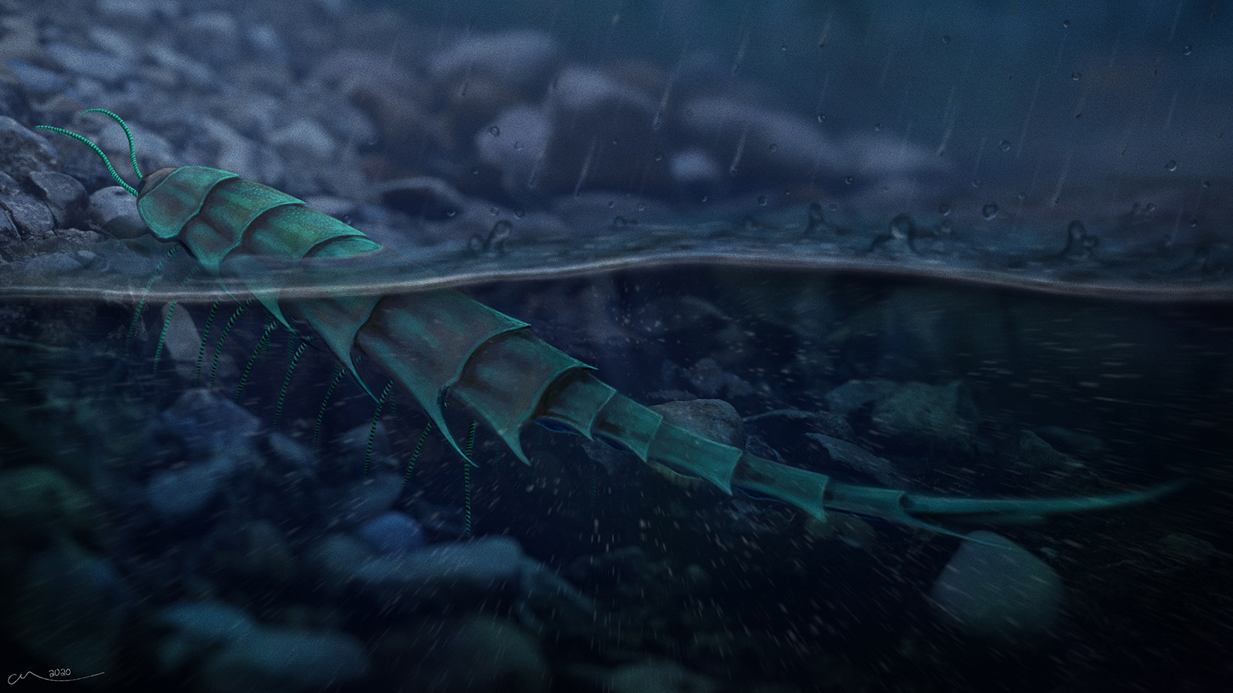
Rediscovered at the bottom of a drawer, a fossil sheds light on how millipede predecessors gained ground
27 November 2020
Spatially Explicit Hydrological Modelling for Water Accounting under Climate Change in the Volta River Basin in West Africa
28 August 2020
An automated data integration framework for stochastic downscaling of coarse-resolution digital elevation models
5 June 2020
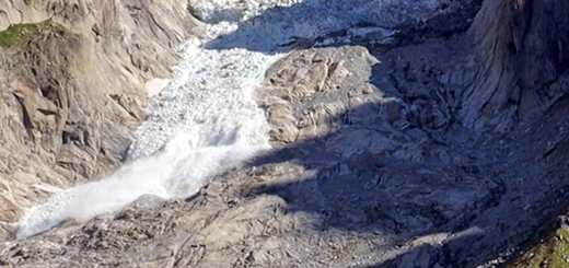
Ice fall in the Mont Blanc massif
15 September 2018
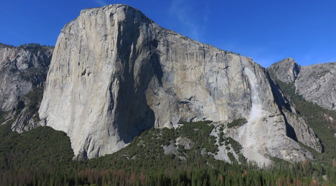
The recent El Capitan rockfalls have been analyzed by the Risk Analysis Group in collaboration with Yosemite National Park
9 October 2017
General Conclusions – Next Steps
10 June 2016
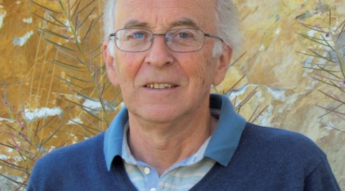
A prestigious prize for Gérard Stampli
4 September 2015
←
Previous Page
1
2
3