Français
English
Géoblog
The popular science blog of the Faculty of Geosciences and the Environment
Research in action
Insight
The faculty’s “Insights” programme brings together researchers from a variety of disciplines, ranging from the humanities to the exact sciences.
Winners and projects
Theses defended
The dynamism of research is reflected in the numerous theses prepared and defended in the Faculty. Here you will find summaries of doctoral theses in geography, earth sciences, environmental sciences and tourism studies. Some of these works are available in full in Open Access on SERVAL.
Press review
Files
Events
Urban farming
« Rapid urban growth in the developing world is placing increasing strain on urban food supply systems. Agriculture, which includes horticulture, livestock raising, fisheries, forestry, and the production of milk and fodder, is expanding within and around cities. Urban agriculture provides fresh food, generates employment, recycles urban waste, creates green belts, and strengthens cities’ resilience to climate change. » — Food and Agriculture Organization of the United Nations
Regional planning
Anthropocene
Weather report
Refresh your knowledge of meteorology with the column by Jean-Michel Fallot, geographer, senior lecturer at the Institute of Geography and Sustainability, and climate specialist. Mr Fallot regularly provides a summary of the weather in Switzerland, climate and seasonal trends, and the history of meteorology in our country, based on data from MétéoSuisse.
Far north
Artificial intelligence
Oceans
Focus on best practices
How are field and research practices evolving in geosciences and environmental sciences? Discover the testimonials and reflections of our research community in this report.
Research at work
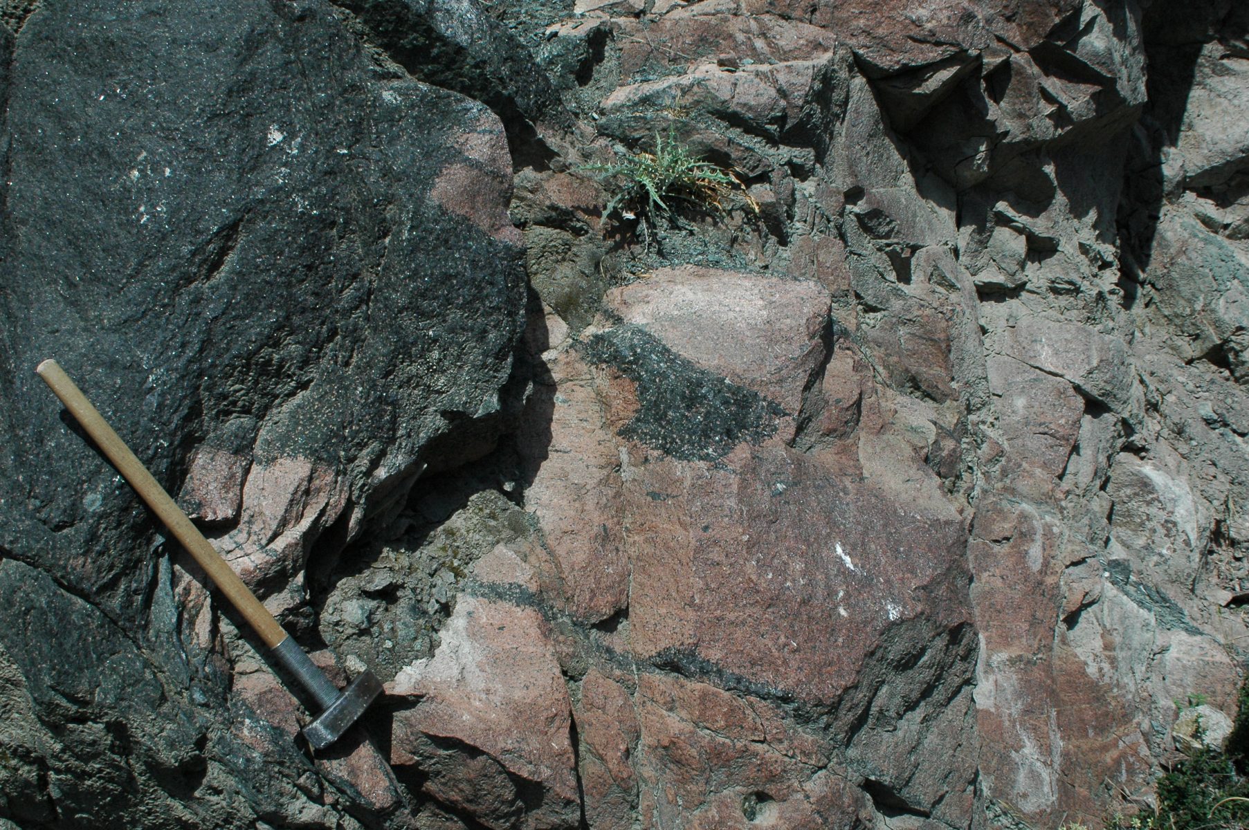
Twice as much water in the magmas of subduction zones: the secrets of the plutonic rocks of Kohistan (Pakistan) – and the Alps?
21 June 2022
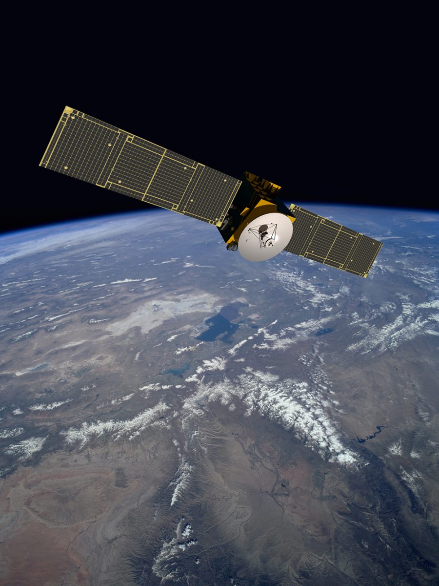
From space, the Alps turn green surprisingly fast
3 June 2022
Price of European Geosciences Union awarded to Mikhail Kanevski
19 April 2022
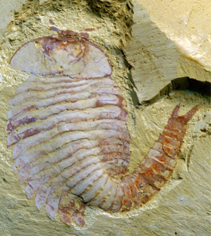
The paleoenvironment of Chengjang Biota: a sedimentological study leads to an unexpected result
12 April 2022
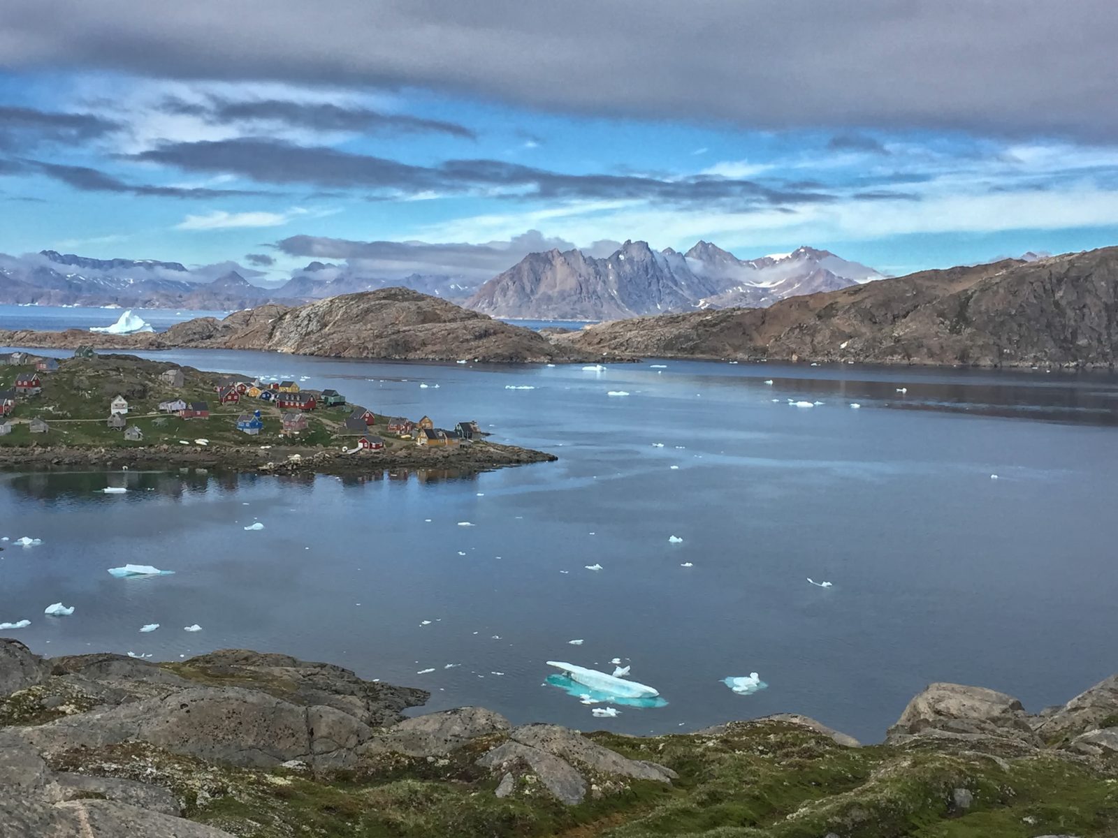
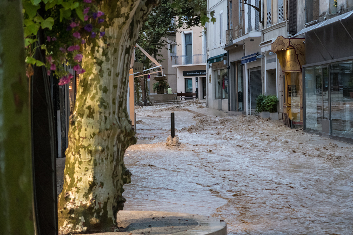
Climate change in the fjords of southern Greenland
4 April 2022
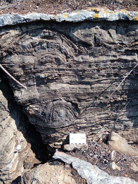
Micropyrites: a signature of life
25 March 2022
Biodiversity restoration: local projects under scrutiny
14 March 2022
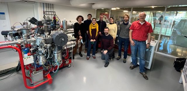
The multiple facets of SIMS in Switzerland
9 March 2022
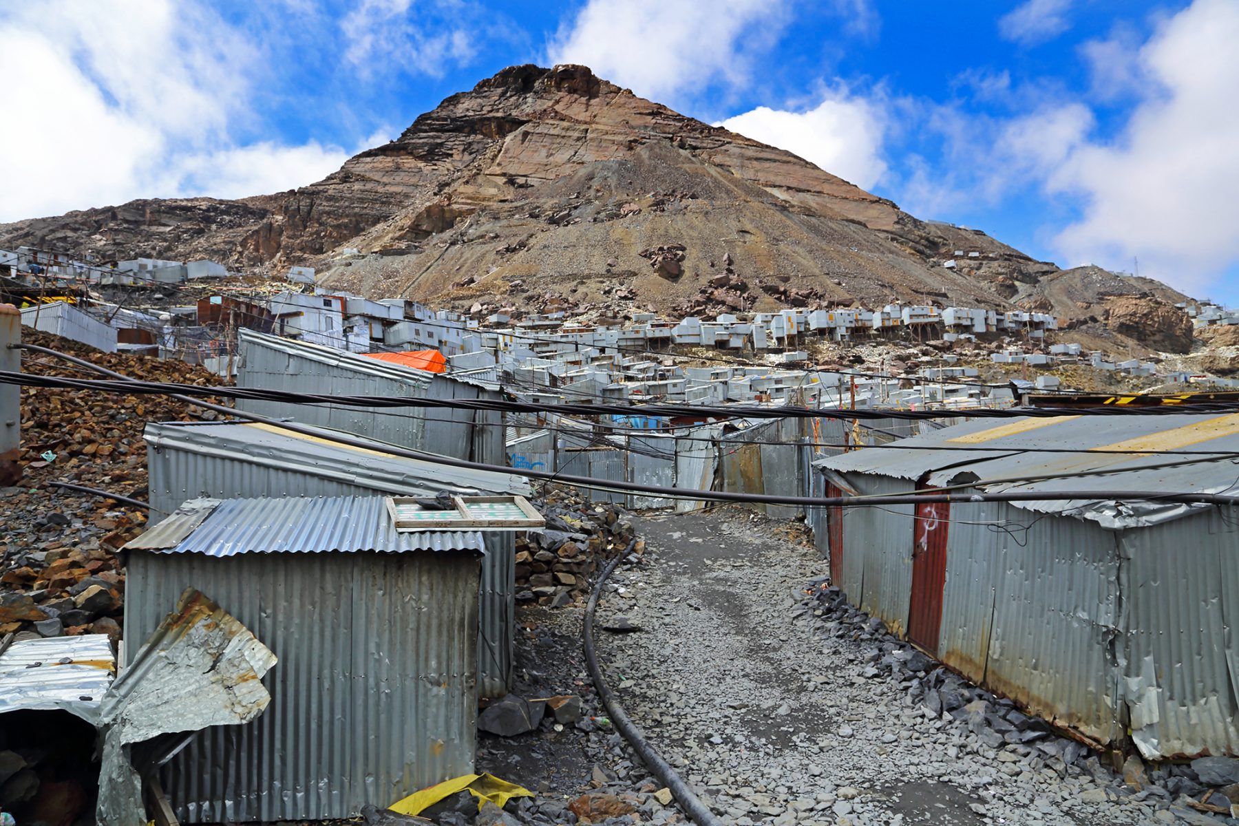
The Origin of Gold: this precious metal has now its geoforensic passport
10 February 2022
Realize a project to create a start-up?
7 February 2022
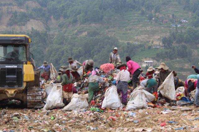
Waste management in South Asia: what impact of the COVID-19 pandemic?
11 January 2022
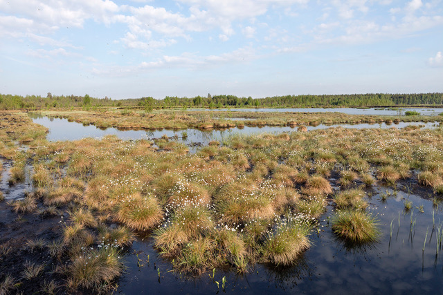
What happens to biodiversity when glaciers disappear?
30 November 2021
How climate change affects extreme rainfall ? A new Eccellenza professor at FGSE addresses this issue
18 October 2021
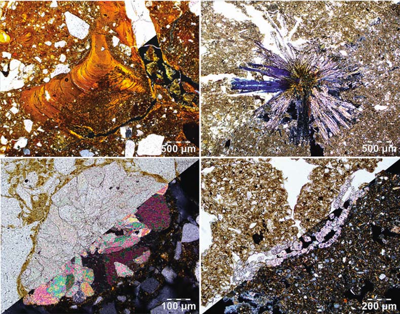
A Visual Atlas for Soil Micromorphologists
12 October 2021
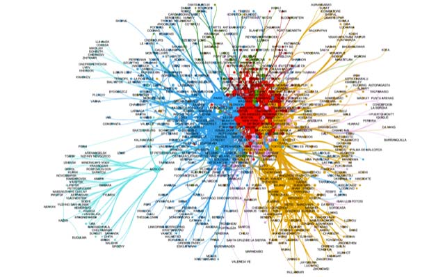
Interview with Céline Rozenblat about the Handbook of Cities and Networks
24 August 2021
←
Previous Page
1
2
3
4
5
6
Next Page
→