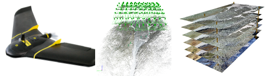
UAV rock glacier monitoring
Since 2016, repeated Unmanned Aerial Vehicles (UAV) surveys are implemented on several rock glaciers using different flight strategies and UAV configurations. The Structure from Motion (SfM) workflow is used to process the raw data for obtaining very-high-resolution datasets, such as point clouds, Digital Elevation Models (DEM), and orthophoto mosaics. Additional processing practices such as image co-registration, feature tracking algorithms and point cloud operations are employed to derived rock glacier surface displacements and elevation changes. As a general approach, most of the UAV-derived results are validated with in situ measurements provided by terrestrial geodetic surveys (TGS).