Wild/Rural Urban Interface assessment and prediction
The Wildland/Rural Urban Interface (WUI/RUI) is known as the area where structures and other human development meet or intermingle with wildland and rural area. Anthropogenic and environmental features, such as urban growth, fragmentation of rural areas, deforestation and more in general land use/land cover changes (LULCC), shaped the WUI’s extension. We applied geospatial and statistical method allowing to elaborate WUI/RUI maps and assessing their evolution. We also developed an innovative approach to make prediction future extension of this interface. Case studies are the Swiss Alpine environment and Portugal.
The main objectives are :
- Evaluate the contribution of different environmental variables to explain the likelihood of a burnable site to effectively become an ignition point of a forest fire.
- Provide a repeatable and robust model based on the results of statistical analyses and integrated in a GIS environment, allowing mapping WUI in Swiss regions.
- Develop an innovative method based on LULCC simulation models and including machine learning algorithm, to elaborate a future land cover map for 2030.
This project is a collaboration with Professor Màrio G. Pereira and Joana Parente (PhD student), Universidade de Trás-os-Montes e Alto Douro (Portugal)
Participants: Marj Tonini, Federico Amato
-
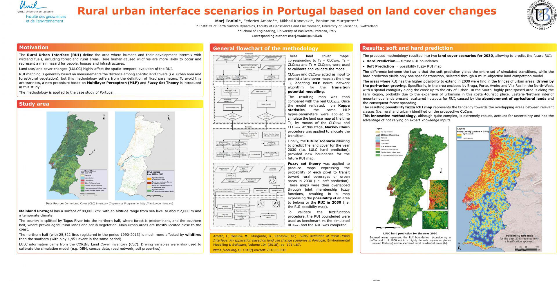
- Rural-Urban interface scenarios in Portugal