Cette publication est également disponible en :
![]() Français
Français

Assessment of rockfall susceptibility is a difficult task because numerous processes contribute to make the rock mass unstable.
The Risk Analysis Group of the Institute of Earth Sciences of the University of Lausanne has been working for several years to improve the forecasting of such events. Since 2010, several PhD students and researchers of the group have worked on rockfalls in Yosemite National Park.
This research, funded by the Swiss National Science Foundation, is performed collaboratively with Dr. Greg M. Stock, Yosemite Park’s geologist of the United States National Park Service (USNPS) and Dr. Brian D. Collins of the Landslide Hazards Program of the U.S. Geological Survey (USGS).
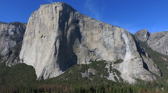
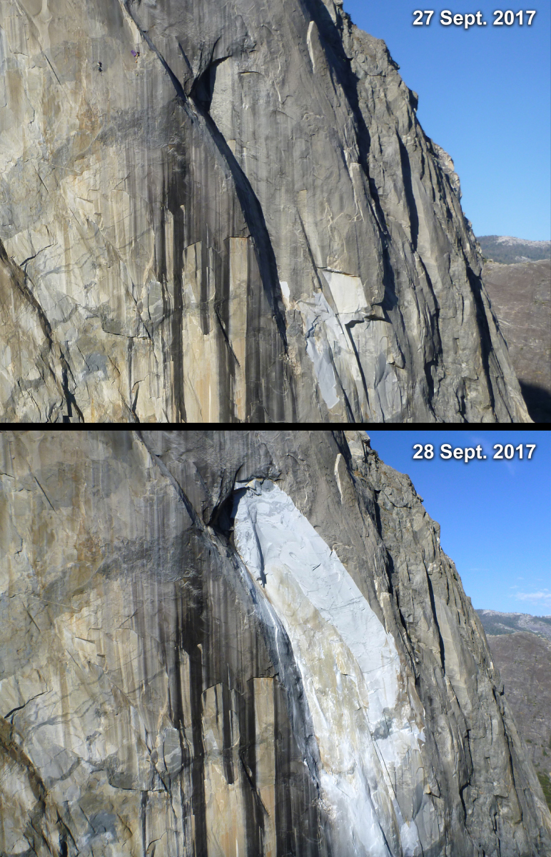
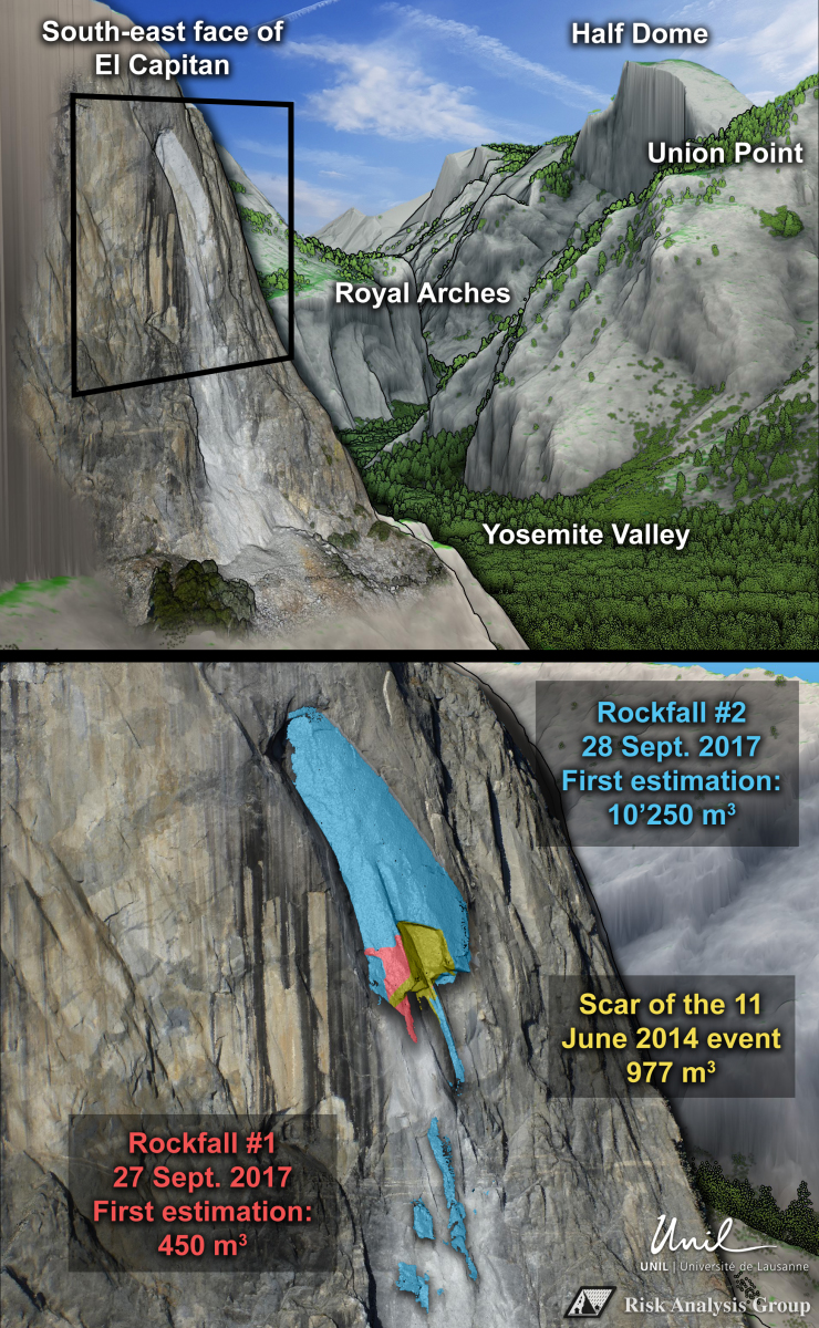
The recent rockfall events (Figure 1) that occurred on the southeast face of El Capitan rock formation caused one fatality and several injuries (refer to the New York Times, the New York Times, the Mercury News and the National Park Service). These rockfall events have been analyzed in detail (Figure 2) by the Risk Analysis Group and in particular by Antoine Guerin, a fifth-year PhD student. Antoine has provided the first estimations of the collapsed volumes (450 m3 and 10’250 m3) by comparing the terrestrial laser scans acquired over several years with new post-event photogrammetric models built with photos taken by Dr. Stock on 27 and 28 September.
In Yosemite Valley, Drs. Collins and Stock have shown that thermal forcing and solar radiation play a major role in the destabilization and rupture of large granitic rock slabs (See Collins and Stock, 2016, in Nature Geoscience and this video of exfoliating rock from YouTuber dotysan).
By comparing infrared thermal images and high resolution 3D models, the Risk Analysis Group has shown that the El Capitan rockmass, amongst others, goes through significant deformations because of daily thermal cycles. Such deformation occurs every day and leads to a progressive weakening of the rock that may result with ruptures and collapses similar to the events that occurred last week in the southeast face of El Capitan.
The rapid progression of remote sensing techniques over the past decade has improved not only characterization of rockfalls (in terms of number and volume), but also improved understanding of the mechanisms causing these events. However most of these types of analyses are performed only after an event, and forecasting the precise location of a future rockfall remains a difficult task requiring further investigation. Achieving this would require a detailed knowledge of dimensions of all the fractures cutting the rock mass in order to define rock compartments more susceptible to collapse. The trajectories of the resulting falling blocks would then need to be simulated to produce rockfall hazard maps that could be used for land planning in mountainous areas. This issue of rockfall susceptibility is precisely the topic of a scientific paper to be published this year in the journal Landslides (Matasci et al., 2017).
Press release
New York Times
- El Capitan Rockfall Kills One and Injures Another in Yosemite
- Second Yosemite Rockfall in Two Days Injures One at El Capitan
Mercury News
National Park Service
Scientific papers
- Collins, B. D., & Stock, G. M. (2016). Rockfall triggering by cyclic thermal stressing of exfoliation fractures. Nature Geoscience, 9(5), 395-400.
- Matasci, B., Stock, G. M., Jaboyedoff, M., Carrea, D., Collins, B. D., Guerin, A., Matasci, G., Ravanel, L. (2017). Assessing rockfall susceptibility in steep and overhanging slopes using three-dimensional analysis of failure mechanisms. Landslides.
Leave a Reply