Masters and Bachelors projects
Are you interested in working on contemporary ice sheet processes at local, regional and perhaps whole-ice-sheet scales? Do you have a basic grounding in Glaciology and/or Hydrology? And do you already have some experience in data analysis using a scripting language such as Python? Then we’d be happy to hear from you.
We have put together some suggested topics below. This is a non-exhaustive list. You are welcome to approach us to discuss these topics or your own ideas further. We also suggest that you take a look at some of our most recent publications (via the links on the Team page) to get a feel for the approaches and methods that we use. Of course, we will help you develop your knowledge and skills further in the directions needed for your project.
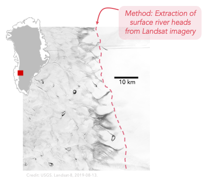
Surface topography evolution around the Greenland Ice Sheet runoff limit
At the uppermost reaches of the Greenland Ice Sheet’s ephemeral surface rivers, the surface topography transitions from a flat plateau into shallow fluvial valleys. To date, it isn’t clear whether this shift in topographic signature is induced by the transfer the ice sheet bed to the surface, or rather by surface hydrological processes which have re-modelled the surface. Moreover, the ice sheet’s visible runoff limits have generally expanded over the last 40 years (Tedstone and Machguth, 2022). This project would seek to understand how the surface topography has evolved during this period of visible runoff area expansion. We suggest that this would mainly involve analysing multi-temporal strips of ArcticDEM data in conjunction with visible runoff limits and optical satellite imagery. By investigating whether there is evidence for switching of flow routing (‘water piracy’) it should also be possible to identify whether hydrological catchments have changed through time.
High elevation meltwater input points
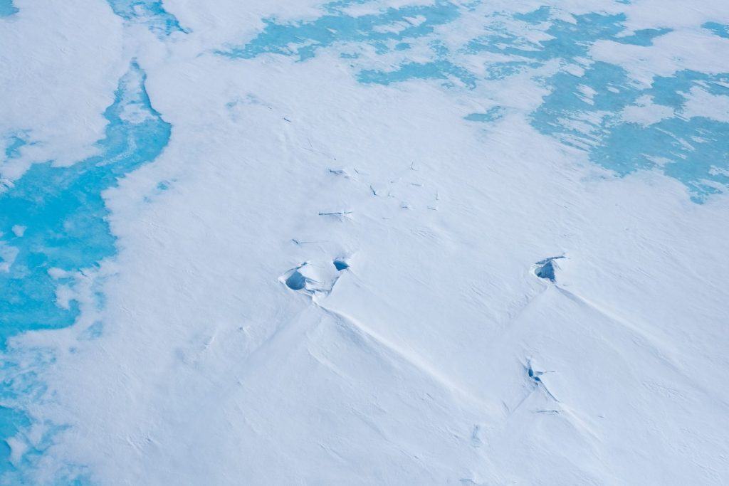
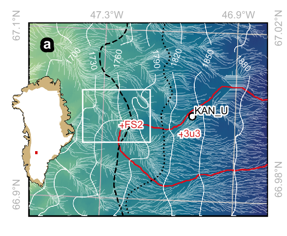
A fundamental gap in our knowledge of Greenland Ice Sheet hydrology is that we do not have a consolidated catalogue of meltwater input points which drain water from the ice sheet surface to its bed and eventually out to sea. We particularly lack validated information above the equilibrium line altitude. Considering a case study of south-west Greenland, previous research by Yang and Smith (2016) suggests that there are multiple input points above 1,600 metres above sea level, but this research was mainly based on a single satellite image with 30 m resolution. In this project you would use up-to-date, higher-resolution satellite data and complementary data sources to constrain the frequency of meltwater input points to the ice sheet bed above the equilibrium line altitude.
Consolidating an automated pipeline for detecting visible runoff limits from satellite imagery
We have an existing pipeline to extract seasonal and annual visible runoff limits from multi-spectral satellite imagery, ice-sheet-wide. This pipeline was initially presented in Tedstone and Machguth (2022) using single-band near-infrared imagery and subsequently extended to ingest annual mosaics of the Normalised Difference Water Index (NDWI) generated using Google Earth Engine from band combinations. This project would seek to cross-validate these two complementary approaches with the intent of building an operational automated pipeline which can be quickly and easily run to maintain an up-to-date time series of visible runoff limits. This project would suit a candidate with more substantial previous programming experience in Python, and/or experience with Google Earth Engine.
Advancing our knowledge of supraglacial meltwater runoff versus retention using in-situ measurements
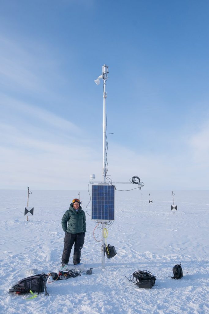
In April 2026 we plan to download the first year of data from our in-situ field experiments, which were installed in April 2025. These installations include time-lapse cameras and pressure transducers to measure surface slush field, stream and river flow, and are supplemented by a time series of very high resolution satellite imagery collected during the summer melt season. You would be involved in our ongoing work to derive discharge time series from these datasets.
Subglacial hydrology modelling with GLaDS in Elmer/Ice
The sliding response of the Greenland Ice Sheet to a warming climate is strongly influenced by the way meltwater drains beneath the ice. However, current models that couple subglacial hydrology and ice dynamics remain poorly constrained, especially beneath thick ice, where hydraulic gradients are small.
In this project, you will use the GlaDS (Glacier Drainage System) model, implemented within the ice-flow model Elmer/Ice, to simulate how subglacial water pressure and drainage efficiency evolve in response to meltwater input, and how ice-flow velocities react to changes in the subglacial hydrological system over seasonal timescales. The project will begin with parameter testing on a simplified model domain, followed by more realistic simulations focused on the K-transect (southwest Greenland), informed by field observations.
This project would suit a student interested in glacier modelling, subglacial hydrology, or ice dynamics. Previous modelling experience would be an advantage but is not essential.