From ownership linkages to world economic networks

  • ORBIS Database description

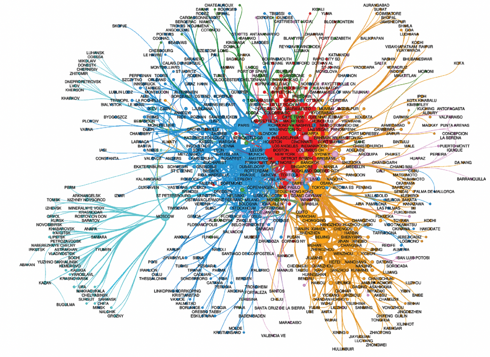
Analysing the integration of cities into global economic networks we use the ORBIS database from Bureau van Dijk (BvD; 2010, 2013, 2016, 2019, 2022) that focuses on corporate long term investment relations based on parent–subsidiary ownership links in every economic sector. It is distinct from the interlocking world city network model and the interorganizational project approach, which focus on advanced producer services (APSs) and banks, respectively, and use a bipartite networks approach. In contrast, in the ORBIS-BvD, linkages between cities are built directly according to the ownership linkages between the owner and the subsidiary firms located in different cities. In this way, cities are considered as nodes in networks constituted by oriented links of the relations between headquarters and subsidiaries, forming global groups of firms that are mostly totally interconnected.
  • Cities delineation – Large Urban Areas (LURs)

A Large Urban Region (LUR) can be defined as an aggregation of continuous statistical units around a core that are economically dependent on this core and linked to it by economic and social strong interdependences. The main purpose of this delineation is to make cities comparable on the national and world scales and to make comparative social-economic urban studies. Aggregating different municipal districts around a core city, we construct a single large urban region, which allows to include all the area of economic influence of a core into one statistical unit (see Rozenblat, 2020 or Rogov & Rozenblat, 2020 for Russia). In doing so we use four principal urban concepts (Pumain et al., 1992): local administrative units (Municipality or localities: MUNI), morphological urban area (MUA), functional urban area (FUA) and conurbation that we call Large Urban Region (LUR). The LURs are the spatial extensions of influence of one or several FUAs or MUAs. MUAs and FUAs are defined by various national or international sources. We implemented LURs using criteria such as the population distribution among one or several MUAs or FUAs, road networks, access to an airport, distance from a core, presence of multinational firms. FUAs and MUAs perimeters, if they form a part of a LUR, belong to a unique LUR. In this database we provide the composition of the LURs in terms of local administrative units (MUNI), Morphological Urban Area (MUA), Functional Urban Area (FUA).

More about Large Urban Regions:

Rogromel, C., & Rozenblat, C. (2024). Delineating African cities (large urban regions) to compare them within global urban networks. Cybergeo: European Journal of Geography.

Rozenblat, C. (2020). Extending the concept of city for delineating large urban regions (LUR) for the cities of the world. Cybergeo: European Journal of Geography.

Rogov, M., & Rozenblat, C. (2020). Delineating Russian cities in the perspective of corporate globalization: towards Large Urban Regions. Cybergeo: European Journal of Geography.

LUR delineation Database worldwide:

https://zenodo.org/records/3700052