Naz Islam has just published a paper that considers Glacial Lake Outburst Floods (GLOFs), a recurring hazard in the Himalayas, posing significant threat to downstream communities, in the North Sikkim district of India. This district comprising the upper reaches of the Teesta River in the Eastern Himalayas, and has experienced past GLOF events. The identification of lakes susceptible to this phenomenon is therefore paramount. Using multi-temporal satellite images, this study tracks lake growth in the region, revealing that 203 new lakes had developed herein during the observation period (2000–2018). Of these, 82 lakes had formed during 2011–2018 alone; indicating marked glacial retreat and consequent lake area growth, alongside a rising temperature trend. Using various weighted geometric and geomorphic parameters, the 36 most hazardous lakes were identified, from which the 10 lakes posing the greatest GLOF threat were discerned. These lakes are mostly situated along the main snowline and Great Himalayan water-divide in the north-eastern part of Sikkim and should be monitored continuously. A link to the paper is available here.
News
New Paper Published : Climate Change Impacts on Sediment Yield and Debris‐Flow Activity in an Alpine Catchment
Climate change impacts on sediment production and transfer processes on hillslopes and through channels are governed by possible changes in precipitation, runoff, and air temperature. These hydrological and geomorphological impacts are difficult to predict in temperature‐sensitive Alpine environments. In this study, we combined a stochastic weather generator model with the most current climate change projections to feed a hillslope‐channel sediment cascade model for a major debris‐flow system in the Swiss Alps (the Illgraben). This allowed us to quantify climate change impacts and their uncertainties on sediment yield and the number of debris flows at hourly temporal resolution. We show that projected changes in precipitation and air temperature lead to a reduction in both sediment yield (−48%) and debris‐flow occurrence (−23%). This change is caused by a decrease in sediment supply from hillslopes, which is driven by frost‐weathering. Additionally, we conduct model experiments that show the sensitivity of projected changes in sediment yield and debris‐flow hazard to basin elevation, with important implications for assessing natural hazards and risks in mountain environments. Future changes in hydrological and sediment fluxes are characterized by high uncertainty, mainly due to irreducible internal climate variability. Therefore, this stochastic uncertainty needs to be considered in climate change impact assessments for geomorphic systems. The paper cab be accessed here.
New Paper Published: Daily entropy of dissolved oxygen reveals different energetic regimes and drivers among high-mountain stream types
High-resolution time series of dissolved oxygen (DO) have revealed different ecosystem energetics regimes across various stream types. Ecosystem energetic regimes are relevant to better understand the transformation and retention of nutrients and carbon in stream ecosystems. However, the patterns and controls of stream energetics in high-mountain landscapes remain largely unknown. Here we monitored percent DO saturation (every 10 min) over 2 years in a glacier-fed, krenal (groundwater-fed) and a nival (snowmelt-fed) stream as they are typical for the high mountains. We used daily Shannon entropy to explore the temporal dynamics of stream water DO and to infer information on the ecosystem energetics and on the potential drivers. We found that discharge modulated the drivers of DO variations at daily and seasonal scales. Elevated bed movement along with high turbidity and very high gas exchange rates drove the daily DO patterns in the glacier-fed stream during snow and ice melt, whereas light seemed to drive DO dynamics in the krenal and nival streams. We found a window of favorable conditions for potential gross primary production (GPP) during the onset of the snowmelt in the glacier-fed stream, whereas potential GPP seemed to extend over longer periods in the krenal and nival streams. Our findings suggest how the energetic regimes of these high-mountain streams may change in the future as their biological and physical drivers change owing to climate warming. A copy can be obtained here.
New Paper Published : Combining UAV-Based SfM-MVS Photogrammetry with Conventional Monitoring to Set Environmental Flows: Modifying Dam Flushing Flows to Improve Alpine Stream Habitat
Setting environmental flows downstream of hydropower dams is widely recognized as important, particularly in Alpine regions. However, the required flows are strongly influenced by the effects of the physical environment of the downstream river. Here, we show how unmanned aerial vehicle (UAV)-based structure-from-motion multiview stereo (SfM-MVS) photogrammetry allows for incorporation of such effects through determination of spatially distributed patterns of key physical parameters (e.g., bed shear stress, bed grain size) and how they condition available stream habitat. This is illustrated for a dam-impacted Alpine stream, testing whether modification of the dam’s annual flushing flow could achieve the desired downstream environmental improvement. In detail, we found that (1) flood peaks in the pilot study were larger than needed, (2) only a single flood peak was necessary, (3) sediment coarsening was likely being impacted by supply from nonregulated tributaries, often overlooked, and (4) a lower-magnitude but longer-duration rinsing flow after flushing is valuable for the system. These findings were enabled by the spatially rich geospatial datasets produced by UAV-based SfM-MVS photogrammetry. Both modeling of river erosion and deposition and river habitat may be revolutionized by these developments in remote sensing. However, it is combination with more traditional and temporarily rich monitoring that allows their full potential to be realized. A copy of the paper is available here.
New Paper Published : A Numerical Study of the Influence of Channel-Scale Secondary Circulation on Mixing Processes Downstream of River Junctions
Resulting from a collaboration with Perm State University, this paper investigates river mixing. A rapid downstream weakening of the processes that drive the intensity of transverse mixing at the confluence of large rivers has been identified in the literature and attributed to the progressive reduction in channel scale secondary circulation and shear-driven mixing with distance downstream from the junction. These processes are investigated in this paper using a three-dimensional computation of the Reynolds averaged Navier Stokes equations combined with a Reynolds stress turbulence model for the confluence of the Kama and Vishera rivers in the Russian Urals. Simulations were carried out for three different configurations: an idealized planform with a rectangular cross-section (R), the natural planform with a rectangular cross-section (P), and the natural planform with the measured bathymetry (N), each one for three different discharge ratios. Results show that in the idealized configuration (R), the initial vortices that form due to channel-scale pressure gradients decline rapidly with distance downstream. Mixing is slow and incomplete at more than 10 multiples of channel width downstream from the junction corner. However, when the natural planform and bathymetry are introduced (N), rates of mixing increase dramatically at the junction corner and are maintained with distance downstream. Comparison with the P case suggests that it is the bathymetry that drives the most rapid mixing and notably when the discharge ratio is such that a single channel-scale vortex develops aided by curvature in the post junction channel. This effect is strongest when the discharge of the tributary that has the same direction of curvature as the post junction channel is greatest. A comprehensive set of field data are required to test this conclusion. If it holds, theoretical models of mixing processes in rivers will need to take into account the effects of bathymetry upon the interaction between river discharge ratio, secondary circulation development, and mixing rates. An Open Access copy of the paper is available here.
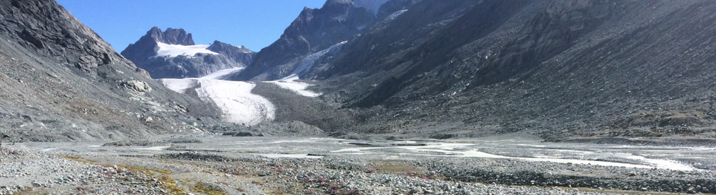
New Paper Published : Changes in sediment connectivity following glacial debuttressing in an Alpine valley system
Mancini, D. and Lane, S.N., 2020. Changes in sediment connectivity following glacial debuttressing in an Alpine valley system. Geomorphology, 352, UNSP 106987
Increasing air temperature and declining winter snowfalls are resulting in rapid glacier recession and the expansion of proglacial margins in Alpine regions. Such margins include substantial debris accumulations (e.g. frontal/lateral moraine ridges; till-covered and steep valley sidewalls) which may be unstable due to glacial debuttressing. Rainfall, snowmelt and ice melt out may then cause mass movements. Here, we quantify the decadal-scale erosion and deposition patterns and changes in connectivity for two valley sidewall geomorphological systems following retreat of the Glacier d’Otemma, Switzerland. We apply archival digital photogrammetric methods to the period 1964 to 2009 to determine high resolution digital elevation models. These were differenced to calculate patterns of erosion and deposition and to quantify the evolution of sediment connectivity. We found that gully headward erosion (rates between ca. −10.6 mm/year and −1002.1 mm/year) was the main geomorphological process during glacier thinning but increasing depositional rates downslope of the gullies (ca. +21.3 to +298.5 mm/year) were recorded in the following years associated with significant alluvial fan growth at the slope base. While gullying enhanced connectivity by removing glacially conditioned sediment transfer buffers, so connecting side-slopes to upstream sediment sinks (the upslope contributing area between 1964 and 2009 increased by +73.8% and +195.1% in each subsystem), alluvial fans reduced the rates of sediment transfer to the rapidly enlarging glacial forefields. The detail of these responses is conditioned by three generic processes: (1) the wider geomorphic setting – here, the presence of a moraine bastion as a primary part of the sediment cascade strongly influenced gully morphology evolution and the likely length of the paraglacial period length; (2) the thickness of sediment left by the retreating glacier which controlled the influence of bedrock topographic buffers on connectivity; and (3) the extent to which diffusive drainage systems develop in response to the deposition at the hillslope base, which tend to disconnect sediment flux. Post-glacially, gully development has a self-limiting effect on sediment connectivity in that while gullying increases sediment connectivity, the eroded sediment leads to deposition on the alluvial plain that reduces sediment connectivity. Please email davide.mancini@unil.ch if you would like a copy.
New Paper Published : Disruption of emergency response to vulnerable populations during floods
Yu, D., Yin, J., Wilby, R., Lane, S.N., Aerts, J., Lin, N. Liu, M. Yuan, H., Chen, J., Prudhomme, C., Guan, M., Baruch, A., Johnson, W., Tang, X., Kwan, M.P., Yu, L. and Xu, S., 2020. Disruption of emergency response to vulnerable populations during floods. Nature Sustainability, 3, 728–736
Emergency responders must reach urgent cases within mandatory timeframes, regardless of weather conditions. However, flooding of transport networks can add critical minutes to travel times between dispatch and arrival. Here, we explicitly model the spatial coverage of all Ambulance Service and Fire and Rescue Service stations in England during flooding of varying severity under compliant response times. We show that even low-magnitude floods can lead to a reduction in national-level compliance with mandatory response times and this reduction can be even more dramatic in some urban agglomerations, making the effectiveness of the emergency response particularly sensitive to the expected impacts of future increases in extreme rainfall and flood risk. Underpinning this sensitivity are policies leading to the centralization of the Ambulance Service and the decentralization of the Fire and Rescue Service. The results provide opportunities to identify hotspots of vulnerability (such as care homes, sheltered accommodation, nurseries and schools) for optimizing the distribution of response stations and developing contingency plans for stranded sites.
New Paper Published : Mitigating systematic error in topographic models for geomorphic change detection: moving beyond off-nadir imagery
James, M.R., Antoniazza, G., Robson, S. and Lane, S.N., 2020. Mitigating systematic error in topographic models for geomorphic change detection: moving beyond off-nadir imagery. Earth Surface Processes and Landforms, 45, 2251-71
Unmanned aerial vehicles (UAVs) and structure‐from‐motion photogrammetry enable detailed quantification of geomorphic change. However, rigorous precision‐based change detection can be compromised by survey accuracy problems producing systematic topographic error (e.g. ‘doming’), with error magnitudes greatly exceeding precision estimates. Here, we assess survey sensitivity to systematic error, directly correcting topographic data so that error magnitudes align more closely with precision estimates. By simulating conventional grid‐style photogrammetric aerial surveys, we quantify the underlying relationships between survey accuracy, camera model parameters, camera inclination, tie point matching precision and topographic relief, and demonstrate a relative insensitivity to image overlap. We show that a current doming‐mitigation strategy of using a gently inclined (<15°) camera can reduce accuracy by promoting a previously unconsidered correlation between decentring camera lens distortion parameters and the radial terms known to be responsible for systematic topographic error. This issue is particularly relevant for the wide‐angle cameras often integrated into current‐generation, accessible UAV systems, frequently used in geomorphic research. Such systems usually perform on‐board image pre‐processing, including applying generic lens distortion corrections, that subsequently alter parameter interrelationships in photogrammetric processing (e.g. partially correcting radial distortion, which increases the relative importance of decentring distortion in output images). Surveys from two proglacial forefields (Arolla region, Switzerland) showed that results from lower‐relief topography with a 10°‐inclined camera developed vertical systematic doming errors > 0·3 m, representing accuracy issues an order of magnitude greater than precision‐based error estimates. For higher‐relief topography, and for nadir‐imaging surveys of the lower‐relief topography, systematic error was < 0·09 m. Modelling and subtracting the systematic error directly from the topographic data successfully reduced error magnitudes to values consistent with twice the estimated precision. Thus, topographic correction can provide a more robust approach to uncertainty‐based detection of event‐scale geomorphic change than designing surveys with small off‐nadir camera inclinations and, furthermore, can substantially reduce ground control requirements. An Open Access copy is available here.
New Paper Published : Evaluation of aDcp processing options for secondary flow identification at river junctions
Secondary circulation in river confluences results in a spatial and temporal variation of fluid motion and a relatively high level of morphodynamic change. Acoustic Doppler current profiler (aDcp) vessel‐mounted flow measurements are now commonly used to quantify such circulation in shallow water fluvial environments. It is well established that such quantification using vessel‐mounted aDcps requires repeated survey of the same cross‐section. However, less attention has been given to how to process these data. Most aDcp data processing techniques make the assumption of homogeneity between the measured radial components of velocity. As acoustic beams diverge with distance from the aDcp probe, the volume of the flow that must be assumed to be homogeneous between the beams increases. In the presence of secondary circulation cells, and where there are strong rates of shear in the flow, the homogeneity assumption may not apply, especially deeper in the water column and close to the bed. To reduce dependence on this assumption, we apply a newly‐established method to aDcp data obtained for two medium‐sized (~60–80 m wide) gravel‐bed river confluences and compare the results with those from more conventional data processing approaches. The comparison confirms that in the presence of strong shear our method produces different results to more conventional approaches. In the absence of a third set of fully independent data, we cannot demonstrate conclusively which method is best, but our method involves less averaging and so in the presence of strong shear is likely to be more reliable. We conclude that it is wise to apply both our method and more conventional methods to identify where data analysis might be impacted upon by strong shear and where inferences of secondary circulation may need to be made more cautiously.
A copy is available here.
New Grant to Start : Glacier recession, glacial sediment export and the morphodynamics of proglacial forefields
The Swiss National Science Foundation has funded a new project that will involve two PhD students and a technician to work on the behaviour of the areas that form in front of glaciers (proglacial forcefields) as they retreat. They are dramatically increasing in size due to rapid climate warming and glacier recession. Impacts of climate change upon glacier recession are well-established over the timescale of years to decades. Geomorphic response of proglacial margins, of which forefields are one component, has also received significant attention (e.g. consequences of glacial debuttressing; role of vegetation as an ecosystem engineer in stabilising deglaciated terrain). Forefields themselves, especially in Alpine settings, have received less attention notably (1) how they are forced by their upstream boundary condition, glacier runoff and sediment export; and (2) how they filter this signal to influence downstream sediment yield. Quantifying these processes fully and continually at scales from the sub-daily (due to rapid discharge variation following from snow/ice melt) to the seasonal has not yet been attempted but is necessary if we are to understand how changing glacier sediment export translates into downstream sediment delivery. It is of practical importance (e.g. for hydropower management) and scientific interest (e.g. whether measurements of sediment yield can be used to infer glacial erosion rates; how forefield morphodynamics create the habitats upon which new postglacial ecosystems can develop).
The core aim of this project is to undertake the first, coupled study of the relationship between subglacial sediment export, forefield morphodynamics and downstream sediment flux for a retreating Alpine glacier. The project is structured around two broad sets of hypotheses. The first addresses subglacial sediment export, a critical boundary condition that will drive forefield morphodynamics. It seeks to quantify how and over what timescales the marginal zone of a glacier regulates the export of glacially-eroded sediment to its forefield, for both bedload and suspended load. The second focuses upon how the forefield responds to glacial sediment export in terms of morphodynamics and how these morphodynamics in turn filter glacier-exported sediment to drive downstream sediment yield.
The project uses both field data collection and computational modelling. The former focuses upon a representative temperate Alpine valley glacier forefield, Otemma, in Switzerland. In a technician-led work package (WP1) new opportunities for monitoring bedload continuously using acoustic pipe samplers will be combined with standard stage and turbidity monitoring to produce, after calibration, the first season-scale, continuous records of discharge, suspended load and bedload. WP2 will use gauging station data to quantify glacial sediment export and its timescales of variability. It will be supported by ground penetrating radar survey of the subglacial channel in the snout marginal zone and the first attempt to introduce into crevasses and moulins tagged gravel/cobble particles and to track their emergence at the snout. Existing one-dimensional models will be adapted to allow us to simulate how sediment moves through the snout marginal zone under different forcing conditions. WP3 focuses on the forefield, quantifying sub-daily morphodynamics and grain size patterns using UAV systems. These will allow us to quantify how the forefield filters glacier-exported sediment and to relate it to morphodynamics. The HSTAR numerical model will be developed for multiple grain sizes and applied to simulate how different boundary conditions, including the size of the proglacial area, filter the signal of glacier sediment export. WP4 will bring together results from WPs 1-3 to answer the critical science questions: what are the timescales over which glacier sediment export can be used to infer glacial erosion rates? how do proglacial margins filter glacial sediment export to determine basin sediment yield? and how do proglacial morphodynamics evolve as glaciers retreat, so impacting frequencies of forefield disturbance.