The Swiss plate geophone (SPG) system has been installed and tested in more than 20 steep gravel-bed streams and rivers, and related studies generally resulted in rather robust calibration relations between signal impulse counts and transported bedload mass. Here, we compare this system with three alternative surrogate measuring systems. A variant of the SPG system uses the same frame (housing) set-up but with an accelerometer instead of a geophone sensor to measure the vibrations of the plate (GP-Acc, for geophone plate accelerometer). The miniplate accelerometer (MPA) system has a smaller dimension of the impact plate and is embedded in more elastomer material than the SPG system. The Japanese pipe microphone (JPM) is a 1 m long version of the system that has been installed in many streams in Japan. To compare the performance of the four systems, we used calibration measurements with direct bedload samples from three field sites and an outdoor flume facility with controlled sediment feed. At our field sites, the systems with an accelerometer and a microphone showed partly large temporal variations in the background noise level, which may have impaired the calibration measurements obtained during certain time periods. Excluding these periods, the SPG, GP-Acc, and JPM all resulted in robust calibration relations, whereas the calibration of the MPA system showed a poorer performance at all sites. A copy is freely available here.
News
New Paper Published : Warming-driven erosion and sediment transport in cold regions
Rapid atmospheric warming since the mid-twentieth century has increased temperature-dependent erosion and sediment-transport processes in cold environments, affecting food, energy and water security. In this Review, we summarize landscape changes in cold environments and provide a global inventory of increases in erosion and sediment yield driven by cryosphere degradation. Anthropogenic climate change, deglaciation, and thermokarst disturbances are causing increased sediment mobilization and transport processes in glacierized and periglacierized basins. With continuous cryosphere degradation, sediment transport will continue to increase until reaching a maximum (peak sediment). Thereafter, transport is likely to shift from a temperature-dependent regime toward a rainfall-dependent regime roughly between 2100–2200. The timing of the regime shift would be regulated by changes in meltwater, erosive rainfall and landscape erodibility, and complicated by geomorphic feedbacks and connectivity. Further progress in integrating multisource sediment observations, developing physics-based sediment-transport models, and enhancing interdisciplinary and international scientific collaboration is needed to predict sediment dynamics in a warming world. A copy of the paper published in Nature – Earth and Environment can be obtained by emailing Stuart Lane (stuart.lane@unil.ch).
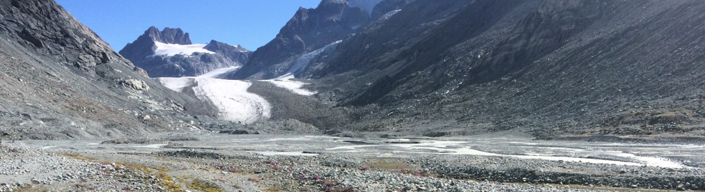
New Grant to Start : ALTROCLIMA
ALTROCLIMA is a three-year project funded jointly by the Swiss National Science Foundation and the Autonomous Province of the South Tyrol (Italy). It will support two PhD students based at the University of Lausanne, Switzerland, and a research assistant and a post-doctoral researcher at the Free University of Bozen-Bolzano, Italy (Professor Francesco Comiti, and involves a number of project partners in Switzerland and Italy.
Project aims and objectives
Alpine landscapes are experiencing climate warming at rates higher than other regions of the world. Globally, impacts of warming on the cryosphere are evident in all mountain regions including permafrost degradation; rates of mass movement (rockfalls, debris flows, landslides) at higher altitudes; river flows; and terrestrial/ aquatic ecosystems. Predictions of changing snow/ice cover are available to the end of the 21st century and there are attempts to couple climate change to river flow in Alpine landscapes including correct treatment of the cryosphere. How bedload transport will evolve under these drivers is much less well-established despite the important environmental significance of bedload for the ecological functioning of Alpine streams and for its potential hazard to Alpine communities. There are only a few decadal-scale records of bedload transport in mountain basins and almost no studies coupling such records to changing river basin function, historically or in terms of predictions. Such analysis must consider the balance between climate-driven changes in bedload supply (S) and bedload transport capacity (C); but also the feedbacks that follow when SC, such as sediment sorting processes when S<C. It is challenging because bedload transport is exceptionally difficult to measure and globally, unlike other measures of environmental change, we have very few instrumented sites worldwide for bedload transport monitoring extending to more than a decade of observations.
Aims and objectives: The core aim of this project is to understand and to predict how rapid climate warming has and will impact bedload transport in Alpine environments at the centennial timescale. The objectives are; O1 to provide the first reliable, multi-site quantification in Alpine environments of how bedload transport is changing under warming; O2 to determine the relative role of landscape-scale processes in driving estimated bedload export in the analyzed basins; O3 to establish an appropriate modelling framework for predicting glacier and hillslope bedload supply to the river network using evidence from O1 and O2; O4 to calibrate and to validate of a predictive model for representing bedload flux through the drainage network supported by data from O3; and O5 to provide the first predictions of Alpine bedload transport under future climate considering changes in both supply and capacity.
Methods: Using an innovative method for analyzing the bedload flushing records provided by high altitude Alpine water intakes we will reconstruct bedload export for more than 60 Alpine basins with varying glacier cover for the Swiss Alps and South Tyrol (O1). We will combine these within-basin reconstructed erosion and deposition patterns and connectivity analyses to explain the changes found in O1 (O2). Using results from O2 we will identify and test against O1 the relative merits of stochastic and physically-based models of subglacial and hillslope bedload delivery to the river network (O3). We will integrate these models to generate network-scale predictions of bedload transport under climate change with relative uncertainty (O4).
Expected results and impact: The research will produce the first decadal-scale multi-site quantification of how bedload transport has changed in Alpine environments due to climate warming and why. It will provide the first predictions with uncertainty of how Alpine bedload transport might evolve under 21st century climate change. The associated understanding and predictions will not only be of academic value but also of importance for water resource managers (including hydropower companies and national/local flood mitigation agencies) in Alpine regions.
New Grant to Start : EnvSeis
AlpWISE is a partner in a new MCSA doctoral training network, EnvSeis. Details of the network are available here. This is part of the EU Horizon 2020 programme. Switzerland is currently excluded from the programme but has adopted transitional measures, including direct Swiss government funding, to allow Swiss scientists to collaborate. So, we have a new grant starting. We will be leading on the project concerned with Seismic sensing of subglacial to proglacial marginal sediment flux and also collaborating on many of the other projects. We are particularly keen to look at subglacial seismic sediment transport monitoring. The grant will allow us to hire a PhD student.
New Paper Pair Published : On Invalidating Environmental Models – Part 1 – Principles for formulating a Turing-like test – Part 2 – Implementation
Part 1 : Model invalidation is a good thing. It means that we are forced to reconsider either model structures or the available data more closely, that is to challenge our fundamental understanding of the problem at hand. It is not easy, however, to decide when a model should be invalidated, when we expect that the sources of uncertainty in environmental modelling will often be epistemic rather than simply aleatory in nature. In particular, epistemic errors in model inputs may well exert a very strong control over how accurate we might expect model predictions to be when compared against evaluation data that might also be subject to epistemic uncertainties. We suggest that both modellers and referees should treat model validation as a form of Turing-like Test, whilst being more explicit about how the uncertainties in observed data and their impacts are assessed. Eight principles in formulating such tests are presented. Being explicit about the decisions made in framing an analysis is one important way to facilitate communication with users of model outputs, especially when it is intended to use a model simulator as a ‘model of everywhere’ or ‘digital twin’ of a catchment system. An example application of the concepts is provided in Part 2.
Part 2 :
Part 1 of this study discussed the concept of using a form of Turing-like Test for model evaluation, together with eight principles for implementing such an approach. In this part, the framing of fitness-for-purpose as a Turing-like Test is discussed, together with an example application of trying to assess whether a rainfall-runoff model might be an adequate representation of the discharge response in a catchment for predicting future natural flood management scenarios. It is shown that the variation between event runoff coefficients in the record can be used to create some limits of acceptability that implicitly take some account of the epistemic uncertainties arising from lack of knowledge about errors in rainfall and discharge observations. In the case study it is demonstrated that the model used cannot be validated in this way across all the range of observed discharges, but that behavioural models can be found for the peak flows that are the subject of interest in the application. Thinking in terms of the Turing-like Test focusses attention on the critical observations needed to test whether streamflow is being produced in the right way so that a model is considered as fit-for-purpose in predicting the impacts of future change scenarios. As is the case for uncertainty estimation in general, it is argued that the assumptions made in setting
behavioural limits of acceptability should be stated explicitly to leave an audit trail in any application that can be reviewed by users of the model outputs.
New Paper Published : Toward a general calibration of the Swiss plate geophone system for fractional bedload transport
Substantial uncertainties in bedload transport predictions in steep streams have encouraged intensive efforts towards the development of surrogate monitoring technologies. One such system, the Swiss plate geophone (SPG), has been deployed and calibrated in numerous steep channels, mainly in the Alps. Calibration relationships linking the signal recorded by the SPG system to the intensity and characteristics of transported bedload can vary substantially between different monitoring stations, likely due to site-specific factors such as flow velocity and bed roughness. Furthermore, recent flume experiments on the SPG system have shown that site-specific calibration relationships can be biased by elastic waves resulting from impacts occurring outside the plate boundaries. Motivated by these findings, we present a hybrid calibration procedure derived from flume experiments and an extensive dataset of 308 direct field measurements at four different SPG monitoring stations. Our main goal is to investigate the feasibility of a general, site-independent calibration procedure for inferring fractional bedload transport from the SPG signal. First, we use flume experiments to show that sediment size classes can be distinguished more accurately using a combination of vibrational frequency and amplitude information than by using amplitude information alone. Second, we apply this amplitude–frequency method to field measurements to derive general calibration coefficients for 10 different grain-size fractions. The amplitude– frequency method results in more homogeneous signal responses across all sites and significantly improves the accuracy of fractional sediment flux and grain-size estimates. We attribute the remaining site-to-site discrepancies to large differences in flow velocity and discuss further factors that may influence the accuracy of these bedload estimates. A copy of the paper is freely available here.
New Paper Published : Large-scale spatial variability in loess landforms and their evolution, Luohe River Basin, Chinese Loess Plateau
Loess landform variability across large spatial extents needs to be analyzed to understand the formation and evolution of loess landscapes. This is becoming increasingly possible via the automated analysis of remotely-sensed data. Here, we quantify loess landforms using an object-based image analysis (OBIA) method and use this classification to describe the spatial variability of loess landforms. Quantitative indicators are used to drive the spatial variability analysis of loess landforms and explain their spatio-temporal evolution. Moreover, the hypsometric integral (HI) and topographic interpolation are employed to investigate soil erosion and development patterns of loess landscape. Results show that the OBIA method classified loess landforms to an accuracy of 88.7 %. The derived metrics in terms of the area, slope and complexity of landform shape allow the determination of the spatial structure of the loess landscapes. The HI value of the entire basin is 0.486, representing the mature stage of landform development, with relatively severe surface erosion. Correlation analysis of HI values and related indicators in the sub-basins shows that HI is poorly correlated with the area proportion of loess landform types and the total erosion volume in the basin but shows a relatively strong correlation with the volume of erosion per unit area. A link to the paper is here.
New Paper Published : Spatial patterns of benthic biofilm diversity among streams draining proglacial floodplains
Glacier shrinkage opens new proglacial terrain with pronounced environmental gradients along longitudinal and lateral chronosequences. Despite the environmental harshness of the streams that drain glacier forelands, their benthic biofilms can harbor astonishing biodiversity spanning all domains of life. Here, we studied the spatial dynamics of prokaryotic and eukaryotic photoautotroph diversity within braided glacier-fed streams and tributaries draining lateral terraces predominantly fed by groundwater and snowmelt across three proglacial floodplains in the Swiss Alps. Along the lateral chronosequence, we found that benthic biofilms in tributaries develop higher biomass than those in glacier-fed streams, and that their respective diversity and community composition differed markedly. We also found spatial turnover of bacterial communities in the glacier-fed streams along the longitudinal chronosequence. These patterns along the two chronosequences seem unexpected given the close spatial proximity and connectivity of the various streams, suggesting environmental filtering as an underlying mechanism. Furthermore, our results suggest that photoautotrophic communities shape bacterial communities across the various streams, which is understandable given that algae are the major source of organic matter in proglacial streams. Overall, our findings shed new light on benthic biofilms in proglacial streams now changing at rapid pace owing to climate-induced glacier shrinkage. A copy of the paper is freely available here.
New Paper Published : High Mountain Asia hydropower systems threatened by climate-driven landscape instability
Global warming-induced melting and thawing of the cryosphere are severely altering the volume and timing of water supplied from High Mountain Asia, adversely affecting downstream food and energy systems that are relied on by billions of people. The construction of more reservoirs designed to regulate streamflow and produce hydropower is a critical part of strategies for adapting to these changes. However, these projects are vulnerable to a complex set of interacting processes that are destabilizing landscapes throughout the region. Ranging in severity and the pace of change, these processes include glacial retreat and detachments, permafrost thaw and associated landslides, rock–ice avalanches, debris flows and outburst floods from glacial lakes and landslide-dammed lakes. The result is large amounts of sediment being mobilized that can fill up reservoirs, cause dam failure and degrade power turbines. Here we recommend forward-looking design and maintenance measures and sustainable sediment management solutions that can help transition towards climate change-resilient dams and reservoirs in High Mountain Asia, in large part based on improved monitoring and prediction of compound and cascading hazards. A link to the paper is available here.
New Paper Published : Centimeter-scale mapping of phototrophic biofilms in glacial forefields using visible band ratios and UAV imagery
Microbial biofilms have received great attention in the last few decades from both aquatic ecologists and biogeomorphologists. Most recently, this has focused on mapping biofilms to understand their spatial distributions and ecosystem services. Such studies often involve the use of satellite imagery, which typically provides large temporal and spatial scales and wide-range spectral information. Although satellites have the advantage of multi- and hyper-spectral sensors, images often have low spatial resolution that limits their use in river studies, where both rivers are narrower and stream processes occur at resolutions smaller than the footprint of satellite sensors. Spatial resolution is sensor quality dependent but also controlled by sensor elevation above the ground. Hence, high resolutions can be achieved either by using a very expensive sensor or by decreasing the distance between the target area and the sensor itself. To date, sensor technology has advanced to a point where multi- or even hyper-spectral cameras can be easily carried out by an Uncrewed Aerial Vehicle (UAV) at unprecedented spatial resolutions. Where such sensors have high spectral resolution, they are often prohibitively expensive, especially as their use in extreme environments such as glacial forefields risks UAV damage. In this paper, we test the performance of visible band ratios in mapping biofilms in an Alpine glacier forefield characterized by a well-developed and heterogeneous stream ecosystem but using a low-cost UAV. The paper shows that low-cost and consumer grade UAVs can be easily deployed in such extreme environments, delivering both quality RGB images for photogrammetric (SfM-MVS) processing and sufficient spectral information for benthic biofilm mapping at high temporal and spatial resolution. A copy id freely available here.