Stream periphytons are candidate ecosystem engineers in proglacial margins. Here, we quantify the extent to which they are engineers for the case of hillslope-fed tributaries in the terrace zones of proglacial margin alluvial plains. Candidate ecosystem engineering effects relate to periphyton-driven changes in (1) vertical infiltration of water, which in turn could aid plant colonization and hence local surface stabilization, and (2) near-bed hydraulics, notably near-bed turbulence properties. We ran two flume experiments in parallel in the proglacial margin of the Otemma glacier (Switzerland), reproducing the environmental conditions found in terrace streams. In both experiments, we followed periphyton development on initially bare sediments for 28 days. Then, whilst the experiment continued undisturbed in one flume, in the second and over a further 26 days, we introduced disturbances in the form of desiccation events. Throughout the entire experiment length, we collected imagery for close-range SfM-MVS photogrammetry, data on vertical infiltration, and near-bed hydraulics. The experiments showed that periphyton development significantly changed the streambed properties. First, periphyton development over the timescale of a few days reduced bed roughness and clogged the benthic interstitial space, reducing water infiltration. These effects were insensitive to the disturbance regime. Second, the changes in streambed roughness modified the near-bed turbulent structures, and this resulted in a reduction of bursting events and in the modification of the turbulent kinetic energy at the near-bed layer. The latter, however, appeared to be less important in these environments as compared with the impacts on infiltration. Given the low water retaining capacity of glacial sediments, the observation that periphyton can reduce vertical infiltration explains wider observations of their importance in glacial floodplains where vegetation succession is critically constrained by water availability. The relatively reduced impacts on near-bed turbulence also contribute to explaining why disturbance in proglacial margin streams remains a key limit on ecological succession. A copy is freely available here.
News
New Paper Published : Improving UAV-SfM photogrammetry for modelling high-relief terrain: Image collection strategies and ground control quantity
Image collection strategies and ground control points (GCPs) are of particular importance for uncrewed aerial vehicle combined with Structure-from-Motion (UAV–SfM) photogrammetry, and the generalization of their effects has proved elusive. This study designed various photogrammetric scenarios to investigate the effects of image collection strategies, ground control quantity, and their interaction on digital elevation model (DEM) errors and their spatial structure in high-relief terrain. The results of 1.77 × 10⁵ UAV–SfM scenarios provide insights for improving UAV–SfM practices. A high image capture angle (20–40°) enhances camera calibration quality decreasing the magnitude and spatial correlation of errors. High camera inclination reduces the sensitivity of mean and standard deviation of error to flying height but not the spatial correlation of error. Including additional data (e.g. supplemented convergent images; images captured at multiple flying heights) has only a minor effect if imagery is highly inclined. GCPs provide more effective constraints than image collection strategies. The mean error and standard error decline quickly with a small number of GCPs and then become stable in all scenarios, but the spatial correlation of error can be further improved with increasing GCPs. However, the effects of GCP quantity do interact with image collection strategies. High camera inclination reduces requirements for GCPs, whilst strategies combining different flying heights and image orientations have little effect on necessary GCP quantity. The distribution of GCPs still affects the errors, but the effect of GCP distribution becomes less important with an increase in the number of GCPs. Finally, we show that UAV–SfM photogrammetric quality assessment should routinely assess the spatial dependence of error using a statistic like Moran’s I. The paper is available here or a copy can be obtained by emailing stuart.lane@unil.ch.
New Paper Published : Anatomy of an Alpine Bedload Transport Event: A Watershed-Scale Seismic-Network Perspective
The way Alpine rivers mobilize, convey and store coarse material during high-magnitude events is poorly understood, notably because it is difficult to obtain measurements of bedload transport at the watershed scale. Seismic sensor data, evaluated with appropriate seismic physical models, can provide that missing link by yielding time-varying estimates of bedload transport albeit with non-negligible uncertainty. Low cost and ease of installation allow for networks of sensors to be deployed, providing continuous, watershed-scale insights into bedload transport dynamics. Here, we deploy a network of 24 seismic sensors to estimate coarse material fluxes in a 13.4 km2 Alpine watershed during a high-magnitude transport event. First, we benchmark the seismic inversion routine with an independent time-series of bedload transport obtained with a calibrated acoustic system. Then, we apply the procedure to the other seismic sensors across the watershed. Propagation velocities derived from cross-correlation analysis between spatially consecutive bedload transport time-series were too high with respect to typical bedload transport velocity suggesting that a faster-moving water wave (re-)mobilizes local coarse material. Spatially distributed estimates of bedload transport reveal a relative inefficiency of Alpine watersheds in evacuating coarse material, even during a relatively infrequent high-magnitude bedload transport event. Significant inputs estimated for some tributaries were rapidly attenuated as the main river crossed less hydraulically efficient reaches. Only a small proportion of the total amount of material mobilized in the watershed was exported at the outlet. Multiple periods of competent flows are likely necessary to evacuate coarse material mobilized throughout the watershed during individual bedload transport events. The paper is freely available here and was also the topic of an EOS Spotlight here.
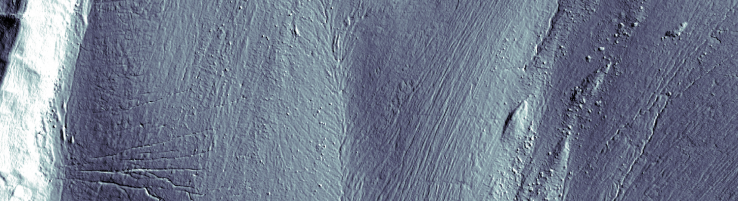
New Paper Published : Patterns and drivers of glacier debris-cover development in the Afghanistan Hindu Kush HimalayaNew Paper Published :
Debris-covered ice is widespread in mountain regions with debris an important control on surface ice melt and glacier retreat. Quantifying debris cover extent and its evolution through time over large regions remains a challenge. This study develops two Normalized Difference Supraglacial Debris Indices for mapping debris-covered ice based on thermal and near Infrared Landsat 8 bands. They were calibrated with field data. Validation suggests that they have a high level of accuracy. They are then applied to Landsat data for 2016 to produce the first detailed glacier inventory of the Afghanistan Hindu Kush Himalaya that includes debris cover. 3408 glaciers were identified which, for those ⩾0.01 km2 in area, gives an ice cover of 2,222 ± 11 km2 and a debris cover of 619 ± 40 km2. Principal components analysis was used to identify the most influential drivers of debris-covered ice extent. Lower proportions of debris cover were associated with glaciers with a higher elevation range, that were larger, longer and wider. These relations were statistically clearer when the dataset was broken down into climate and geological zones. A glaciers continue to shrink, the proportion of debris cover will become higher, making it more important to map debris cover reliably. A copy of the paper is freely available here.
New Paper Published : The climate change research that makes the front page: Is it fit to engage societal action?
By growing awareness for and interest in climate change, media coverage enlarges the window of opportunity by which research can engage individuals and collectives in climate actions. However, we question whether the climate change research that gets mediatized is fit for this challenge. From a survey of the 51,230 scientific articles published in 2020 on climate change, we show that the news media preferentially publicizes research outputs found in multidisciplinary journals and journals perceived as top-tier. An in-depth analysis of the content of the top-100 mediatized papers, in comparison to a random subset, reveals that news media showcases a narrow and limited facet of climate change knowledge (i.e., natural science and health). News media selectivity reduces climate change research to the role of a sentinel and whistleblower for the large-scale, observed, or end-of-century consequences of climate change for natural Earth system components. The social, economic, technological, and energy aspects of climate change are curtailed through mediatization, as well as local and short-term scales of processes and solutions. Reviewing the social psychological mechanisms that underlie behavioral change, we challenge the current criteria used to judge newsworthiness and argue that the consequent mediatization of climate change research fails to breed real society engagement in actions. A transformative agenda for the mediatization of climate change research implies aligning newsworthiness with news effectiveness, i.e., addressing the extent to which communication is effective in presenting research that is likely to produce behavioral change. A copy of the paper is freely available here.
New Paper Published : The Changing Water Cycle: the case of Afghanistan water resources under rapid climate warming
Rapid climate change is impacting water resources in Afghanistan. The consequences are poorly known. Suitable mitigation and adaptation strategies have not been developed. Thus, this paper summarizes current status of knowledge in relation to Afghan water resources. More than 130 scientific articles, reports and data sources are synthesized to review the potential impacts of climate change on the cryosphere, streamflow, groundwater and hydrological extremes. The available information suggests that Afghanistan is currently witnessing significant increases in temperature, less so precipitation. There is evidence of shifts in the intra-annual distribution of streamflow, with reduced summer flows in non-glaciated basins and increased winter and spring streamflow. However, in the short-term there will be an increase in summer ice melt in glaciated basins, a “glacial subsidy”, which sustains summer streamflow, despite reduced snow accumulation. The future prognosis for water resources is likely to be more serious when this glacier subsidy ends. A copy is freely available here.
New Paper Published : Homogeneous Environmental Selection Structures the Bacterial Communities of Benthic Biofilms in Proglacial Floodplain Streams
In proglacial floodplains, glacier recession promotes biogeochemical and ecological gradients across relatively small spatial scales. The resulting environmental heterogeneity induces remarkable microbial biodiversity among proglacial stream biofilms. Yet the relative importance of environmental constraints in forming biofilm communities remains largely unknown. Extreme environmental conditions in proglacial streams may lead to the homogenizing selection of biofilm-forming microorganisms. However, environmental differences between proglacial streams may impose different selective forces, resulting in nested, spatially structured assembly processes. Here, we investigated bacterial community assembly processes by unraveling ecologically successful phylogenetic clades in two stream types (glacier-fed mainstems and non-glacier-fed tributaries) draining three proglacial floodplains in the Swiss Alps. Clades with low phylogenetic turnover rates were present in all stream types, including Gammaproteobacteria and Alphaproteobacteria, while the other clades were specific to one stream type. These clades constituted up to 34.8% and 31.1% of the community diversity and up to 61.3% and 50.9% of the relative abundances in mainstems and tributaries, respectively, highlighting their importance and success in these communities. Furthermore, the proportion of bacteria under homogeneous selection was inversely related to the abundance of photoautotrophs, and these clades may therefore decrease in abundance with the future “greening” of proglacial habitats. Finally, we found little effect of physical distance from the glacier on clades under selection in glacier-fed streams, probably due to the high hydrological connectivity of our study reaches. Overall, these findings shed new light on the mechanisms of microbial biofilm assembly in proglacial streams and help us to predict their future in a rapidly changing environment. A copy is freely available here.
New Paper Published : Primary and potential secondary risks of landslide outburst floods
Outburst floods triggered by breaching of landslide dams may cause severe loss of life and property downstream. Accurate identification and assessment of such floods, especially when leading to secondary impacts, are critical. In 2018, the Baige landslide in the Tibetan Plateau twice blocked the Jinsha River, eventually resulting in a severe outburst flood. The Baige landslide remains active, and it is possible that a breach happens again. Based on numerical simulation using a hydrodynamic model, remote sensing, and field investigation, we reproduce the outburst flood process and assess the hazard associated with future floods. The results show that the hydrodynamic model could accurately simulate the outburst flood process, with overall accuracy and Kappa accuracy for the flood extent of 0.956 and 0.911. Three future dam break scenarios were considered with landslide dams of heights 30 m, 35 m, and 51 m. The potential storage capacity and length of upstream flow back up in the upstream valley for these heights were 142 × 106m3/32 km, 182 × 106m3/40 km, and 331 × 106m3/50 km. Failure of these three dams leads to maximum inundation extents of 0.18 km2, 0.34 km2, and 0.43 km2, which is significant out-of-bank flow and serious infrastructure impacts. These results demonstrate the seriousness of secondary hazards associated with this region. A copy is freely available here.
New Paper Published : Decrypting the stream periphyton physical habitat of recently deglaciated floodplains
The rapid recession of glaciers is exposing large zones to the development of embryonic phototrophic ecosystems and eventual ecological succession. Traditionally, succession patterns in glacial forefields have been seen as a response to time since deglaciation, but nowadays forefield exposure is so rapid that this theory may be less applicable. In this succession process, periphyton are potential pioneer organisms because of their role in modifying the local environment (e.g. access to water) to create conditions conducive to plant colonization. In this paper, we aimto decrypt the physical properties of the habitats that define the spatial and temporal assemblage of periphyton during the melt-season of an Alpine temperate glacier in the context of rapid climate change. We show that periphyton develop in glacial floodplains throughout the melt-season and could extend to cover significant surfaces. However, development is only possible when the combined conditions of stability and water accessibility are met. In glacial floodplains, stable zones exist and are typically located on terraces; but they can also be locally found for much shorter periods in the more active, glacial-stream reworked zone. On terraces, water accessibility can be a limit due to well-drained sediments, but when present, often aided by the role that biofilms play in creating an impermeable layer, it provides a stable and clear water source that biofilms could exploit. In the active part of the braid plain, whilst water availability is very high, the water is harsh (low temperature, high turbidity) and erosive. Therein, periphyton can rapidly exploit short windows of opportunity but the habitat conditions rarely remain stable for long enough for continuous periphyton cover to develop. Thus, the role of periphyton in ecosystem succession is strongly conditioned by the spatial extent of the active zone, itself a function of high rates of glacier melt and sediment supply associated with rapid glacier retreat. A copy of the paper is freely available here.
New Paper Published : Towards a hydrogeomorphological understanding of proglacial catchments: an assessment of groundwater storage and release in an Alpine catchment
Proglacial margins form when glaciers retreat and create zones with distinctive ecological, geomorphological and hydrological properties in Alpine environments. There is extensive literature on the geomorphology and sediment transport in such areas as well as on glacial hydrology, but there is much less research into the specific hydrological behavior of the landforms that develop after glacier retreat in and close to proglacial margins. Recent reviews have highlighted the presence of groundwater stores even in such rapidly draining environments. Here, we describe the hydrological functioning of different superficial landforms within and around the proglacial margin of the Otemma glacier, a temperate Alpine glacier in the Swiss Alps; we characterize the timing and amount of the transmission of different water sources (rain, snowmelt, ice melt) to the landforms and between them, and we compare the relationship between these processes and the catchment-scale discharge. The latter is based upon a recession-analysis-based framework. In quantifying the relative groundwater storage volumes of different superficial landforms, we show that steep zones only store water on the timescale of days, while flatter areas maintain baseflow on the order of several weeks. These landforms themselves fail to explain the catchment-scale recession patterns; our results point towards the presence of an unidentified storage compartment on the order of 40 mm, which releases water during the cold months. We suggest attributing this missing storage to deeper bedrock flowpaths. Finally, the key insights gained here into the interplay of different landforms as well as the proposed analysis framework are readily transferable to other similar proglacial margins and should contribute to a better understanding of the future hydrogeological behavior of such catchments. A copy is freely available here.