The retreat of glaciers and ice sheets since the end of the Little Ice Age has exposed proglacial margins that rapidly develop new ecosystems. These areas are quickly colonized by soil microbes (Bacteria, Archaea), which are less constrained by nutrient scarcity and disturbance than higher organisms. Microbial communities drive biogeochemical changes that initiate pedogenesis, and glacier-forefield ecosystem development is commonly examined through chronosequences. However, the ecological trajectory of the soil microbiome and the influence of local environmental factors on community composition remain unclear. We investigated bacterial community composition along a 180-year glacier-forefield chronosequence in southwestern Switzerland, focusing on links between sediment microbiology, geochemistry, and environmental context. Taxonomic diversity decreased over the first 115 years after exposure, driven by declining psychrophilic autotrophs and increasing psychrotolerant heterotrophs. Species turnover corresponded to changing abiotic conditions, including rising carbon and nitrogen content, soil acidification, and warming. Local context (topography, seasonality) exerted only minor effects on the soil microbiome, likely contributing to the rapid ecological convergence observed among sites farther from the current glacier front. Our results show that soil bacterial communities and soil development follow a shared geoecological trajectory after deglaciation. Considering environmental context improves understanding of proglacial-margin ecology amid accelerating twenty-first-century glacier retreat. A copy of the paper is freely available here.
News
New Paper Published: Increased Glacier Melt Across Millennia to Hours Enhances Erosion and Sediment Export Processes
Glacial erosion and sediment evacuation are key in shaping polar and mountain landscapes and influencing downstream ecological and social systems. The glacier dynamics and hydrology responsible for these processes are closely linked to hydrological and climatic (hydro-climatic) conditions. Recent studies indicate that sediment export and glacier erosion respond strongly to hydro-climatic variations across millennia to individual events lasting hours to weeks. (a) Sedimentary records and numerical ice flow models indicate increased erosion during glacier retreat following climate warming. (b) Rising equilibrium line altitudes due to climate change enhance meltwater access to subglacial sediment, increasing sediment export markedly. (c) Changing meltwater dynamics over hydrological events, particularly daily variations in melt or precipitation events, strongly impact sediment transport capacity. We propose that hydro-climatic changes from millennia to hours, along with the climatic conditions themselves, provide a useful framework for examining glacier erosion. The sensitivity of glacier erosion and sediment export to hydro-climatic conditions likely introduces timescale biases when averaging glacier erosion over long or short periods. Major uncertainties in interactions amongst processes and their relevant timescales underscore the need to better understand climate change impacts on glacierized landscapes. Emerging observational methodologies combined with numerical models may provide new insights into the complex and interacting dynamics controlling glaciers’ impact on sediment export. A copy of the paper is freely available here.
New Paper Published : Intra-Annual Isotope Variations in Tree Rings Reveal Climate Change Impacts on Tree Growth and Water Use in the Turtmann River Basin, Switzerland
It is well established that changes in climatic conditions across Alpine environments have influenced tree-growth at altitudes close to the tree line. Less well known is the impact that increasing proportions of glacial melt water, which may accompany increasing temperatures and otherwise drier conditions during warmer summers, have on the tree growth along the glacial outwash rivers within the basin. In many Alpine basins in Switzerland, hydropower development further alters natural hydrological regimes by modifying runoff timing and flow composition. This study investigates the combined effects of climate variability and hydropower regulation on tree growth and isotopic compositions in the Turtmann River Basin in south-west Switzerland, where an upstream hydropower dam (2200 m a.m.s.l.) stores almost all glacial meltwater, and therefore, the riverine flow below the dam becomes increasingly dependent on snowmelt and rainfall from the unglaciated and unexploited basins. We analysed 75 years (1946–2020) of δ18O and the δ2H values in earlywood (EW) and latewood (LW) Larix decidua growing proximal and distal to the river at two sites within the Turtmann basin. The results show that tree ring growth was primarily temperature-limited at both sites, with a tendency for precipitation becoming a growth-limiting factor particularly at the downstream Site 2 in recent decades. The LW showed stronger climatic sensitivity than EW, reflecting increasingly dry summer conditions. Both δ18O and δ2H values of proximal trees are lower compared with those of the distal trees, reflecting snowmelt and summer precipitation but are not influenced by the glacial meltwaters draining from the upper catchment and/or released by the dam. These results demonstrate that tree-ring stable isotopic compositions can effectively trace changes in Alpine hydrologic regimes and provide valuable insights into how climate change and hydropower operations combine to influence water availability and tree growth dynamics in glaciated basins. A copy of the paper is freely-available here.
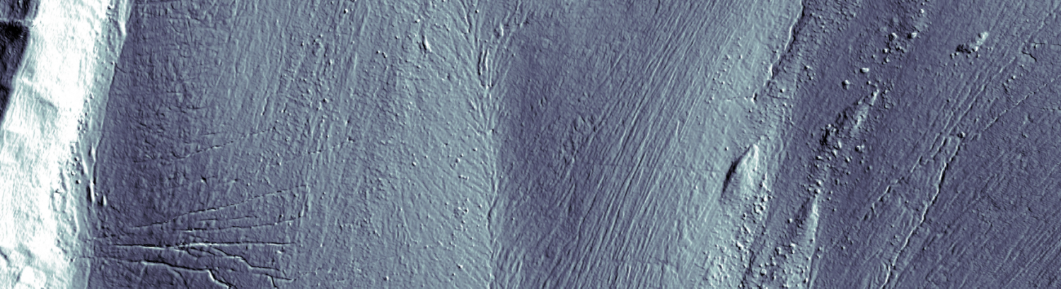
New Paper Published : Development and hypermobility of the Basu rock avalanche in the Nu River ophiolitic mélange, southeastern Tibetan Plateau
Areas of serpentine in ophiolitic mélange zones often trigger large rock avalanches and exhibit strong movement. However, how the mechanism under which they post-failure hypermobility and long runout are unclear. Here, we identify and analyze a representative prehistoric rock avalanche, the Basu rock avalanche, with a large volume and a high mobility, which developed in the Nu River ophiolitic mélange zone of the Tibetan Plateau. Based on field investigations, experimental, and Numerical simulation analyses we determined its development background and thus explained why it was hypermobile. This rock avalanche, with a volume of approximately 3.15 × 10⁹ m3, occurred around ∼187 ka before present (B·P.). It developed on a marble nappe, with serpentine soft rock exposed locally at its base. It may have ultimately been triggered under seismic action, resulting in intense movement. The lubrication effect of fine-grained serpentine particles within the slip zone facilitated the hypermobility of the rock avalanche, resulting in both a large volume and an extended runout distance. This demonstrates that serpentine soft fine particles widely distributed in the suture zone are a typical lubricating material. The hypermobility of this large rock avalanche are striking and emphasizes the need to determine where, how and when these rare but high-magnitude rock avalanche events may occur. We proposed a new perspective on the triggering mechanisms of the rock avalanches and further verified the hypothesis of powder lubrication control effects. The paper may be accessed here.
New Paper Published : Microbial mats promote surface water retention in proglacial streams
The retreat of glaciers opens up large proglacial areas which become available for colonization and primary succession. Yet, factors that contribute to habitability during early succession in proglacial areas remain poorly understood. In proglacial streams, biofilms, which are matrix-enclosed microbial communities, colonize the streambed and grow into millimeter thick mats. Particularly in proglacial streams draining relatively flat and stable lateral terraces, these biofilms may augment habitability by reducing water scarcity through clogging of the streambed. To quantitatively address this phenomenon, we performed streamside flume experiments and conceived the idealized terrace model, which models stream length elongation as a function of microbially induced clogging, sediment hydraulic properties, stream roughness, slope, width and inflow. Significant stream elongation, and hence habitabilization, occurs when clogging suffices to induce unsaturated conditions below the streambed. Considering multiple terrace configurations with educated parameter bounds, we found a wide range of possible elongation, ranging from none to 100-fold. Sensitivity analysis suggests that sediment hydraulic properties mostly contribute to variability in stream elongation due to biofilm induced clogging. Taken together, we here show that microbial communities can significantly extend the habitability of proglacial stream ecosystems by inducing streambed clogging and retaining water. This is relevant in light of the rapid glacier retreat. A copy of the paper is freely available here.
New Paper Published : The thermal future of a regulated river: spatiotemporal dynamics of stream temperature under climate change in a peri-Alpine catchment
Climate change is driving an increase in river water temperatures, presenting challenges for aquatic ecosystems and water management. Many rivers are regulated by hydropower production, which alters their thermal regimes, causes short-term temperature fluctuations (thermopeaking) linked to flow variations, and whose future evolution under climate change remains uncertain. This study examines how the thermal regime of a peri-alpine regulated river could evolve under future climate scenarios using a high-resolution process-based model. Projections indicate that mean annual water temperatures may rise by up to 4 °C by 2080–2090 under RCP 8.5, with daily mean temperatures exceeding 15 °C for nearly half the year, raising ecological concerns. While these trends are comparable to those in unregulated rivers, river regulation introduces distinct spatial and seasonal patterns in climate change impacts. The reach with only a residual flow is particularly susceptible to warming due to limited discharge, whereas deep reservoir releases help moderate climate change impacts downstream of the dam and the hydropower plant. Furthermore, unlike in unregulated rivers where the strongest warming typically occurs in summer, climate change impacts in this regulated system are projected to be most pronounced in autumn and winter due to the thermal inertia of the reservoir. Indicators used to assess thermopeaking impacts remain largely unaffected by climate change, provided that hydropower operation remains unchanged. This study highlights that while regulation can exacerbate vulnerabilities to climate change, it also mitigates climate change impacts by influencing river temperature dynamics beyond thermopeaking alone. A copy of the paper is freely available here.
New Paper Published : Classification and evaluation of dangerous glacial lakes in the Hindukush region of Afghanistan (HKA) using a multi-criteria approach
The formation and rapid expansion of glacial lakes following from climate change and rapid glacier recession in the Hindukush-Himalayan (HKH) region may increase the risk of glacial lake outburst floods (GLOFs). This paper develops a methodology for assess-ing the susceptibility of lakes (those ≥ 0.01 km² in size) to GLOF hazards. First, lakes were classified into six main types based on morphological features. Second, a multi-criteria approach (MCA) was applied, analyzing 13 factors across three GLOF-criteria: lake hydro-glacial characteristics, dam conditions and surrounding-triggers. The factors were ranked and weighted using an Analytical Hierarchy Process (AHP) and Pairwise Comparison Matrix (PCM) to drive a Susceptibility to Hazard Index (SHI). Lakes were categorized as high, medium or low susceptibility based on SHI values. The SHI- evaluations used past GLOF events from Afghanistan and the High Mountain Asia (HMA) dataset. Of 162 lakes assessed in Afghanistan, 36 showed high GLOF susceptibil-ity, and 54 with medium susceptibility. Smaller lakes (0.01−0.04 km²) dominated high and medium hazard classes, while larger lakes (0.1−0.5 km²) were few in these classes. This indicates smaller lakes may drive future GLOF risks in Afghanistan, where regular monitoring and fieldwork is important. These findings support hazard mapping and disaster risk reduction-measures for downstream-communities. A copy is freely available here.
New Paper Published : Model Inputs and Data Requirements for Process‐Based Stream Temperature Modeling in Regulated Peri‐Alpine Rivers
Regulated rivers can experience sharp temperature variations induced by intermittent hydropower production (thermopeaking). To mitigate ecological impacts, dam operators need to assess the impacts of hydropeaking on stream temperature, and to test scenarios that might reduce them. While stream temperature modeling has been investigated in numerous studies, few have systematically assessed how integrated processes and their representation affect model performance, and models capable of capturing both sub‐hourly variations and long‐term thermal dynamics remain a challenge. Herein, a stream temperature model within the HEC‐RAS platform was used to model the thermal regime of a regulated river in Switzerland, with a 10‐min timestep over the annual time‐scale and for a 22‐km long reach; and for which we had installed a network of stream temperature sensors. While the initial model demonstrated an acceptable performance at the yearly scale (Mean Absolute Error: 0.78–2.10°C and Kling‐Gupta Efficiency: 0.55–0.85), this was not the case at the daily or
seasonal time‐scales. Two model corrections were found to be crucial; (a) the correction of potential incoming solar radiation for local shading; and (b) the representation of the heat flux linked to water‐sediment exchanges. With these two corrections, the annual performance improved (MAE: 0.48–0.83°C and KGE: 0.85–0.93) as did the daily and seasonal performance. Although physically based, the model required calibration, underscoring the importance of high‐quality in situ temperature data. The resulting model proves effective for practical applications in hydropower mitigation and river temperature management under complex flow regimes. A copy of the paper is freely available here.
New Paper Published : Glacial lake formation and evolution in the Hindukush Region of Afghanistan between 1990 and 2020
The rapid retreat of mountain glaciers and the formation of new glacial lakes due to climate change pose considerable risks in mountain regions, especially where they increase the frequency and magnitude of glacial-lake outburst floods (GLOFs) and Jökulhlaups. This study presents an integrated inventory of glacial lakes in the Hindukush- Region of Afghanistan (HKA) for 2020 and the first multi-decadal assessment (1990–2020) of glacial lake changes. For 2020, we identified 2596 glacial lakes and supra-glacial ponds with an area of 96.8 ± 14.8 km2 (2362 lakes ≥0.003 km2 and 234 smaller lake/ponds <0.003 km2). This indicates an increase of 32% by number and 21% by area since 1990. We analyzed lake formation, expansion, decline and disappearance and found that patterns of change vary significantly between regions and as a function of altitude. 56% of lakes expanded, 20% shrunk, 17% were newly formed and 6% disappeared between 1990–2020. Glacial lakes in the HKA begin at ∼2980 m-asl, and the rate of increase of lake area was greatest for the elevation range 5300–5800 m-asl, during 2010–2020. Whilst lakes were generally increasing in area, those in the southwestern region of the HKA were decreasing, mainly because they were associated with smaller glaciers that were in a drier region. Smaller lakes (≤0.01–0.05 km2), particularly ice-contact proglacial lakes showed rapid increases, whereas larger lakes (>1.0 km2) tended to decrease in size. This study reveals the importance of considering geographical and altitudinal variation in glacial-lake formation and the role of smaller-lakes in GLOF-formation and water resources. A copy is freely available here.
New Paper Published : Simulation of proglacial forefield morphodynamics and their implications for the filtering of subglacial sediment export following glacier retreat
Proglacial forefields are geomorphologically active zones with rivers that may buffer sediment connectivity between glaciers and downstream regions. To date, there are few studies of the magnitude of this process and the role of system‐internal perturbations, such as meltwater discharge rates, subglacial sediment supply and changing valley topography (e.g. valley slope, lateral accommodation space) following glacier retreat. Here, we use a physically‐based morphodynamic model, calibrated using continuous field‐collected data, to investigate the geomorphic response of these fluvial systems to varying topographical, sedimentological and hydrological boundary conditions. Results confirm the central role of the supply to transport capacity ratio in determining both proglacial stream geomorphic response and downstream sediment delivery rates, particularly for bedload particles; while suspended sediment transport is less affected by morphodynamic processes. Simulations also showed that the filtering effect is influenced by the lateral accommodation space and valley bottom slope. These observations not only suggest that the filtering varies between geomorphological settings, but also that the form of a valley (width, slope), as it is revealed following glacier retreat, will also impact filtering. These findings are important for understanding the future evolution of the longitudinal sediment connectivity in deglaciating catchments, in light of likely peak water and peak sediment. In the near‐future, the evolution of the proglacial margin filtering will have repercussion for the supply of sediment towards downstream regions, for the management of hydropower plants and for aquatic ecosystems. A copy of the paper if freely available here.