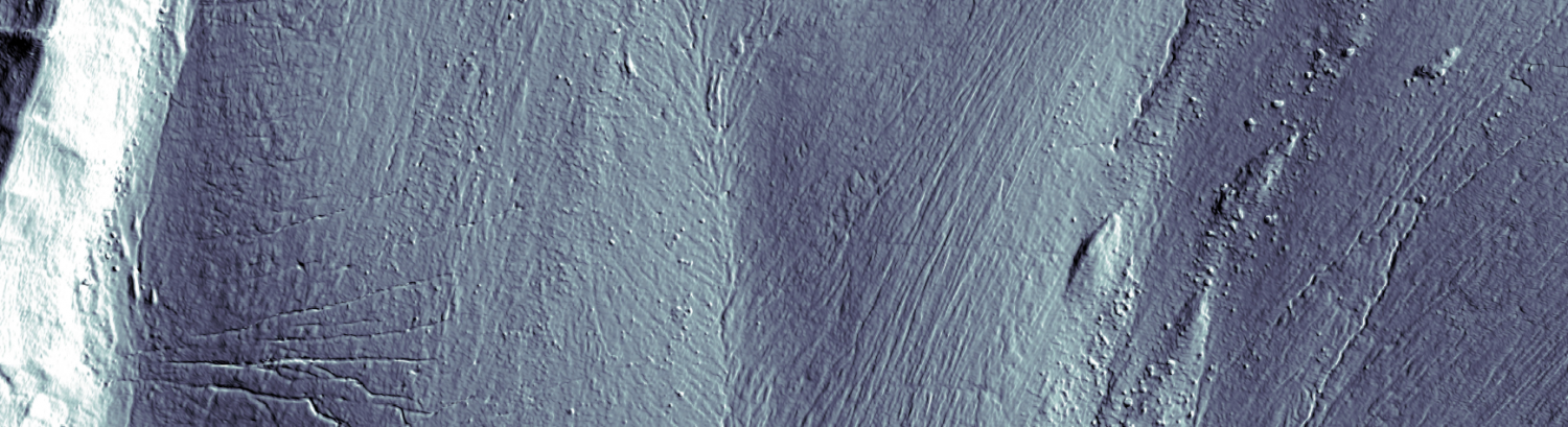
Rapid retreat of Alpine glaciers since the end of the Little Ice Age has increased the spatial extent of proglacial margins. Whilst the response of glaciers to climate warming is well-documented, the response of proglacial landscapes, especially regarding sediment transfer processes, is less understood. Sediment transport, through erosion and deposition, modifies the landscape and affects sediment connectivity. The latter may be described as structural (static, related to the configuration of the system) or functional (dynamic, resulting from time-space variation in sediment flux). This paper quantifies the functional connectivity of sediment flux for a recently deglaciated Alpine hillslope. Analysis of high-resolution digital elevation models is coupled to a morphological method to assesses the spatial pattern of sediment flux required to conserve mass over a seasonal and a multi-year time-scale. Results show that functional connectivity is strongly controlled by micro-scale topography on the hillslope that has developed during and since deglaciation. Functional connectivity is then a key factor determining the delivery of sediment to the valley bottom for eventual transport by the proglacial stream following glacier retreat. This effect is stronger at the seasonal time-scale than at the multi-year time-scale. A copy is freely available here.
New Paper Published : Different geomorphic processes control suspended sediment and bedload export from glaciers
Ongoing cryospheric change has modified sediment export from glacierized catchments substantially, with significant implications for ecosystems and downstream users, notably hydropower companies. Sediment is exported either as finer sediment in suspension or as coarser bedload with intermittent contact between sediment and the bed. To date, the difficulty in observing subglacial bedload transport limits the understanding of the physical processes associated with evacuating bedload compared with suspended load. We elucidate the factors controlling sediment export by inverting a physically-based numerical model of subglacial sediment production and sediment transport with suspended sediment and continuous bedload discharge records froman Alpine glacier. Comparable quantities of suspended sediment and bedload are exported, and model results suggest that both rely on the availability of sediment for transport. Yet, bedload export in subglacial channels also depends on particular hydraulic conditions, notably channel shape and hydraulic roughness. This makes exporting bedload-sized particles inefficient compared to fine-grained sediment. As a result, subglacial hydraulics should be explicitly considered when examining bedload export processes, and suspended and bedload transport should be considered separately. Inefficient bedload evacuation by melt water implies that glacial erosion may only continue when non-fluvial mechanisms evacuate sediment, such as sediment entrainment into the ice. A copy of the paper is freely available here.
New Paper Published : A first chronological framework for fluvial terrace deposits of the Kampar Kanan River, Indonesia
Late Quaternary landscape evolution in tropical environments, such as Indonesia, remains poorly constrained due to limited prior studies and mineral properties that are challenging for luminescence dating. In this study, single- and multi-grain luminescence measurements of quartz and K-feldspar were explored for fill terrace deposits at the Kampar Kanan River, Indonesia. Our objective is to develop a chrono-stratigraphic framework that allows the reconstruction of late Quaternary fluvial morpho-dynamics, including climatic change. Quartz measurements were made using blue and green stimulation and single-aliquot regenerative dose (SAR) and double SAR protocols. However, as none of the quartz signals were fast component-dominated, they were not used for dating. Infrared-stimulated luminescence of multiple grains of K-feldspar at 50 ºC (IR50) and post-infrared infrared-stimulated luminescence at 225 ºC (pIR50IRSL225) yielded sufficiently bright signal intensities for dating, and ages were calculated using either the average dose (ADM) or minimum age model (MAM). The luminescence chronology based on fading corrected pIR50IRSL225 data yields ages from Marine Isotope Stage (MIS) 6 or earlier to MIS 1. The chrono-stratigraphy indicates that the river was likely aggradational during climate transitions from wet to dry with the deposition of more gravelly material, and erosional during colder periods when overbank deposition of fines may have been coincident with increased vertical river erosion due to a stronger monsoon.
A copy of the paper is freely available here.
New Paper Published : Lagrangian simulation of bedload-sized particle trajectories at a 90° river confluence
Whilst confluence hydrodynamics are now very well known, their morphodynamics are less so. This is particularly true for bedload transport, including the trajectories followed by bedload supplied to a confluence by the main channel or the tributary, and their interactions. Field measurement of this phenomenon is currently difficult. Laboratory measurement allows study of gross effects, but not the detailed physics of the process. This paper applies a Lagrangian particle tracking model to a 90° discordant confluence, i.e. where the tributary enters the main channel at a height above the mainstream bed. The model was set up to represent the confluence of the Rhône and Avançon Rivers, Switzerland. The model is based upon a three-dimensional solution of the incompressible Navier-Stokes equations in the open-source toolbox OpenFOAM. It applies a Delayed Detached Eddy Simulation. Particle movement allows for coupled interactions between particles as well as between particles and the stream bed. Results show that as bedload arrives at the tributary mouth, there is size segregation. Some particles from the tributary fall rapidly to the mainstream bed and then travel along the main channel margin to the zone where bank-attached point bars commonly form. Others travel further into the main channel, notably if interactions between particles are allowed. The zone of maximum shear between the joining flows tends to have lower densities of particle tracks. There is sediment sorting at the junction with the very coarsest particles, due to interactions and momentum effects, and the very finest particles, due to greater ease of turbulent suspension, extending further into the main channel.
A copy of the paper is freely available here.
New Paper Published : Tree-ring based May-June streamflow reconstruction of Zemu River in the Eastern Himalaya
Study region
Zemu River, Upper Teesta River Basin, Eastern Himalaya
Study focus
In this study, a tree-ring chronology of Abies densa was used as a proxy to reconstruct a century-long May-June streamflow of the Zemu River. The reconstruction was carried out based on a scaling approach which explained 35 % of variance in observed streamflow and was varified by comparing with other regional reconstructions. Moving windowed Pearson correlation was performed to reveal the temporal influence of major climate forcings (e.g., ENSO) with the streamflow of Zemu River.
New hydrological insights for the region
Our study identified a strong negative relationship between tree-growth and observed May-June streamflow in the glacier-fed Zemu River. This counterintuitive, inverse relationship is likely due to the contribution of additional meltwater when conditions are dry and insulation over the glacier is high. The reconstructed streamflow record reveals several high- and low-flow periods above and below the mean value (+/- 1σ) and identifies 30 high-flow years and 33 low-flow years, including some historically recorded floods in 1927, 1968, 1980, 1982 and 1998, and of severe droughts in 1951, 1976 and 2017. Most recently, a positive association between reconstructed streamflow and the ENSO has become apparent, which we attribute to reduced penetration of the Indian Summer Monsoon during ENSO years, which reduces precipitation but maintains for longer warmer and drier conditions that allow glacier melt.
A copy of the paper is freely available here.
New Paper Published : Glacier-influenced hydrologiucal regimes in the Afghanistan Hindu Kush Himalaya under current and future climate
Glaciers in the Hindu Kush Himalaya (HKH) are important freshwater resources. Glacier recession may lead to a significant decrease in summer runoff. This study focuses on Afghanistan in the western Himalayas with an arid to semi-arid climate, where, despite strong societal and ecosystem dependance upon mountain water resources, the contribution of glacier melt is poorly known. This study used a new conceptual precipitation and ice melt-runoff model to assess current and future streamflow, taking into account the effects of debris-covered ice. Three catchments with varying glacier cover are considered: Sust (4,609 km2, 15.6% glacier cover) in eastern Afghanistan; the Taqchakhana (264.4 km2 area, 2.8% glacier cover) in northern Afghanistan; and the Bamyan (325.3 km2, 0.7% glacier cover) in central Afghanistan. Results identified different annual hydrological regimes, with glacier runoff dominating Sust (76%), rain and snow runoff dominating Taqchakhana (50%), and baseflow dominating Bamyan (61%). Under RCP 2.6, glacier runoff in Sust and Taqchakhana is expected to increase until 2050, then decline as temperatures stabilize; under RCP 8.5, a more significant increase is projected, while runoff in Bamyan will decrease throughout the century. Catchments may experience a peak water phase due to both temperature effects and progressively diminishing size of glaciers. A copy of the paper is freely available here.
New Paper Published : Scale dependency in modeling nivo-glacial hydrological systems: the case of the Arolla basin, Switzerland
Hydrological modeling in alpine catchments poses unique challenges due to the complex interplay of meteorological, topographical, geological, and glaciological drivers with streamflow generation. A significant issue arises from the limited availability of streamflow data due to the scarcity of high-elevation gauging stations. Consequently, there is a pressing need to assess whether streamflow models that are calibrated with moderate-elevation streamflow data can be effectively transferred to higher-elevation catchments, notwithstanding differences in the relative importance of different streamflow-generation processes. Here, we investigate the spatial transferability of calibrated temperature-index melt model parameters within a semi-lumped modeling framework. We focus on evaluating the melt model transferability from the main catchment to nested and neighboring subcatchments in the Arolla valley, southwestern Swiss Alps. We use the Hydrobricks modeling framework to simulate streamflow, implementing three variants of a temperature-index snow and ice melt model (the classical degree-day model, the aspect-related model, and the Hock temperature-index model). Through an analysis of streamflow simulations, benchmark metrics consisting of resampled and bootstrapped discharge time series, and model performance metrics, we demonstrate that robust parameter transferability and accurate streamflow simulation are possible across diverse spatial scales. This finding is conditional upon the melt model applied, with melt models using more spatial information leading to convergence of the model parameters until we observe overparameterization. We conclude that simple semi-lumped models can be used to extend hydrological simulations to ungauged catchments in alpine regions and improve high-elevation water resource management and planning efforts, especially in the context of climate change. A copy of the paper is freely available here.
New Paper Published : Elevation-dependent breakpoint in climate forcing of tree growth in the Turtmann River Basin, Switzerland
Tree rings are valuable proxies for reconstructing changes in climate at annual and intra-annual resolutions. In Alpine regions, changes in climate may well lead to switches between tree-growth being temperature-limited and precipitation-limited. Distinguishing between these is important as they may express themselves differently in tree rings. However, such switches cannot be separated from more local environmental influences such as elevation and aspect. In this study, we seek to understand how tree growth evolves as a function of elevation in the context of climate change. For the growth of European larch (Larix decidua Mill) in the Turtmann River Basin, a glacier-fed high-elevation river basin in the Swiss Alps, located in southwestern Switzerland, we find that the average temperature increase leads to a switch from temperature-limitation to precipitation-limitation as a function of elevation. The growth of Larix decidua Mill in this river basin is influenced by previous year’s September-October-November (SON) temperature and current year’s January-February-March (JFM) precipitation in the higher- and lower-elevations across an elevational gradient respectively. Based on the analysis from four sites, assuming a linear response, our study suggests that there is a transition zone (i.e., an elevational breakpoint) between 1800 and 900 m AMSL where the signal changes from precipitation-limited to temperature-limited. We also conclude that this elevation breakpoint appears to be rising with time due to increasingly warmer annual average temperatures in this Alpine setting, where this warming is noted to be more than twice compared to the global average temperature change. A copy of the paper is freely available here.
New Book Published : The Field Guide to Mixing Social and Biophysical Methods in Environmental Research

Despite ongoing debates about its origins, the Anthropocene—a new epoch characterized by significant human impact on the Earth’s geology and ecosystems—is widely acknowledged. Our environment is increasingly a product of interacting biophysical and social forces, shaped by climate change, colonial legacies, gender norms, hydrological processes, and more. Understanding these intricate interactions requires a mixed-methods approach that combines qualitative and quantitative, biophysical and social research.
However, mixed-methods environmental research remains rare, hindered by academic boundaries, limited training, and the challenges of interdisciplinary collaboration. Time, funding, and the integration of diverse data further complicate this research, whilst the dynamics and ethics of interdisciplinary teams add another layer of complexity.
Despite these challenges, mixed-methods research offers a more robust and ultimately transformative understanding of environmental questions. This Field Guide aims to inspire and equip researchers to undertake such studies. Organized like a recipe book, it assists researchers in the preparation of their field work, as well as offering entry points to key methods and providing examples of successful mixed-methods projects.
This book will be of interest to scholars wishing to tackle environmental research in a more holistic manner, spanning ‘sister’ disciplines such as anthropology, statistics, political science, public health, archaeology, geography, history, ecology, and Earth science.
The book is Open Access and so freely available here.
New Paper Published : The Sikkim flood of October 2023: Drivers, causes and impacts of a multihazard cascade
On 3 October 2023, a multihazard cascade in the Sikkim Himalaya, India, was triggered by 14.7 million m3 of frozen lateral moraine collapsing into South Lhonak Lake, generating an ~20 m tsunami-like impact wave, breaching the moraine, and draining ~50 million m3 of water. The ensuing Glacial Lake Outburst Flood (GLOF) eroded ~270 million m3 of sediment, which overwhelmed infrastructure, including hydropower installations along the Teesta River. The physical scale and human and economic impact of this event prompts urgent reflection on the role of climate change and human activities in exacerbating such disasters. Insights into multihazard evolution are pivotal for informing policy development, enhancing Early Warning Systems (EWS), and spurring paradigm shifts in GLOF risk management strategies in the Himalaya and other mountain environments.
A copy of the paper is freely available here.