AGU has published a “Research Spotlight” highlighting a paper by Stuart Lane and Pete Nienow “Decadal?Scale Climate Forcing of Alpine Glacial Hydrological Systems” in Eos. It can be read here.
Month: April 2019
New data made freely available
We have recently made lots of our data newly available in open access format. All the data can be accessed here : These data include
- 15 minute resolution normalized hydrographs for 6 glaciated basins in south-west Switzerland (search on: Q_1969_2014)
- Long-term digital elevation models of the Borgne d’Arolla reconstructed from aerial imagery and starting in the 1960s. These are supported by data on flushing of sediment from two intakes (search on: Bakker M)
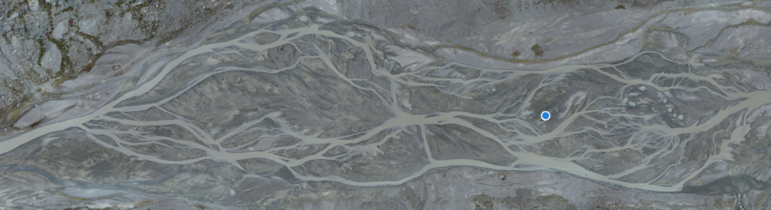
- Short-term (daily time-scale) digital elevation models of a braided river (c. 300 m wide, 1600 m long) over a three week period (search on: Bakker M)
- Data from a monitoring project (SNSF PNR70 Hyroenv) of macroinvertebrate life in the Borgne d’Arolla (search on: macroinvertebrate)
If you want to look for other data available (e.g. glacier recession, DEMs of hillslopes), choose “advanced search”; then unclick all boxes except “data”
New Paper Published : Decadal?Scale Climate Forcing of Alpine Glacial Hydrological Systems
Quantification of climate forcing of glacial hydrological systems at the decadal scale is rare because most measurement stations are too far downstream for glacier impacts to be clearly detected. Here we apply a measure of daily hydrograph entropy to a unique set of reliable, high?altitude gauging stations, dating from the late 1960s. We find a progressive shift to a greater number of days with diurnal discharge variation as well as more pronounced diurnal discharge amplitude. These changes were associated with the onset of rapid warming in the 1980s as well as declining end of winter snow depths as inferred from climate data. In glaciated catchments, lower winter snow depths reduce the magnitude and duration of snowpack buffering and encourage the earlier onset of glacier ice exposure, with associated lower surface albedo and more rapid melt. Together, these processes explain the increase in the observed intensity of diurnal discharge fluctuations.
The paper has been published in Water Resources Research and can be accessed here.
New paper published : Quantification of bedform dynamics and bedload sediment flux in sandy braided rivers from airborne and satellite imagery
Images from specially?commissioned aeroplane sorties (manned aerial vehicle, MAV), repeat unmanned aerial vehicle (UAV) surveys, and Planet CubeSat satellites are used to quantify dune and bar dynamics in the sandy braided South Saskatchewan River, Canada. Structure?from?Motion (SfM) techniques and application of a depth?brightness model are used to produce a series of Digital Surface Models (DSMs) at low and near?bankfull flows. A number of technical and image processing challenges are described that arise from the application of SfM in dry and submerged environments. A model for best practice is presented and analysis suggests a depth?brightness model approach can represent the different scales of bedforms present in sandy braided rivers with low?turbidity and shallow (< 2?m deep) water. The aerial imagery is used to quantify the spatial distribution of unit bar and dune migration rate in an 18?km reach and three ~1?km long reaches respectively. Dune and unit bar migration rates are highly variable in response to local variations in planform morphology. Sediment transport rates for dunes and unit bars, obtained by integrating migration rates (from UAV) with the volume of sediment moved (from DSMs using MAV imagery) show near?equivalence in sediment flux. Hence, reach?based sediment transport rate estimates can be derived from unit bar data alone. Moreover, it is shown that reasonable estimates of sediment transport rate can be made using just unit bar migration rates as measured from 2D imagery, including from satellite images, so long as informed assumptions are made regarding average bar shape and height. With recent availability of frequent, repeat satellite imagery, and the ease of undertaking repeat MAV and UAV surveys, for the first time, it may be possible to provide global estimates of bedload sediment flux for large or inaccessible low?turbidity rivers that currently have sparse information on bedload sediment transport rates.
The paper is published in Earth Surface Processes and Landforms and can be accessed here.
New paper published : Comparison of remote sensing based approaches for mapping bathymetry of shallow, clear water rivers
Shallow rivers provide important habitat for various aquatic and terrestrial species. The bathymetry of such environments is, however, difficult to measure as devices and approaches have been traditionally developed mainly for deeper waters. This study addresses the mapping of shallow waterbathymetry with high spatial resolution and accuracy by comparing three remote sensing (RS) approaches: one based on echo sounding (active RS) and two on photogrammetry (passive RS): bathymetric Structure from Motion (SfM) and optical modelling. The tests were conducted on a 500?m long and ~30?m wide reach of sand-bedded meandering river: (1) during a rising spring flood (Q?=?10–15?m3/s) with medium turbidity and high water color and; (2) during autumn low discharge (Q?=?4?m3/s) with low turbidity and color. Each method was used to create bathymetric models. The models were compared with high precision field measurements with a mean point spacing of 0.86?m. Echo sounding provided the most accurate (ME~?0.02?m) and precise (SDE?=?±?0.08?m) bathymetric models despite the high degree of interpolationneeded. However, the echo sounding-based models were spatially restricted to areas deeper than 0.2?m and no small scale bathymetric variability was captured. The quality of the bathymetric SfM was highly sensitive to flow turbidity and color and therefore depth. However, bathymetric SfM suffers less from substrate variability, turbulent flow or large stones and cobbles on the river bed than optical modelling. Color and depth did affect optical model performance, but clearly less than the bathymetric SfM. The optical model accuracy improved in autumn with lower water color and turbidity (ME?=??0.05) compared to spring (ME?=??0.12). Correlations between the measured and modelled depth values (r?=?0.96) and the models precision (SDE?=?0.09–0.11) were close to those achieved with echo sounding. Shadows caused by riparian vegetation restricted the spatial extent of the optical models.
The paper is published in the journal Geomorphology and can be accessed here.